- Place
- Akmenė District Municipality
- Region
- Šiauliai Region
- Type
- archaeological hillfort on a forest upland
- Address
- Lakava Forest, between Vėlaičiai and Kerėžiai villages, Naujoji Akmenė Rural Eldership, Akmenė District
- Coordinates
- 56.37275, 22.97975
- Visit duration
- 1-2 hours; longer for a slow look around the forest paths or a combined Akmenė District route
- Best time
- a dry bright morning or evening; after rain and in spring wear shoes with good grip, and check for ice on winter visits
Lokava Hill, Kerėžiai Hillfort, Luokava and Kerėžiai Hillfort
Luokavos Hillfort is hidden in the Lakava Forest upland
Luokavos Hillfort lies between Vėlaičiai and Kerėžiai villages in the Naujoji Akmenė Rural Eldership, in Lakava Forest. Akmenė District Municipality describes it as the highest point on the north-eastern edge of an upland surrounded by marshes. The officially published coordinates are 56.37275, 22.97975.
The site has several names: Luokavos Hillfort, Lokava Hill, and Kerėžiai Hillfort. They refer to the same archaeological place, so try the official and local variants when searching a map. The coordinate on this page marks the site itself rather than a general forest address.
Forest-path surfaces, moisture, and visibility depend on the season and weather. Visit in daylight, wear shoes with good grip, and use the existing approach because the hillfort slopes and forest floor are not places for new shortcuts.
Gravel pits changed the hillfort's earthwork shape
The municipal description emphasises that gravel pits heavily damaged Luokavos Hillfort from the late nineteenth century. This is part of the site's identity: visitors do not see a perfectly preserved geometric rampart, but a forest landform where the natural hill and human damage overlap.
Akmenė District planning material describes slopes reaching up to 20 metres and a large plateau, while the earthworks survive more clearly on the north-west side. This helps explain why the summit deserves attention not only for its view, but also for the uneven geometry of its slopes.
This is an archaeological site, not simply a viewpoint hill. Do not climb unstable edges, disturb slopes, dig, or look for artefacts. Even a small new path across a slope can increase erosion and damage what remains of the cultural layer.
Paths lead to an open clearing in the forest
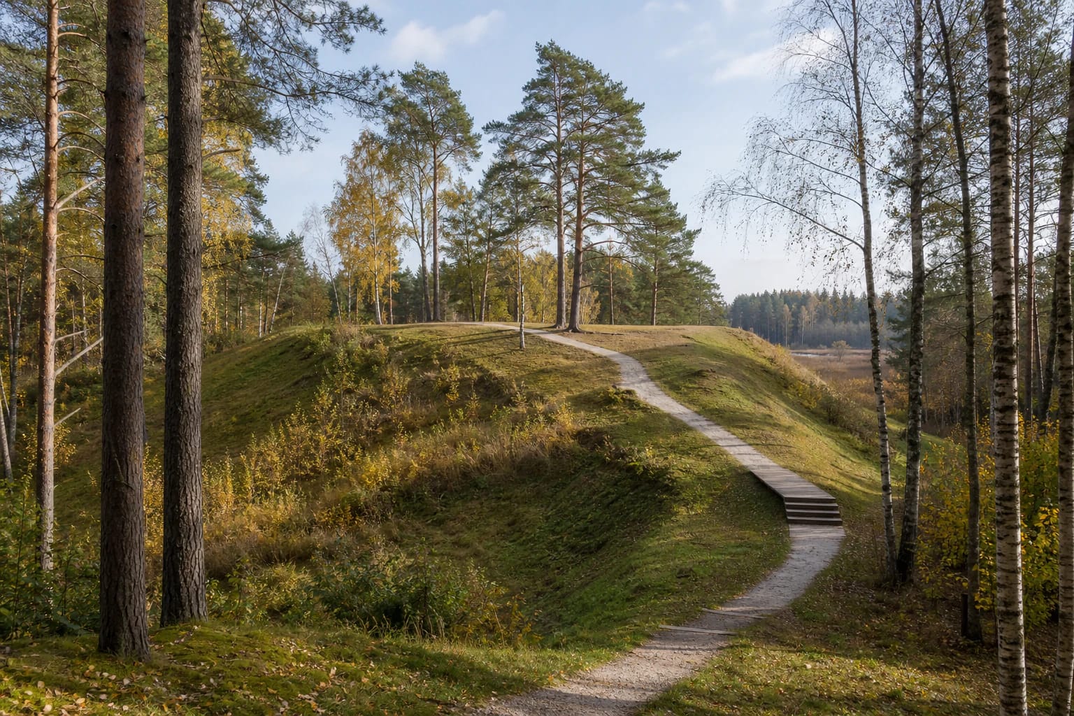
Akmenė District Municipality says that paths lead upwards and that the spacious plateau has room for a larger group. Real place photographs show pine and birch forest, grassy slopes, an open summit, and a winding improved approach. The season changes the view: birch gold stands out in autumn, while summer vegetation makes the summit blend more closely into the forest.
There is no reason to rush the climb. Slopes can be uneven, wet, or slippery, and leaves and pine needles hide roots and small hollows. Children and dogs need supervision at the steeper edges and damaged earthwork sections.
The plateau allows a short stop, but it is not an event square or intensively urbanised recreation site. Groups should leave room for others, keep vehicles away from the summit, and not set up temporary equipment on the archaeological earthwork.
A nearby campsite is mentioned, but woodland rules still apply
The municipal attraction page says that a campsite has been installed near the hillfort. This makes it possible to combine Luokava with a longer forest stay, but the source does not specify current equipment, booking, or seasonal conditions. Check local signs and the responsible institution's information before planning an overnight stay.
A campsite is not permission to make a fire anywhere at the foot of the hillfort. Use only designated equipment and follow fire safety, waste, and forest-visiting rules. Do not hang hammocks on trees if doing so damages vegetation or blocks other visitors.
The forest landscape is part of the experience: birds, pine scents, and the marshy low ground around the upland explain the place's relief. Luokava is worth visiting not only for a summit photograph, but also for the slow path that shows how the hillfort has grown into the surrounding woods.
Plan the visit and protect the archaeological site
Allow 1-2 hours for the hillfort itself and more for a combined Akmenė District route or campsite. Dry bright weather is easiest because forest paths become slippery after rain. In winter check for ice on the slopes and do not drive onto paths intended for pedestrians.
The hillfort area may not have town conveniences, so bring water, suitable footwear, and a bag for rubbish. The municipal page confirms a nearby campsite, but it does not confirm that a toilet, firewood, or caretaker will be available every day.
Stay on existing paths, keep off damaged earthwork edges, do not move stones, and respect the forest's quiet. This lets visitors experience both the archaeological relief and the wooded landscape in which the hillfort survived.