- Place
- Zarasai District Municipality
- Region
- Aukštaitija
- Type
- large protected lake
- Address
- Lake Luodis, Salakas elderate, Zarasai District
- Coordinates
- 55.58436, 26.21235
- Visit duration
- 1-3 hours for a shore visit; half or full day for boating and Salakas
- Best time
- May to September; early morning for calm scenery and birds
Luodis Lake
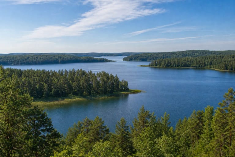
A 1,287.6-hectare maze of water
The Universal Lithuanian Encyclopedia gives Luodis an area of 1,287.6 hectares. It is about 6.3 km long, up to 4.4 km wide, and 18.4 m deep. Its 6.7 m average depth and extensive shallows create very different shores.
The shoreline extends for about 28.5 km. Four islands cover 17.8 hectares, while long bays and headlands divide the water so that Luodis can resemble several lakes from different banks.
The Šventoji flows in and out
The River Šventoji enters Luodis and continues beyond it, making the lake a link in a larger river-and-lake system rather than an enclosed basin.
Current, wind and the broad surface can change boating conditions quickly. Wear a buoyancy aid, monitor forecasts and never plan only by the straight-line distance shown on a map.
A protected regional-park landscape
Luodis belongs to Gražutė Regional Park. Water clarity can reach four metres, while reeds, shallows, islands and forest create a varied habitat for waterbirds and other species.
Avoid islands and secluded nesting shores, light fires only at designated sites and remove all waste. Protected status does not make every shore public or every track a legal parking place.
Seeing Luodis without trespassing
The clearest public introduction is on the Salakas side, where the nature trail, bird tower and campsite provide identifiable access. The map pin marks the lake centre, not a beach or entrance.
Fishing, motorised navigation and camping have separate permits and restrictions. Check the Environmental Protection Department and park information rather than relying on an old forum post or an unsigned shore track.