- Place
- Giedraičiai Eldership, Molėtai District Municipality
- Region
- Aukštaitija
- Type
- 98.6-hectare glacially dammed lake near Giedraičiai
- Address
- Paežerių Street, Giedraičiai, Molėtai District Municipality
- Coordinates
- 55.07410, 25.26492
- Visit duration
- 1-2 hours for the public swimming place; allow half a day with Giedraičiai and Piliakiemiai Hillfort
- Best time
- May-September for swimming and shore recreation in daylight; forest roads and sand can be slippery after rain
Giedraičiai Lake, Kiemento ežeras, Kiementas Lake
Kiementas is Giedraičiai Lake in Molėtai District
VLE calls Kiementas Giedraičiai Lake and places it in the south-west of Molėtai District Municipality, beside Giedraičiai. A municipal eldership report confirms a public swimming place on Paežerių Street, and this page maps that representative visitor point at 55.074096, 25.264916 rather than the geometric centre of the lake.
Giedraičiai stands on the western side of Kiementas, by the old Molėtai road. The lake name can therefore appear beside the town name in public maps, but Kiementas is more than the town swimming place: it is a larger water body with different shores.
One or two hours is enough for the public swimming place and a short rest. If you want to see Giedraičiai, Piliakiemiai Hillfort, and lakeside features, allow half a day and choose each destination separately in navigation.
VLE data reveal the scale of a small but fairly deep lake
VLE gives an area of 98.6 hectares, a length of 2.4 kilometres, a maximum width of 0.7 kilometres, a surface elevation of 128.8 metres, a maximum depth of 7.3 metres, and an average depth of 4 metres. The lake is glacially dammed and its catchment covers 23.3 square kilometres.
The shoreline is very indented and extends for 7.3 kilometres. Shores are low and marshy in places, so the view at one public swimming place does not represent the condition of every bank. The littoral has muddy sand, with deeper mud below.
A stream runs through Kiementas towards the Širvinta, and the lake belongs to the Šventoji basin. VLE's listed 198 percent flow-through figure reminds us that this is a connected lake rather than a closed pond.
Piliakiemiai Hillfort is the historic stop on the eastern shore
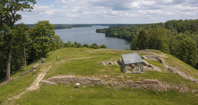
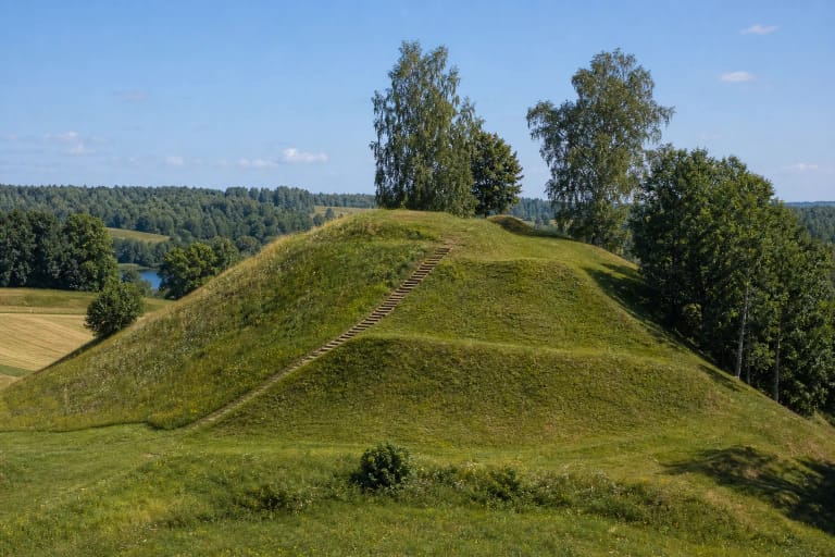
Cultural Heritage Register and municipal documents place Piliakiemiai Hillfort and settlement on the eastern shore of Kiementas, in Piliakiemiai village and Giedraičiai Eldership. The hillfort occupies the western end of an elongated hill, with traces of an ancient settlement at its south-eastern foot.
The site has produced hand-built rough and smooth pottery. It is a separate archaeological destination, so plan another approach from the public swimming place rather than expecting to see the hillfort from every beach position.
Giedraičiai adds a cultural setting to the lake visit. Molėtai District Municipality highlights the town's relationship with the western shore of Kiementas, making it natural to combine the lake with a short walk through the settlement and its local sites.
The public swimming place and Buzaičiai campsite are different visitor points
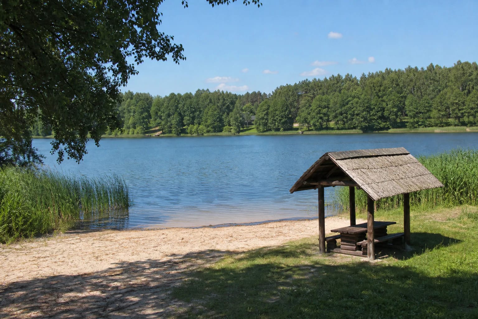
A Molėtai District Municipality report places the public swimming site on Paežerių Street in Giedraičiai. A pontoon and a lighting column were installed there in 2024; this page maps the bathing-site area at 55.074096, 25.264916, but assess the current condition of the equipment on site.
Buzaičiai campsite stands on the shore of Kiementas near Giedraičiai, but it is a separate service rather than an automatically public beach. Its official description mentions a fire site, outdoor toilet, tables, children's playground, and boat rental; contact the campsite about access and rules.
Do not infer the condition of the entire lake from the public swimming place. Marshy shores, muddy lakebed, and private land can change access, so enter the water only at the designated site and follow local instructions.
The bathing-site point is not a promise of access around the whole lake
This page's marker leads to the public bathing-site area on Paežerių Street in Giedraičiai. That is more useful to visitors than the lake centre, but it says nothing about every part of the 7.3-kilometre shoreline and does not grant access across private land.
The municipality includes the Kiementas bathing site in water-quality monitoring, but each results notice applies to a particular sampling period. Before swimming, check the municipality's latest information, signs on site, and the visible condition of the water.
If your goal is swimming, search for the official swimming place on Paežerių Street. If you want overnight facilities, a fire site, or a boat, check the Buzaičiai campsite separately.
Plan a specific and safe Kiementas route
For swimming, choose daylight and the officially listed location, bring your own water, and wear footwear suited to sand and grass. After rain, the access road or shore may be slippery, while muddy lakebed means that not every bank is equally comfortable.
Supervise children near the water, reeds, shelter, and any boats or playground facilities. Use life jackets for boating or fishing, and do not step onto ice without checking its thickness and local conditions.
Visit Piliakiemiai Hillfort as a separate stop, stay off private land, and park only where public access is clear. A lake or area label can help orient you, but it does not replace the exact visitor address.