- Place
- Kazlų Rūda Municipality
- Region
- Suvalkija
- Type
- forest-fringed pond near Jūrė village and Kazliškiai
- Address
- Jūrė village, Kazlų Rūda Municipality
- Coordinates
- 54.78371, 23.50805
- Visit duration
- 1-2 hours; travel only after checking the dam-repair and emergency status
- Best time
- May to October for forest and water views, but only after checking official repair restrictions and during daylight
Jūrės Water Body, Jūrės Pond by Kazliškiai, Jūrės tvenkinys
Jūrės Pond is a forest water body between Jūrė and Kazliškiai
Jūrės Pond lies in Kazlų Rūda Municipality near Jūrė and Kazliškiai villages, a few kilometres from Kazlų Rūda. It is a separate water body and should not be confused with the ponds in Kazlų Rūda town or Kazlų village.
The checked visitor reference is 54.783706, 23.508052. This is a representative shore point, not the only entrance or a guaranteed car park. Choose the final approach according to local roads, signs, and the actual surface condition.
The most important current fact is that a municipal emergency was declared in the Jūrės Pond and dam area on 3 July 2026. Open the municipality's latest notice before travelling, and do not enter if barriers or prohibitory signs are in place.
A sandy shore gives way to pine and spruce forest
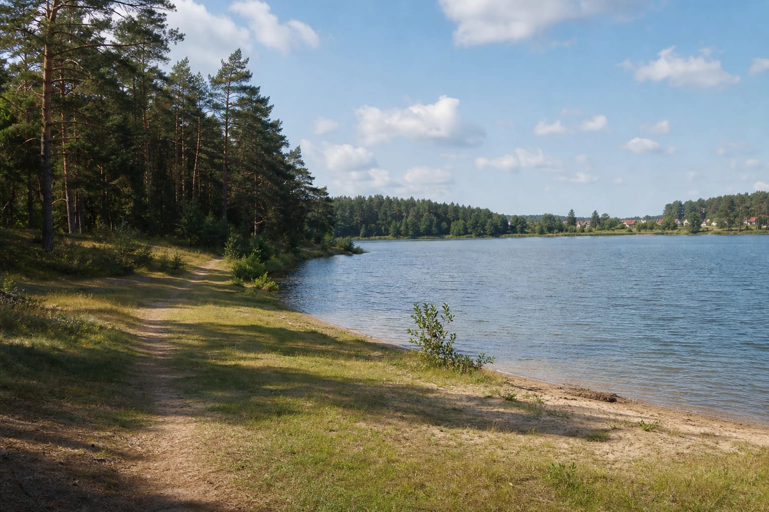
Local descriptions associate Jūrės Pond with conifer woodland and a sandy shore. The edge can look different with water level: in one place a narrow sand strip appears, while elsewhere grass, roots, and low shrubs reach the water.
The approach is not confirmed as a built route with an even surface, lighting, or rails. Wear shoes with good grip, especially after rain on the forest track, and do not attempt to drive right to the bank.
Morning and evening light pick out tree trunks and the water surface, while wind removes some of the pond's mirror-like calm. Keep away from sudden slopes, wet roots, and unfamiliar places at the water when taking photographs.
It is a dammed river, not a natural lake
Jūrės Pond was formed by damming the River Jūrė, a left tributary of the Višakis. VLE gives the river a length of 39 km and a basin of 111 km², and records dams at both Jūrė and Kazlai villages; this pond should therefore not be confused with the separate Kazlai Pond downstream.
The Ministry of Environment's 2023 fishing conditions give water-body code 15050157 and an area of 32.0 ha. A 2026 state land-planning document gives 30.35 ha, while the municipal strategy rounds the scale to 0.3 km², so the sources may measure slightly different water or land-parcel boundaries.
The reservoir's engineered character matters to visitors: water level, currents near outlets, and bank condition are not the same as at a natural forest lake. Keep away from technical structures, do not climb dam elements, and do not boat into unknown areas.
The surrounding forest gives the pond a coherent landscape, but it does not make every bank public recreation land. Do not cross homestead yards, private woodland, or places marked with prohibiting signs.
The 2026 dam works can change both shoreline and access
Kazlų Rūda Municipality says the unsafe condition of Jūrės dam was identified in 2018. A repair contractor was secured in 2026, but the works require the reservoir level to be lowered and permit coordination was delayed; an emergency was declared on 3 July because of the potential consequences for people, property, and the environment.
During the works, the usual water edge, sand strip, forest approaches, and fishing places may look different from older photographs. Do not step onto exposed mud, enter a works zone, or treat dam structures as a viewpoint.
The notices checked do not state that every part of the reservoir shore is universally closed, but that is not permission to enter a fenced or active construction area. If the municipality has not confirmed a clearly safe approach, choose another Kazlų Rūda woodland site and postpone this visit.
Fishing is governed by separate conditions
The Ministry of Environment page, updated in December 2023, lists Jūrės Pond among waters with regulated fishing. From 1 April to 31 October, fishing requires an angler's card; from 1 November to 31 March, an angler's card or recreational-fishing permit is required, alongside the general rules.
Those conditions prohibit fishing from self-propelled watercraft, floating fishing discs, and self-propelled radio-controlled bait boats for carp and grass carp; no more than four hooks may be used at one time. A card allows an angler to keep two carp and two grass carp measuring 40-60 cm during one fishing session.
These rules do not override temporary safety restrictions connected with the 2026 repair and emergency. Before buying a permit, check the latest Ministry version and the municipality's access notices.
Sand alone does not confirm bathing facilities
A sandy shore in map images and older photographs does not make this an official bathing area. The current official sources checked do not confirm lifeguards, permanent beach facilities, or a safe bathing section during the 2026 works.
While access and water-level conditions remain uncertain, choose another place for swimming. Even after the works, enter only after checking official notices, signs, water clarity, the bottom, and your own ability, and keep children within arm's reach.
The outing combines well with Kazlų Rūda Forest Nature Trail or the city park. Those places provide clearer access and a different woodland experience if the pond shore proves wet, slippery, or too natural.