- Place
- Kazlų Rūda Municipality
- Region
- Suvalkija
- Type
- a forest interpretation trail with separate walking and cycling routes, historical stations, and a small timber observation tower
- Address
- 26 Esperanto Street, Kazlų Rūda
- Coordinates
- 54.74724, 23.50958
- Visit duration
- 1.5-2.5 hours for the 4 km walking circuit; about 45-90 minutes for the 6.5 km cycling route, depending on stops and surface conditions
- Best time
- a dry day in spring or autumn, when forest tracks are firmer, insects are fewer, and the relief is easier to see; sand and soil sections can become muddy after heavy rain or a thaw
Kazlų Rūda Nature Trail, Kazlų Rūda Forest Trail
Two routes, not one trail of uncertain length, begin on Esperanto Street
The official trailhead address is 26 Esperanto Street, beside the main entrance to the UAB Ginalas site. The Kazlų Rūda municipal map gives 54.7472847, 23.5095859, while the exact Google listing marks the nearby point 54.7472385, 23.5095811. This is the start on the south-eastern edge of town, not the coordinates of the observation tower or a confirmed parking bay.
The walking route is 4 km and the cycling route 6.5 km. Those figures should not be collapsed into a single 6.5 km walking-trail length: newer official descriptions explicitly distinguish the shorter pedestrian option from the longer ride. Follow the map and waymarks at junctions, because one Google pin cannot show the complete circuit.
Official photographs show a broad sandy forest road, narrower grass tracks, a timber trailhead panel, and simple log benches. This is not a continuous boardwalk, asphalt path, or compacted stone surface. In dry weather the route is not technically demanding, but loose sand, roots, puddles, and traces of forestry work can change the real pace.
The trail interprets a working forest within the much larger Kazlų Rūda woodland complex
VLE describes the Kazlų Rūda forests as a 58,700 ha complex, about 47,000 ha of it wooded. Roughly 70 individual forests extend between the Nemunas and the Kaunas-Marijampolė road. The nature trail occupies only a small town-edge section and should not be presented as a complete ecological sample of the massif or as a strict nature reserve.
Across the wider complex, pine woods account for about 50 per cent, spruce 19, black alder 16, and birch 13 per cent. Pine and spruce do dominate the trail's official photographs, with deciduous trees and shrubs along the margins. Its panels discuss woodland plants and animals, protection, and forestry, so the lesson is both species recognition and the reading of a managed forest.
VLE states that 85 per cent of the whole forest complex is commercial woodland, with smaller shares assigned to ecosystem protection, recreation, or protective functions. Visitors may therefore hear machinery or encounter timber operations, restoration work, and temporary restrictions. Never pass closure signs, climb log stacks, or expect uninterrupted wilderness silence.
The bloomery and charcoal stack explain the iron behind the town's name
Models of an iron-smelting bloomery and a charcoal-burning stack stand along the route. Together they show two connected stages: wood was first converted into charcoal suitable for smelting, then local bog ore was heated in a small furnace. These are interpretive reconstructions, not an operating foundry or archaeological excavation, and the soil around them cannot date the process they portray.
VLE records a tar works at Kazla in 1737 and states that it began smelting ore in 1744. By the mid-nineteenth century it produced about 10 tonnes of iron a year. The VLE account of the forests also explains the local place-name pattern: iron workers were called kazlai, while small iron-ore deposits were exploited in the woodland.
This activity explains the older settlement name, but the present town grew later. A railway station was built in 1861 about 2 km from Kazlai village, and a new settlement formed around it. The trail models therefore interpret an earlier woodland craft layer; they are not a substitute for the full railway, timber-industry, and twentieth-century history of Kazlų Rūda.
The partisan dugout is a full-size model within a resistance story spanning the wider forest
State Forest Enterprise accurately calls the trail feature a full-size model of a partisan dugout. That distinction matters: visitors can understand the scale and construction of a hiding place, but should not describe it as the surviving original bunker of a named unit. The official trail descriptions checked do not identify a specific prototype or date for an earlier structure on this exact spot.
The broader documented context is strong. VLE states that one of the first Suvalkija partisan units formed in the Kazlų Rūda forests in summer 1944. From 1945, the Žalgiris detachment of the Tauras military district operated in the area, where the district headquarters was established. Partisan and non-commissioned officer courses were organised in the forests in 1947.
The forest complex covers tens of thousands of hectares, so its general resistance history does not place every event beside today's trail. Read the reconstruction as an introduction and memorial device. Enter only if the opening is unobstructed, the structure appears sound, and local signs permit access; never disturb its covering or use it for a fire.
Vokiški kalneliai, a timber tower, and rest areas add relief, but visitor structures age
Part of the route crosses rolling ground locally called Vokiški kalneliai. The authoritative sources checked offer no reliable origin for that name, so it should not automatically be connected with German troops, trenches, or a particular war. For a visitor it first describes short ascents and descents that break up an otherwise gentle forest road.
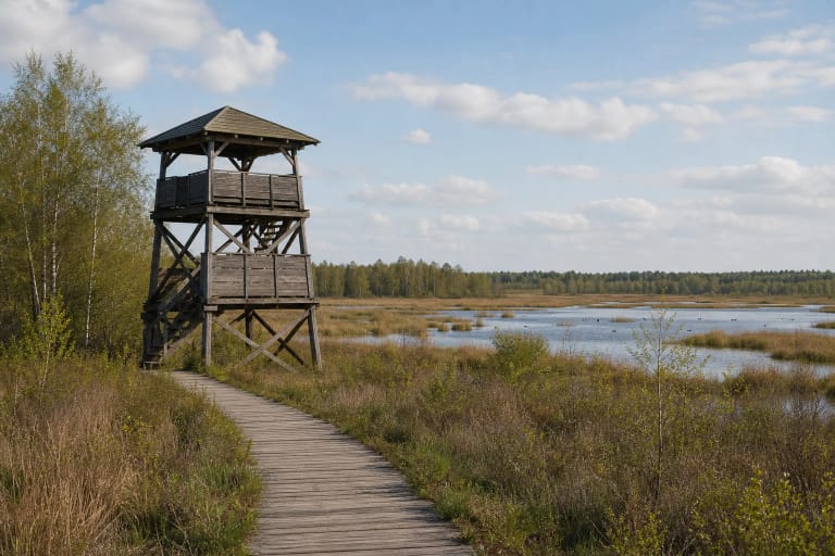
A small four-legged timber observation tower with a roofed platform stands on one sandy rise. Official State Forest Enterprise photographs show its deck below or among the surrounding crowns, promising a close view of forest vegetation rather than a far-reaching Suvalkija panorama. No reliable public figure was found for its height or maximum occupancy.
The route is also described as having shelters, benches, viewing areas, timber animal sculptures, and a rest site. A 2024 State Forest Enterprise article noted that information panels were being renewed. This demonstrates maintenance rather than guaranteeing that every structure remains unchanged in 2026. Inspect steps, railings, and boards before climbing, and stay off any closed or visibly damaged feature.
The free forest route is shown as open around the clock, but daylight remains the sensible choice
On 15 July 2026, the exact Google Maps listing Kazlų Rūdos pažintinis takas, place ID ChIJsYI8X0fX5kYRtQyEBqVFqXc, averaged 4.5 out of 5 from 147 reviews and displayed 24-hour access. The rating met the selection threshold exactly, and both the average and review count will change. The official municipal attraction page lists neither a separate ticket nor gated opening hours.
A 24-hour map label does not mean the route is lit, cleared, or continuously supervised. Waymarks and roots are easier to see by day, and tower condition can be assessed properly. Before setting out, check State Forest Enterprise and municipal updates, the weather, and any forestry restrictions. Light fires only in a clearly designated, currently usable place and follow the fire-prevention rules in force that day.
The main tracks are broad, but official sources do not confirm a continuous step-free surface to every station. Sand, roots, slopes, tower stairs, and the dugout entrance limit universal access. Cyclists should slow down around walkers, junctions, and children, while dogs must remain under control. Use the on-site route map to return to the same Esperanto Street trailhead.