- Place
- Dirvonai, Akmenynai Eldership, Kalvarija Municipality
- Region
- Suvalkija
- Type
- an individually registered hillfort of national significance on the Sudovian Upland, dated from the third century BC to the sixth century AD
- Address
- Dirvonai village, Akmenynai Eldership, Kalvarija Municipality
- Coordinates
- 54.43612, 23.07319
- Visit duration
- 30-60 minutes to read the summit, southeastern slope, and overall landform, excluding the time needed to find lawful access
- Best time
- dry daylight in early spring or late autumn, when lower grass and reduced foliage make the landform easier to recognise
Dirvonų piliakalnis, Piliakalnis
The exact listing marks the eastern edge of the hillfort, not an entrance
The official Dirvonai Hillfort lies in Dirvonai village, Akmenynai Eldership, Kalvarija Municipality. Lithuania's Cultural Heritage Register records it under code 46730 as one individually registered property of national significance. The signed 2021 plan explicitly says it has not been declared protected by the state or municipality. National describes its level of significance; it does not replace the site's legal status.
The exact Google Maps listing, place ID ChIJvfdRBAAl4UYRuF41A8oBG28, marks 54.4361176, 23.073193. Comparison with the signed register boundary places the point beside the eastern slope, approximately 11 metres beyond the registered polygon. It is a useful adjacent site marker, but not a gate, car park, or verified starting point for access.
On 15 July 2026, the listing averaged 4.5 out of 5 from only two reviews. It met the selection threshold exactly, but a sample this small is exceptionally fragile: a single new rating could change both the average and the site's eligibility. The listing also provided no reliably verified official opening schedule.
This site should not be confused with another historical use of the Dirvonai name in Zarasai District. That property is now officially registered as Šišponiškiai Hillfort under code 5725. Adding Akmenynai, Kalvarija, or heritage code 46730 to a search identifies the hillfort described here.
A 2019 discovery became a single registered property of 6,696 square metres in 2021
Archaeologist Egidijus Šatavičius recognised the hillfort in 2019 and completed a detailed survey and protection proposal on 15 November 2020. His report brought together the topography, surface material, LiDAR imagery, and the generic local name Piliakalnis, meaning Hillfort, to show that this was a previously unregistered archaeological site.
The Cultural Heritage Department's evaluation council signed its act on 7 December 2021, and the property entered the register on 20 December. The final area is 6,696 square metres. Its summit, bank, slopes, and archaeological deposit are recognised together; archaeological value is decisive, while landscape value is also significant.
The discovery report proposed a possible foot settlement north and northwest of the hill and recommended a protected area of roughly 1.34 hectares. The final act did not adopt that version. It registered an individual 0.6696-hectare hillfort without component properties or a separate settlement. The earlier proposal is a legitimate research hypothesis, not a confirmed or registered settlement.
A 32 by 25 metre summit rises between Sudovian fields and peat-forming hollows
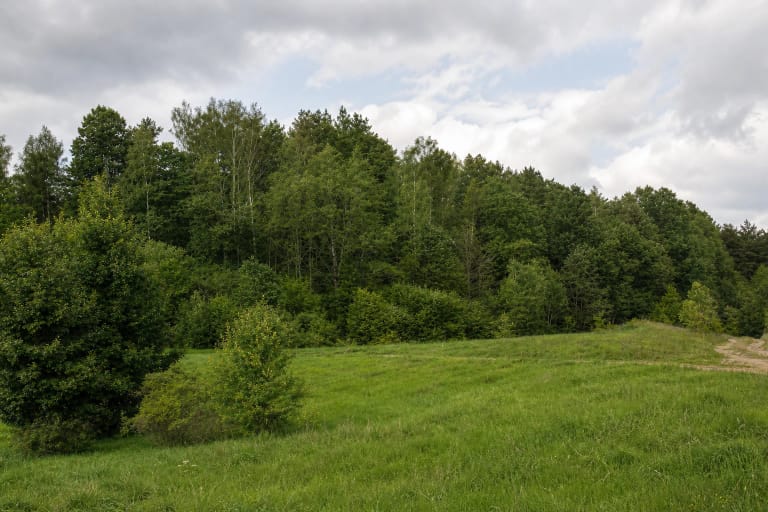
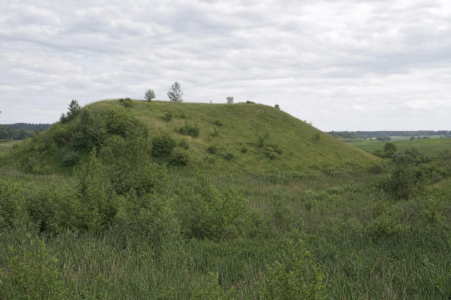
The hillfort stands on the Sudovian Upland, at the northeastern edge of the Gražiškiai-Vištytis hill country. It occupies a small spur beside thermokarst hollows that once resembled tiny lakes and are now turning to peat. The summit reaches approximately 215.5-216 metres above sea level, so the hill can merge into the rolling agricultural landscape when viewed from the upland side. Its Suvalkija classification is supported not only by the geographic name Sudovian Upland: the official EKGT map also assigns Kalvarija Municipality to Suvalkija.
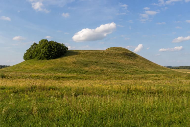
The register describes a trapezoidal summit measuring 32 by 25 metres, elongated from southwest to northeast and dipping gently southeastward. The discovery report measured the base of the whole hill at roughly 33 by 62 metres, showing how little of the complete landform is occupied by the summit.
Its most impressive feature is the southeastern slope rather than the summit. The register gives this face a height of 20-22 metres, while the northern and northeastern sides rise only 3.5-6 metres. This contrast explains why the hill looks pronounced above the wet, brush-filled hollow yet can seem almost inconspicuous from the adjacent upland fields.
The small bank may preserve an older earthwork or record drilling work around 1980
The register identifies a quadrangular bank on the summit, 0.3-1.2 metres high and 4-6 metres wide. It is listed among the valuable features of the hillfort's relief, but the label alone does not establish when every part of the form visible today was created. At Dirvonai, the underlying ambiguity is unusually important.
The discovery report offers two possible explanations. A deep-drilling rig stood on the summit around 1980, and earth levelled for that platform may have been pushed toward the edges to form the present quadrangle. Alternatively, levelling may have removed the centre of an older, higher summit while leaving part of its former edge. Neither interpretation can be proved without excavation.
The preliminary report also mentions a possible ditch trace at the western foot, only 0.2-0.3 metres deep and 20-23 metres wide. It was not retained in the final register description of valuable properties. Visitors may notice a very shallow transition in the terrain, but should not present it as a confirmed defensive ditch.
Surface material supports the date, but it is not an excavation assemblage
The register describes a grey, charcoal-rich archaeological deposit up to 20-30 centimetres thick. Burnt boulder fragments, handmade pottery sherds, crumbs of daub or fired clay, and shapeless remains of heavily corroded iron objects were observed in it and on the surface. This evidence supports a date from the third century BC to the sixth century AD.
These are survey and surface observations, not the results of an excavation exposing houses, hearths, or burials. The records provide no named castle, specific battle, or ruler associated with the hillfort. Nor was a reliable site-specific legend found, so a responsible account does not manufacture a historical or mythological narrative to fill that gap.
Long-term ploughing has worn down the landform. An old vehicle approach was pushed into the southwestern slope, the northeastern corner was cut, and badger or fox burrows have disturbed the southeastern edge of the summit. Parts of the hill are fallow while others carry shrubs and trees. These features explain its uneven surface but do not permit digging or collecting archaeological material.
This is an open archaeological hill without verified visitor infrastructure
The discovery report places the hillfort approximately 0.74 kilometres north-northeast of road 200 between Kalvarija, Gražiškiai, and Vištytis. The register plan shows its boundary amid agricultural parcels but establishes no public footpath or vehicle approach. Kalvarija Municipality's visitor-site list names Dirvonai village but supplies no route, parking area, or entrance.
If no clear lawful approach or current signs are visible, do not drive across a field or cross crops, fencing, or obviously private land simply to reach the map pin. Leave a vehicle only where doing so is legal and safe, without blocking a farm access. The checked sources verify no dedicated car park, stairs, handrails, toilet, lighting, or step-free path.
Allow roughly 30-60 minutes at the landform, excluding the time required to find an appropriate approach. The relief is easiest to read on a dry day in early spring or late autumn, when grass is lower and shrubs obscure less of the slope. The southeastern face is steep, and burrows, erosion, and traces of earlier earthmoving make the surface uneven. Wheelchair access is not confirmed, and sturdy footwear is sensible even for walkers.
Official sources publish no ticket office, admission charge, or opening hours. That absence does not create permission to visit at any hour or cross any parcel. Choose daylight, check current conditions before travelling, and leave the archaeological surface undisturbed.