- Place
- Liubavas, Kalvarija Municipality
- Region
- Suvalkija
- Type
- border hill recorded at 225 metres, with a lookout tower used for surveillance during the Soviet period
- Address
- Liubavas village, Liubavas eldership, Kalvarija Municipality
- Coordinates
- 54.35696, 23.02382
- Visit duration
- 30-60 minutes for the hill and panorama; longer if the nearest legal stopping place requires an approach on foot
- Best time
- a clear, dry visit in daylight, when mist and haze do not hide the rolling border landscape
Kačergų kalnas, Kačergų kalno apžvalgos bokštas, Kačergų Hill Lookout
The exact place is Kačergų Hill in Liubavas, not the similarly named town of Kačerginė
The attraction annex published by Kalvarija Municipality lists Kačergų Hill in Liubavas eldership and Liubavas village. Its exact public Google Maps listing is named Kačergų kalnas and marks 54.3569644, 23.0238188. The place ID is ChIJxwVXDC8j4UYRwbdtbKU87fA. This point identifies the hill and lookout itself rather than the centre of Liubavas.
On 15 July 2026, the listing averaged 4.6 out of 5 from 39 reviews. That is a more substantial sample than many little-visited hills in Suvalkija, although both the rating and review count will change. Google categorises the place as a historical landmark; this site groups it with observation towers and panoramas because the view from the hill is the principal visitor experience.
Do not confuse the name with Kačerginė in Kaunas District or its Springs Trail. This is also not Liubavas Manor in Vilnius District. Kačergų Hill is in south-western Lithuania, within Kalvarija Municipality and immediately beside the Polish border, so use the complete name and exact place ID when navigating.
The 225-metre figure belongs to the hill, not to the lookout tower
Kalvarija Municipal Public Library records Kačergų at 225 metres and places it roughly 1 km south of Liubavas. That figure describes the hill and must not be repeated as the height of the lookout. None of the official pages reviewed gives a measured height for the structure, so no unverified tower dimension should be inferred from the elevation of the land.
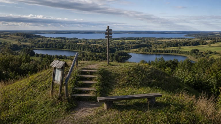
The Liubavas development plan describes the surrounding landscape as a mosaic of substantial hills, deep hollows, small areas of level ground, woodland, and groups of trees. The Šešupė enters this territory from Poland, and the same document places Kačergų directly on the Lithuanian-Polish border. The panorama therefore challenges the stereotype of Suvalkija as uniformly flat: fields and woods rise and fall in long waves across the horizon.
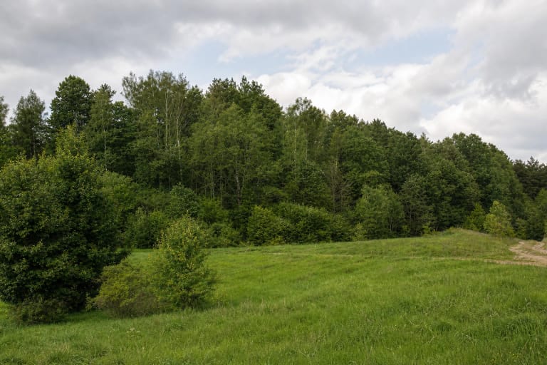
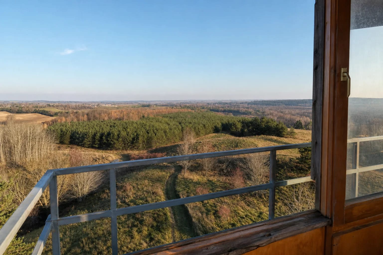
Arūnas Jasaitis's official photographs from 2021 show open yellow-green grassland, belts of pine and birch, winding local tracks, and low hills extending into the distance. This is not a single sheer cliff or dramatic rocky summit. Its visual power comes from a broad, layered horizon, best defined by clear air and low morning or evening light.
The lookout helps visitors search for five church spires and a bend of the Šešupė
The municipal library says that a lookout tower stands on the hill and opens views across Lithuania and Poland. In clear weather, its description names five church spires: Liubavas, Jeleniewo, Wiżajny, Akmenynai, and Gražiškiai. The Liubavas development plan adds a bend of the Šešupė to the same panorama.
The number five is an orientation guide for good conditions, not a promise that every spire will be visible on every visit. Fog, haze, rain, the direction of the sun, and seasonal foliage can hide distant vertical landmarks. Begin with the direction of Liubavas and scan the horizon with binoculars, but never cross a barrier or leave a permitted path merely to improve the angle.
Official photographs from 2021 show a small roofed viewing room with timber window frames and an external metal railing. They establish the character of the structure but do not constitute a technical inspection in 2026. No current structural assessment, load limit, or official confirmation that the tower is presently safe to climb was found. Obey every closure and sign on site, and do not enter a damaged or fenced-off structure.
Soviet-period border surveillance is documented, but the tower's construction date is not
Kalvarija Municipal Public Library records that the tower served border observation during the Soviet period because, in the source's wording, a demarcation line ran here. This use explains why a viewing structure occupied a strategically high position and why its windows opened towards a broad horizon on both sides of today's border.
The authoritative sources reviewed provide no construction year, architect, reconstruction chronology, or surviving inventory from a former border post. It is therefore responsible to describe the documented surveillance function, but not to invent a precise building date or present the current structure as an authenticated design from a particular year.
The library and eldership texts call the hill a place surrounded by legends and traditional tales, yet they provide no archival text, recording date, or catalogue reference for a specific story. More detailed narratives appear in later travel writing, but their authoritative provenance is unclear. This page therefore recognises a general layer of local memory without retelling an unsupported legend as history.
Inside the border zone, Google's 'open 24 hours' field is not permission to enter
Kačergų Hill stands immediately beside the national border, so a journey requires a check of the current VSAT rules for entering the border zone as well as a weather forecast. The VSAT administrative-services page, updated on 17 April 2026, continues to publish a dedicated entry procedure, application form, and contacts. A wish to visit the hill does not itself prove that an exception covers a particular route. Ask VSAT in advance whether a permit is required, and carry valid identification together with any authorisation they specify.
Google displayed the place as open 24 hours on 15 July 2026, but that is only a map field. It cannot override the border regime, signs on site, a temporary instruction from officers, landowner rights, or a safety decision concerning the tower. The official hill sources publish no separate admission ticket, ticket office, or staffed timetable, but the absence of a ticket does not create unrestricted access at any hour.
No current official car park, step-free route, or illuminated approach to the hill was confirmed. Leave a vehicle only where stopping is legal, do not block a narrow road, and never drive across grassland or a private access track because navigation suggests it. Do not touch border markers or cross the border away from a permitted crossing, and return before dark.
Visitor infrastructure is planned, so it must not yet be promised
In December 2025, Kalvarija Municipality reported progress on the 2023-2029 Marijampolė Regional Functional Zone Strategy. Kačergų Hill is named among the places intended for visitor adaptation, while the programme's general tourism description refers to parking, rest areas, and small architectural features. The page does not say which individual elements at Kačergų are already complete. Future parking, paths, and rest equipment must therefore not be described as facilities currently available.
If VSAT confirms that your route is permitted and signs on site allow access to the hill, allow 30-60 minutes for the panorama. Never force entry if the tower is closed or appears unsafe. Concentrate on what can be seen from the permitted part of the hill, and turn back if the ground is waterlogged, the structure is damaged, or access is restricted by officers or construction work.
A sensible itinerary can combine Kačergų with Papiliakalniai Hillfort, Lake Orija, and the heritage of Kalvarija town, but it must follow legal roads rather than a straight line across border fields. Check VSAT information, Kalvarija Municipality notices, and the live map shortly before departure. The border regime and the stage of construction projects may change much faster than the landscape itself.