- Place
- Vilnius City Municipality
- Region
- Vilnius
- Type
- Neris Valley viewpoint in the Paneriai hills of Vilnius
- Address
- Gariūnų St. 37, Vilnius, Lithuania
- Coordinates
- 54.66097, 25.17111
- Visit duration
- 30-60 minutes at the viewpoint; longer if you walk the Paneriai hills
- Best time
- Morning or sunset; a clear day and leafless season give a wider valley view
Gariūnai viewing platform, Gariūnai viewpoint
Gariūnai Viewpoint is a small platform above the southwestern Vilnius valley
Gariūnai Viewpoint is in the Paneriai hills of Vilnius, near Gariūnų Street. The exact site point is 54.660970, 25.171105, but it does not promise a parking bay beside the platform. Use only permitted access and do not leave a car on a forest track or private land.
The viewpoint is a separate panoramic site and should not be confused with the Gariūnai suffosion cirque, Paneriai Hillfort, or Gariūnai Market. All these names belong to the wider southwestern Vilnius area, but they identify different places and experiences.
The Neris bend meets the Lazdynai and Vilnius horizon
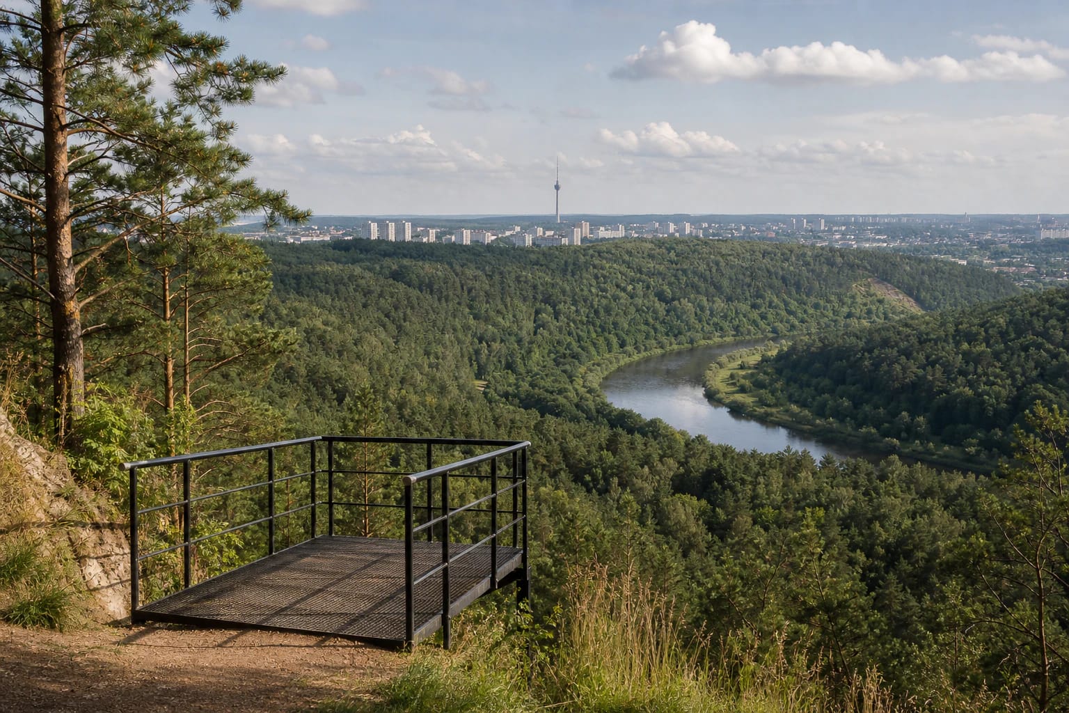
The first view is the broad wooded Neris Valley and its river bend. Farther away, the Lazdynai apartment blocks, the Gariūnai surroundings, and the Vilnius TV tower rise on the horizon. The view combines a seemingly wild valley with the infrastructure of the city edge, making this a landscape and urban viewpoint at once.
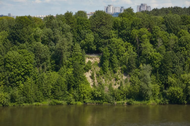
Foliage changes the scale of the panorama. Summer trees hide part of the river and distant buildings, while leafless autumn and winter reveal the slope lines more clearly. Morning light often brings a quieter valley view, and sunset can warm the city silhouettes, but clouds and atmospheric clarity always decide what is visible.
The platform is modest; the Paneriai relief provides the height
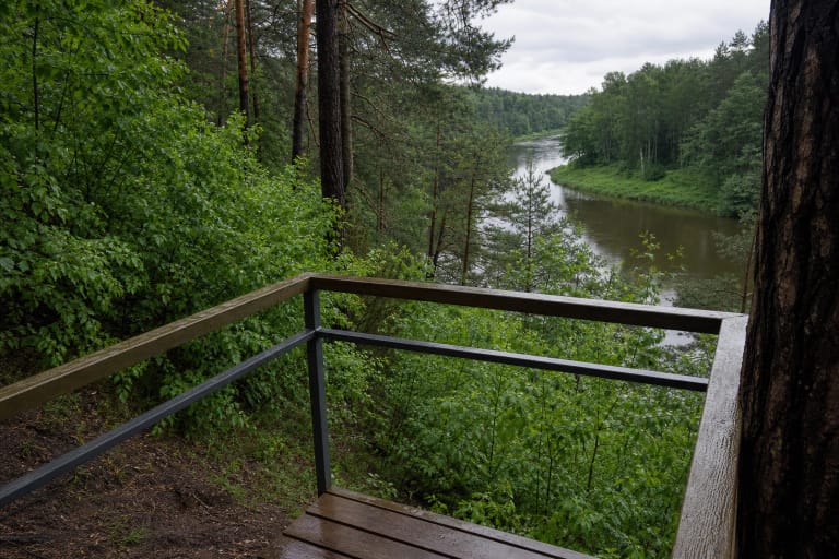
Gariūnai Viewpoint is not a tall tower. It is a simple metal platform with railings on a higher hill, large enough for a small group to pause. The panorama feels high because of the natural wooded slope and the Neris below, not because of a multilevel structure.
The 2026 Vilnius City management-plan map for the Paneriai Erosion Hills Landscape Reserve marks an existing viewing platform and recreational infrastructure in this part of the hills. The plan confirms the site's place in the protected landscape, but it does not guarantee that every mapped approach is always driveable.
Use the railings only as a support, never climb over the edge, and do not photograph from unstable ground. After rain, the metal surface, leaves, and soil can be slippery, while wind is stronger on the open hill than in the woodland below.
The Paneriai hills were shaped by glacial relief and erosion
The Encyclopaedia of Lithuania describes the Paneriai hills as an erosional hill country on the left slope of the Neris Valley. It is about 5 kilometres long and up to 3 kilometres wide, with ridges, hills, ravines, and an average elevation of 160-180 metres. The reserve covers 789.06 hectares. This structure explains the deep green spaces at the city edge.
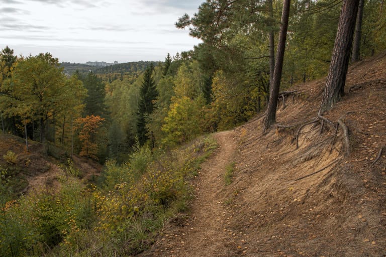
Vilnius landscape descriptions connect the Neris ancient valley with meltwater relief, while later erosion shaped the Paneriai hills. From the viewpoint you can read that process from above: the river follows the lower valley line, while wooded ridges and ravines build the uneven foreground of the panorama.
Approach from Gariūnų Street or climb from Titnago Street
The usual upper approach follows a gravel road from Gariūnų Street to a small parking area, with an alternative climb from below near Titnago Street. This is a practical route orientation rather than a permanent access guarantee: surfaces, barriers, and parking conditions can change, so follow the newest signs on site.
The climb from Titnago Street is steeper and more demanding than the upper approach. If you drive, do not block residents or forest work. Visit in daylight, wear shoes with good grip, and choose only a public or clearly permitted route for a longer walk.
Visit the viewpoint safely and avoid creating shortcuts
Gariūnai Viewpoint is in an urban woodland landscape, so there is no permanent attendant, lighting, or lifeguard. A map point is not a safety assessment: darkness, mud, roots, ice, and the steep slope may matter more than formal outdoor access.
Do not cut a new path straight down from the platform, climb ravine slopes, or drive through the woods. Take rubbish with you, do not light fires outside designated places, and leave the vegetation intact. That keeps the viewpoint small, quiet, and resilient rather than turning it into another erosion scar.