Vilnius City Municipality
Vilnius
geological natural monument and Vilnia valley viewpoint
Pavilnių regioninis parkas, Pūčkoriai, Vilnius
54.69200, 25.35300
45-120 minutes
spring and autumn, when the slope layers and the shape of the Vilnia valley are easiest to see
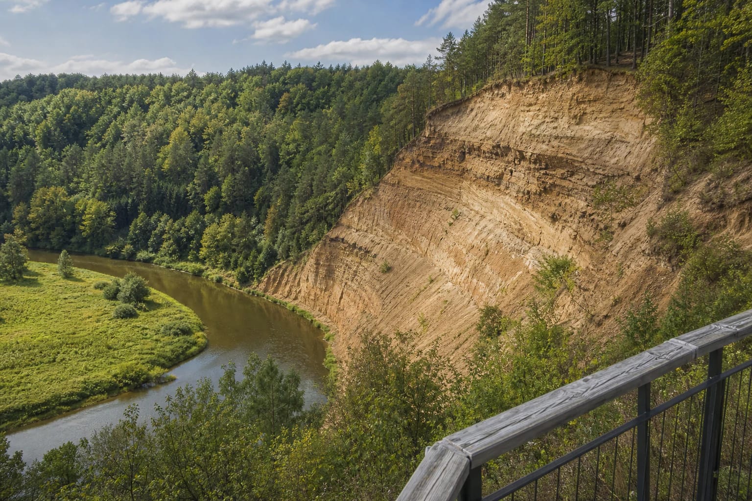
Puškoriai Outcrop
Lithuania's highest outcrop
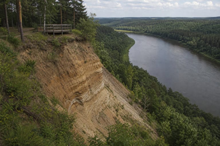
Pūčkoriai Outcrop is on the eastern edge of Vilnius, in Pavilniai Regional Park, beside the Vilnia valley. Saugoma.lt states that it is the highest outcrop in Lithuania: 65.2 m high and 260 m wide.
This is not only a beautiful cliff. VLE defines it as an erosional outcrop and geological natural monument, protected since 1974. In one place you see both the Vilnia valley landscape and the Ice Age layers hidden below it.
What the layers show
Saugoma.lt writes that Pūčkoriai Outcrop exposes the old Medininkai glacial sequence, later crumpled and disturbed by younger glaciers. Layers of moraine, sand, and clay of different ages can be seen, in places even turned almost vertically by moving ice.
VLE gives the geological detail: Quaternary deposits appear in the slope of the Vilnia erosional valley, including loam, boulders, cobbles, gravel, sand, silt, and varved clay. This is a good place to explain how Lithuania's landscape was shaped by glaciers, meltwater, and later river erosion.
Especially interesting are what VLE calls allochthonous blocks - older rocks brought from elsewhere by the glacier. At Pūčkoriai, geologists found a block of Jurassic grey clay with belemnite and ammonite remains and a block of Cretaceous chalk, so a much older-than-Ice-Age story is visible in one place.
The work of the Vilnia
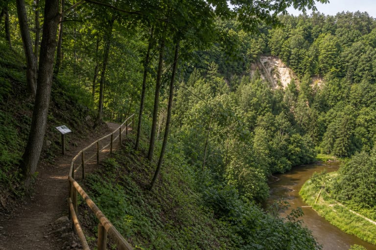
The outcrop formed as the Vilnia River cut into the steep-sided valley. The river is not only a scenic element in the panorama: it still acts on the slope, while rain, snowmelt, and gravity add to the erosion.
For that reason the outcrop is not a stable museum display. VLE notes that the slope is unstable, landslides are common, and the upper part is eroded by rain and wind. For visitors, the rule is simple: look from built viewpoints, but do not climb on the cliff or its foot.
Panorama from the viewpoint
Saugoma.lt emphasizes that the upper viewing platform opens a panorama of the Vilnia valley, the river bend, Pūčkoriai manor buildings, the Pūčkoriai apple orchard, and the direction of Aukštutinis Pavilnys.
This panorama is different from central-city viewpoints. Here Vilnius appears as a landscape of river, forest, and old suburban homesteads, so Pūčkoriai Outcrop works both as a city-route stop and as a nature and geology destination. VLE explains that the name Pūčkoriai comes from the cannon foundry that operated here in the seventeenth to nineteenth centuries, from Polish puszkarnia.
Nature trail and Belmontas
VLE states that a loop nature trail by Pūčkoriai Outcrop has three route lengths: 2.8 km, 3.7 km, and 5.3 km. That lets you choose a short viewpoint stop or a longer Pavilniai Regional Park walk.
Nearby, it is worth combining the outcrop with Pūčkoriai manor, the Vilnia riverside, Belmontas, and Pūčkoriai Hillfort. If you come on a weekend, allow extra time because Belmontas and trail starting points can be busy.
How to visit safely
Most importantly, do not cross barriers and do not climb onto the loose slope. The layers look solid from a distance, but they are affected by landslides, water, and crumbling deposits; unauthorized climbing damages the object and is dangerous.
After rain, trails and slope approaches can be slippery. Keep children close near the viewpoint and cliff edge, and do not step backwards toward the edge while taking photos.