- Place
- Dukurnonys village, Jieznas Eldership, Prienai District Municipality
- Region
- Prienai District
- Type
- hillfort with a settlement at its foot
- Address
- Dukurnonys village, Jieznas Eldership, Prienai District, beside Lake Surmius
- Coordinates
- 54.65944, 24.22333
- Visit duration
- 45-90 minutes for the hillfort, the view over Lake Surmius, and the settlement landscape at its foot
- Best time
- a dry day from late spring to autumn; slopes and steps may be slippery after rain
Paukščiai Hillfort, Steponiškiai Hillfort, Vilkai Hillfort, Bobų Hill
One hillfort, several names
The Cultural Heritage Register names the object Dukurnonys Hillfort and Settlement. VLE calls it Dukurnonys and Steponiškiai Hillfort, while Prienai-area sources use Paukščiai, Vilkai Hillfort, and Bobų Hill. These are not separate sites but layers of names for the same archaeological complex.
The hillfort stands in the south-eastern part of Dukurnonys village on the south-western shore of Lake Surmius, also called Lake Vilkai. The coordinate on this page marks the hillfort itself, so it should not be treated as a guaranteed parking place or the start of a convenient path.
A small but legible defensive mound
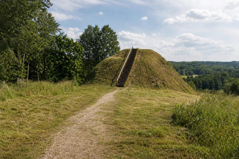
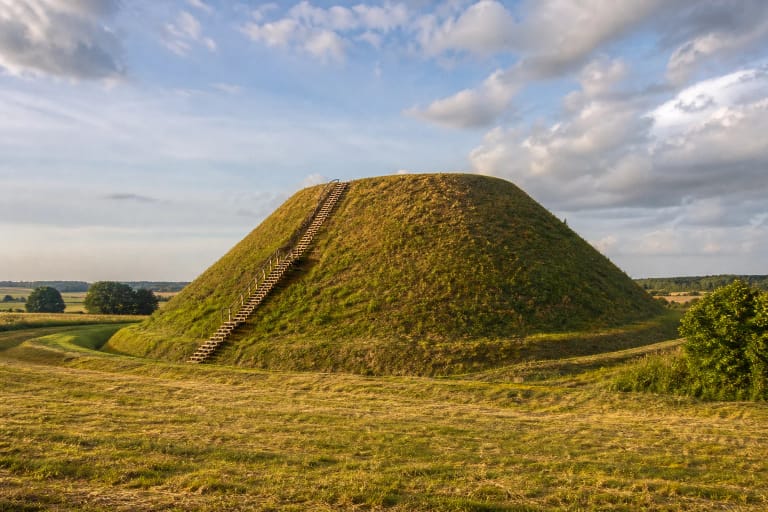
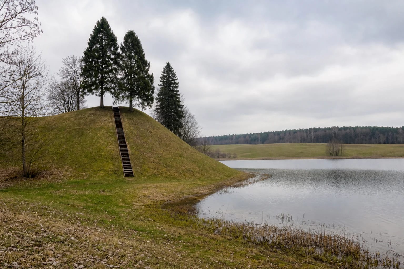
VLE describes a truncated-cone-shaped hill: its eastern and north-eastern slopes descend to the shore of Lake Surmius, while hollows or an adjoining hill surround the other sides. From the lake the slopes rise about 14 metres; from the adjoining hill they rise about 10 metres.
The nearly circular platform is about 8 metres across. A rampart 1-6 metres high rings it, with remains of a defensive ditch beyond. At the top, look for the earthwork structure as well as the lake view: the relief itself is the monument.
The settlement at the foot and archaeological finds
Remains of an ancient settlement survive at the southern and south-western foot of the hillfort. Prienai Regional Museum says that pottery with striped, rough, and smooth surfaces was found across an area of about 5 hectares; the finds are held by the National Museum of Lithuania.
Archaeologists surveyed the object in 1953, 1971, and 1988. The museum description dates the hillfort from the first millennium to the beginning of the second millennium. The settlement at the foot is not a separate museum with visible exhibits: it is part of the wider protected archaeological landscape.
The Lake Surmius shore landscape
The hillfort overlooks Lake Surmius and the surrounding hills. The Prienai district guide also calls the lake Vilkai and gives it an area of about 12 hectares and a maximum depth of 18 metres.
The eastern and north-eastern sides of the hillfort meet the water, which helps explain why the mound worked as a defensive and observation point. It is not automatically a developed beach or bathing site, however: do not descend steep slopes to the water, and use only lawful, locally marked access.
Approach and changing infrastructure
The Prienai district hillfort-route guide places the site about 0.4 km north of the junction of the Jieznas-Kalviai road and the road to Sundakai. The useful navigation point is 54.659444, 24.223333, but assess the final approach according to actual road conditions and local signs.
In 2026, Prienai District Municipality announced a 2025-2029 project to adapt Dukurnonys Hillfort and the Lake Surmius shore for visitors. The plan includes paths, stairs, approaches, parking spaces, information boards, and rest elements. These are planned project outcomes, not a promise that every facility is already complete or operating in the same condition every day.
Visit without harming the monument
The slopes are steep, and natural grass and steps may be slippery after rain. Stay on the existing or marked route, do not cut across the rampart, do not drive onto the mound, and do not reach the lake through eroding slopes.
The official descriptions checked do not list a separate ticket or fixed opening hours, but that is not permission to enter a closed or active work area. Visit in daylight, follow local signs, do not dig or collect pottery and other finds, avoid fires outside a designated place, and take your rubbish with you.