- Place
- Geruliai, Stakliškės Eldership, Prienai District Municipality
- Region
- Dzūkija
- Type
- a hillfort and foot settlement dated from the first millennium to the beginning of the second, with a rampart, ditch, and an Obeltis-eroded slope
- Address
- Geruliai village, Stakliškės Eldership, Prienai District Municipality
- Coordinates
- 54.54610, 24.29030
- Visit duration
- 30-60 minutes to examine the rampart, ditch, and Obeltis-side landform; allow longer if the final approach must be walked
- Best time
- a dry day in early spring or late autumn, when sparse foliage reveals the rampart and summit more clearly; summer undergrowth can be dense
Geruliai Hillfort and Settlement, Gerulių piliakalnis su gyvenviete, Gerulių piliakalnis (Prienų r.)
One name, two hillforts only about 2.1 km apart
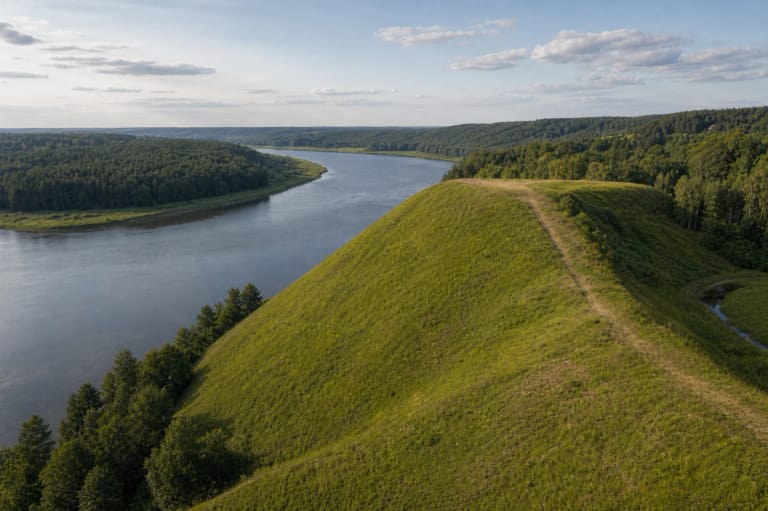
This page covers the Geruliai hillfort in Stakliškės Eldership, Prienai District Municipality. It occupies the southern edge of Gojaus Forest on the right bank of the Obeltis. The Lithuanian Register of Cultural Property records the full site as Geruliai Hillfort and Settlement under unique code 22591. These are the safest identity markers because the village and hillfort names alone are not enough.
The exact Google Maps listing, Place ID ChIJm2gvNQBP50YR_mo9datEOMQ, marks 54.5460967, 24.2903047. On 15 July 2026 it displayed an average rating of 4.7 out of 5 from 3 reviews. That cleared the 4.5 selection threshold, but such a small review count means the average can move sharply. The pin marks the archaeological site itself, not a confirmed car park or entrance.
Another Geruliai hillfort lies roughly 2.1 km to the southwest in Butrimonys Eldership, Alytus District. Its KVR complex number is 22609, and its coordinates and Google listing are different. Always check for the Prienai District address and the Place ID above. Photographs showing a long, straight wooden staircase belong with the other namesake, not this Prienai site; no such staircase appears in the verified photographs here.
A 13 by 7 m summit defended by a rampart up to 7.5 m high
The summit is very small, aligned northwest to southeast and measuring 13 by 7 m. KVR describes its outline as oval, while VLE calls it triangular; both sources give the same dimensions. The Obeltis has washed away the northwestern part, so the outline visible today does not preserve the complete original plan of the fortified summit.
A semicircular rampart about 19 m wide closes the southeastern side. It rises 6.5 m above the summit and 7.5 m on its outer face. Beyond it is a ditch 25 m wide and about 2 m deep, now partly filled and occupied by orchard vegetation. The proportions are striking: the usable summit is tiny, while the defensive rampart and ditch account for much of the visible landform.
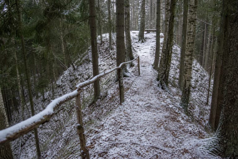
The wooded slopes are steep and descend 11-12 m. From the foot, it can be difficult to separate the natural side of the Obeltis valley from the built earthwork. Read the site as a sequence: a small upper platform, the high southeastern rampart, the broad depression of the ditch beyond it, and the stream-eroded edge on the opposite side.
KVR complex 22591 joins hillfort 5521 and settlement 22592
The Register of Cultural Property protects Geruliai as an archaeological complex of national significance. Hillfort 5521 is its principal component, while the ancient settlement at its foot carries code 22592. The complex is broadly dated from the first millennium to the beginning of the second millennium. This is the official chronological range for the protected site, not a precise construction year for one phase of the rampart.
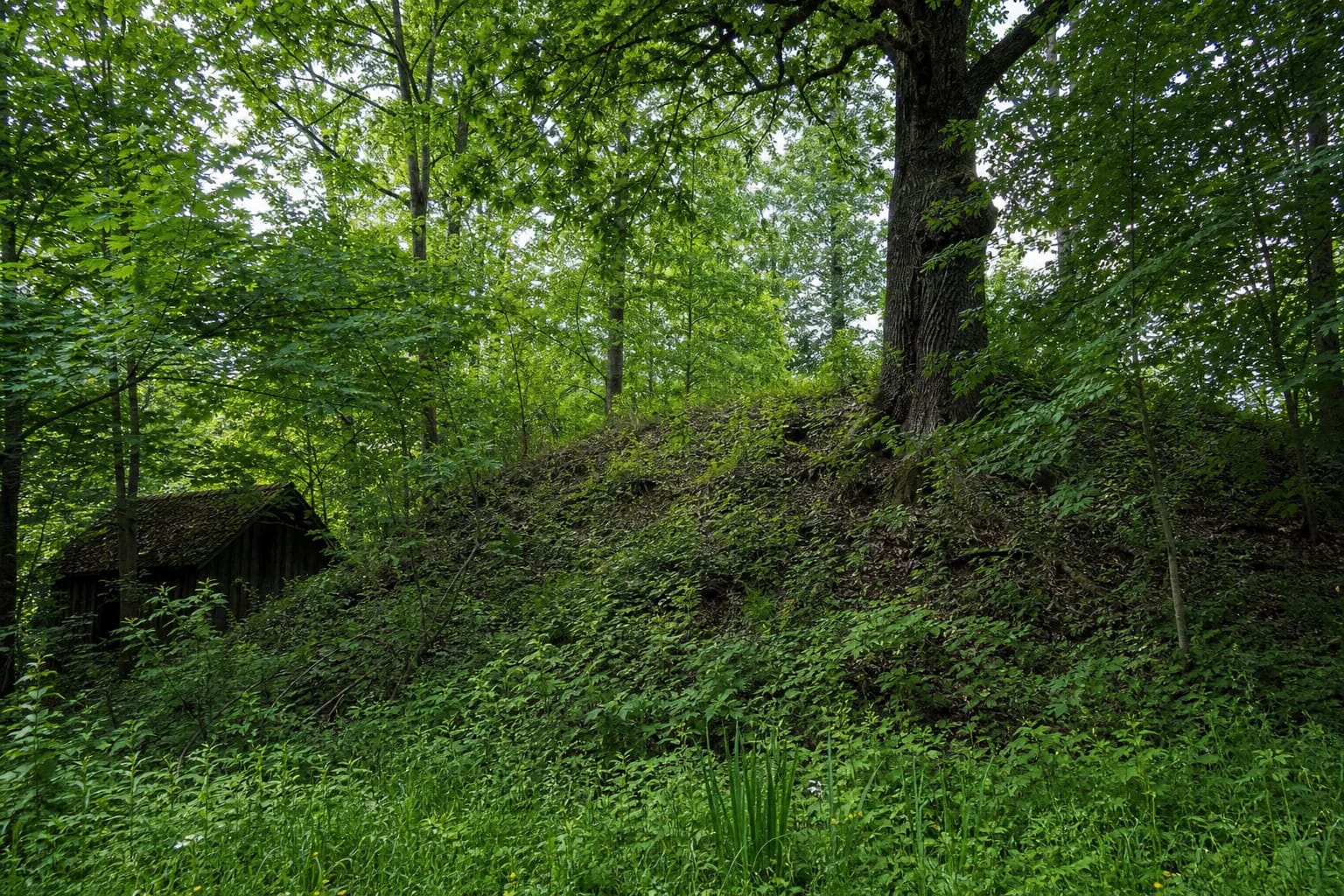
The settlement's protected feature is a dark cultural layer containing archaeological material. Its thickness is not established in the public KVR description, and the settlement has not been fully excavated. An early twentieth-century farmstead at the southern foot and later groundworks damaged parts of the layer. The farmstead is now uninhabited, but photographs still show traces of an old timber building and cellar.
KVR also identifies an old road embankment leading from a former bridge across the Obeltis. Its top is 3-5 m wide, it rises as much as 2 m, and it was probably used during the nineteenth and first half of the twentieth century. It is much later than the hillfort. The same compact landscape therefore contains a prehistoric defence, the ancient settlement area, and marks left by modern transport and farming.
The 1971 and 1988 surveys found pottery, not a named castle story
VLE records archaeological field surveys at Geruliai in 1971 and 1988. They recovered handmade pottery with both smooth and roughened surfaces, now kept at the National Museum of Lithuania. This material helps to place activity at the site, but the published sources checked for this guide provide neither a broad excavation plan nor a reconstruction of buildings that once stood on the summit.
Archaeologist Algirdas Girininkas described Geruliai as a site used from the middle of the first millennium to the beginning of the second, and discussed the Geruliai barrow cemetery about 0.9 km to the west. A possible relationship between hillfort, settlement, and cemetery helps frame a wider inhabited and funerary landscape, but it remains an archaeological interpretation rather than a single investigation proving one continuous complex.
The checked sources do not attach Geruliai to a named ruler, recorded battle, or historically documented castle name. Its significance rests on the surviving earthworks, cultural layer, and pottery, not on a dramatic but unsupported legend. The most accurate description is a small prehistoric fortified settlement.
Real photographs show woodland and undergrowth, not an open panorama
KVR photographs taken from the south and southeast in 2022 show mature deciduous trees, shrubs, and grass covering the rampart and slopes. An old timber building stands at the foot, and a modest heritage marker identifies the archaeological site. Later warm-season photographs show still denser ground cover, with large old oaks rising above it.
This appearance should shape expectations. Geruliai is not a cleared viewpoint, a reconstructed castle, or a hillfort with a broad open summit. In summer, the edges of the earthworks can almost dissolve into the greenery. With the leaves down, the rounded back of the rampart, the hollow of the ditch, and the slopes falling towards the Obeltis are easier to distinguish.
The old building, cellar hollow, and track marks are not reconstructions of the prehistoric fortification. They belong to a much later chapter of farming and local movement. Do not climb on structural remains or enter unstable areas for a photograph. The protected archaeological surface is fragile, so never dig or remove possible finds.
Visit in dry daylight and do not treat the map pin as a parking sign
The official sources checked for this guide confirm no formal car park, toilet, visitor centre, stairs, or step-free path. Approach descriptions lead close to homesteads, so remain on lawful existing routes, never block gates or driveways, and expect to walk the final section if no clearly safe stopping place is available. The Google pin sits on the hillfort rather than on visitor infrastructure.
The wooded 11-12 m slopes are steep, uneven, and eroded in places. Wet grass, leaves, and soil can become slippery after rain. No source verifies a dependable wheelchair route, so the site should not be presented as universally accessible. Wear sturdy footwear, keep children close, and do not create shortcuts directly up the slopes.
The official sources publish no ticket office, admission fee, gate, or set opening hours. That does not guarantee lighting, supervision, or safe access at any hour. Go in daylight, recheck the exact map listing and current local conditions before travelling, and turn back rather than improvise a route around a barrier or across private land.