- Place
- Patyris, Rietavas Municipality
- Region
- Samogitia
- Type
- a small timber observation tower on the north-eastern edge of a state telmological, or peatland, reserve
- Address
- North-eastern edge of Aukštasis Tyras, Patyris village, Rietavas Eldership and Municipality; the municipal attractions list labels the locality Aukštatyris
- Coordinates
- 55.73417, 21.81947
- Visit duration
- 45-75 minutes for the roughly 0.5 km approach from the stated car park, the tower, and an unhurried return
- Best time
- September and October in dry weather and daylight, after the sensitive-season dates given by both official sources have passed
Aukštojo Tyro telmologinio draustinio apžvalgos bokštas, Aukštasis Tyras bog observation tower, Pauškiai bog observation tower
This is the Aukštasis Tyras tower near Patyris, not Aukštojas or Aukštagirė
Aukštasis Tyras Observation Tower stands on the north-eastern edge of a state telmological reserve in Rietavas Municipality. The Lithuanian encyclopaedia dates its construction to 2002. Coordinates 55.73417, 21.819473 mark the timber tower itself. They should not be confused with the reserve-centre point 55.739, 21.781 shown by Saugoma.lt for the entire 1,294 ha protected area rather than for visitor navigation.
Search results sometimes conflate this place with the tower beside Aukštojas, Lithuania's highest point in Vilnius District, or the metal Aukštagirė tower in Varniai Regional Park. Aukštasis Tyras is entirely different: it is a modest timber bog-watching tower among forest trees, near Pauškiai Hillfort.
Even official Rietavas channels use two locality labels. The dedicated visitor entry says Patyris, while the municipality's list of attractions says Aukštatyris. Both refer to the same Aukštasis Tyras tower in Rietavas Eldership. For navigation, use the tower coordinate and follow local signs rather than relying on the locality name alone.
What the tower really looks like and what view to expect
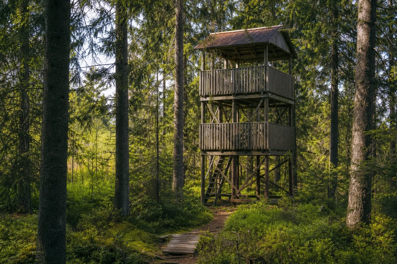
The tower is a roofed timber structure assembled from substantial posts and diagonal braces, with two railed levels. Current photographs in the official visitor catalogue show it standing in dense spruce and pine woodland. No reliable official source gives its height or number of steps, so this page deliberately avoids repeating unsourced figures found elsewhere online.
The upper deck lifts visitors above the understorey but not necessarily above every mature tree crown. The outlook is framed by woodland and is strongest as a view of the transition between forest and raised bog, scattered bog pines, and sphagnum vegetation. Sightlines depend on growth, season, and maintenance around the tower, so visitors should not expect an unobstructed 360-degree horizon.
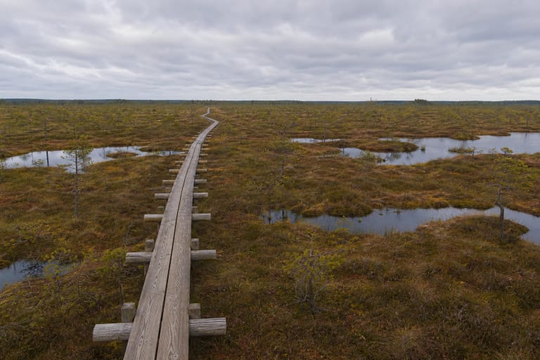
Aerial photographs of Aukštasis Tyras show open mire and numerous small bog pools deeper inside it. The encyclopaedia counts roughly 70 such pools, but that is a characteristic of the raised bog as a whole, not a promise that every pool, or even many of them, can be seen from a tower standing at the wooded margin.
The approach from the car park and why the tower pin is not a parking pin
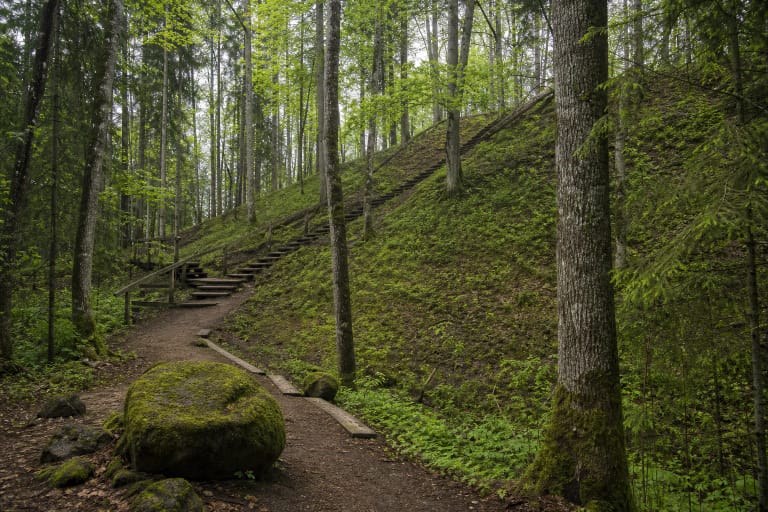
The Lithuanian encyclopaedia describes a path of roughly 0.5 km from a car park to the tower and notes an information board. Current official photographs show a woodland trail and a short timber path or bridge section. This is not a long, uniformly wide boardwalk: part of the approach follows natural forest ground that can become wet and uneven after rain.
The pin on this page marks the tower. As of 20 July 2026, no dependable official source provided a separate exact pin for the car park. Navigation software may suggest driving too far along forest tracks. Use only roads on which driving is permitted, leave the vehicle in the signed parking or pull-off area, and walk the final section.
The approximately 0.5 km figure is the encyclopaedia's one-way distance from the stated car park to the tower, not the length of a complete outing. Allowing for an unhurried walk, stairs, time on the deck, and the return, 45-75 minutes is realistic. Pauškiai Hillfort is nearby, but reach it only by an existing marked path rather than making a shortcut across the bog.
What Aukštasis Tyras Reserve protects
Aukštasis Tyras State Telmological Reserve was established in 1986 and, after its boundary revision in 2011, covers 1,294.5 ha; Saugoma.lt rounds this to 1,294 ha. The encyclopaedia's approximately 800 ha figure describes the physical bog with its peripheral wetland. The figures therefore refer to different things: one to the legally protected territory and the other to the peatland landform itself.
Aukštasis Tyras developed in a depression cutting across the Endriejavas ridge, on the watershed between the Jūra and Žvelsa river systems. The centre of the raised bog stands about 6 m higher than its margins, while peat reaches up to 10 m at its thickest point. Four streams drain from the bog: the Kluonė, Vedega, Tanalupis, and Dievupis. The tower therefore overlooks part of an important watershed as well as a peatland.
The reserve boundary matches the Aukštasis Tyras Bog Natura 2000 Special Protection Area LTPLUB003, and the entire reserve also lies within the Rietavas Forests Special Area of Conservation LTPLU0010. European golden plovers and wood sandpipers are key protected birds here, alongside black grouse, cranes, Eurasian curlews, nightjars, black storks, and other sensitive species. The tower is a place to watch quietly, not a guarantee of seeing any particular bird.
The April-August restriction and the narrow exception for the tower
Current guidance from the State Service for Protected Areas explains the general rule: visiting telmological reserves is prohibited from 1 April to 1 August, when birds are nesting and raising young. The same guidance lists an exception for visiting structures located within such territories. The Aukštasis Tyras tower is a structure, but the exception should be read narrowly as direct access by existing visitor infrastructure, not permission to roam throughout the bog.
The encyclopaedia article on Aukštasis Tyras still gives a longer restriction ending on 1 September. Because authoritative public sources have not been fully synchronised, the least ambiguous option is to visit in September or October. If travelling between April and August, check the latest information with Žemaitija National Park Directorate or the State Service before departure and obey newer on-site signs or temporary closures.
Even when direct access to the structure is allowed, remain on the path, do not enter the open mire, do not approach bog pools, and do not disturb birds with noise. A closure sign at the trailhead takes precedence over a general description read online before the trip.
Opening hours, tickets, stairs, and practical preparation
As of 20 July 2026, dependable official sources did not publish permanent opening hours or a mandatory ticket price for the tower. It should therefore not be advertised as guaranteed to be open and free around the clock. Check notices from Rietavas Municipality, Žemaitija National Park Directorate, and the State Service for Protected Areas before travelling, especially after storms, during forestry work, or in the sensitive bird-breeding season.
Both decks are reached by timber stairs; no lift, ramp, or continuous step-free route to the top is officially documented. Natural ground, timber path sections, and stairs mean the viewing decks are not independently wheelchair accessible. Keep children close on the stairs and small platforms, avoid crowding, and inspect the condition of the structure and treads before climbing.
Wear shoes with grip because wet boards, roots, and forest soil can be slippery. In summer, tick and mosquito protection is useful; in autumn, waterproof footwear helps; in winter, the stairs may ice over. No reliable official source confirms a toilet, drinking water, or other permanent visitor facilities at the trailhead, so carry water and take every item of litter away.