- Place
- Radviliškis District Municipality
- Region
- Aukštaitija
- Type
- a reservoir with a monitored southern bathing site and Velžiai Hillfort
- Address
- Velžiai village, Šeduva Eldership, Radviliškis District, Lithuania
- Coordinates
- 55.79132, 23.66338
- Visit duration
- 1.5-3 hours for the beach and southern shore; half a day if Velžiai Hillfort is included
- Best time
- May to September; check the latest municipal test before swimming, and choose a dry day for the shore and hillfort
Arimaičiai Reservoir, Arimaičiai Lake near Velžiai, Arimaičiai Lake Beach
Arimaičiai Reservoir grew by joining two older lakes
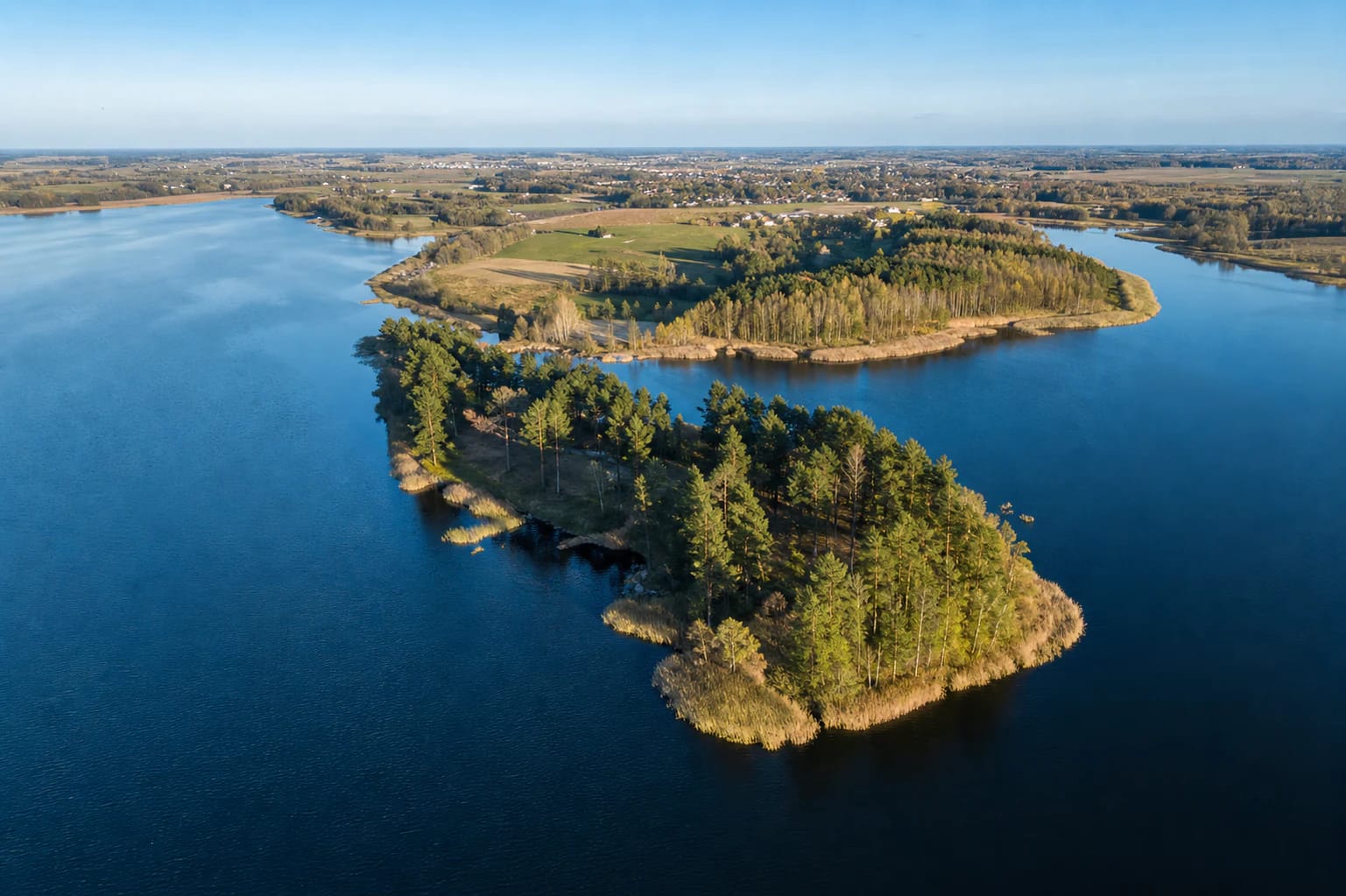
Arimaičiai Lake lies in Radviliškis District, about 5.5 km northwest of Šeduva and north of the Panevėžys-Šiauliai A9 road. VLE gives an area of 290 hectares, a south-to-north length of 4.7 km, a maximum width of 1.1 km, a maximum depth of 18.7 m, and an average depth of 2.8 m. Its winding shoreline is 21.77 km long, so one beach pin does not describe the whole lake.
The present outline formed in 1972 when the upper Ežerėlė was dammed. Rising water covered low marshy shores and joined the former Arimaičiai, or Žirnis, Lake with Ragelis, or Paežeriai, Lake. This is why earlier names still appear alongside the present one in local history and maps.
Šiekštumas, Barškelis, and Prūdelis flow into Arimaičiai Lake, while Ežerėlė leaves it northwards towards the Mūša basin. On the northwestern shore, the Arimaičiai Spring rises from a suffosion hollow in the slope of a glacial moraine highland; VLE identifies it as a hydrogeological natural-heritage object. It is a separate nature stop, not a spring to look for beside the beach.
The winding shoreline is not equally accessible everywhere
The western and northern shores are drier and higher, while the southern and eastern sides are lower and marshier. The southern beach is therefore the sensible way into the water; do not descend onto the first reed-filled or privately held stretch that looks close on a map.
The description of the southern recreation site lists a sandy beach, walking and cycling paths, a jetty, a footbridge, changing cabins, shelters, sports and children's areas, and a refurbished car park. This is useful orientation, but check which particular facilities are working and reachable on the day.
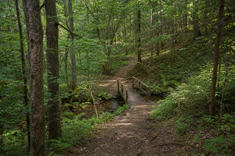
Shore photographs show a line of tall pines, a grassy slope, a sandy strip, and a woodland path. This landscape is better suited to a slow rest and short walk than to an attempt to circle all 21.77 km of shore. Do not cross cultivated fields, wetlands, or unmarked private approaches.
Velžiai Hillfort stands on a southern lake peninsula
Velžiai Hillfort on one of the southern-shore peninsulas is the main archaeological landmark in the Arimaičiai landscape. Heritage descriptions date it to the first millennium and the beginning of the second; its round summit is about 25 m across and its slopes are steep. From the peninsula, the water is not a distant panorama but a direct part of the hillfort setting.
Radviliškis District Municipality's hillfort guide says to approach via the A9 road, turn at the Žarija café in Velžiai, continue for about a kilometre to the parking place, and then walk roughly 150 m along the rampart. Match the final section to local signs because road marking and approach conditions can change.
The hillfort slopes and ditches are not the level lawn of the beach. Climb in dry weather, stay away from unstable edges, keep children close to the water, and do not try to descend directly from the hillfort into reed beds. The beach and hillfort are nearby but have different safety profiles.
The latest sample decides whether swimming makes sense
Radviliškis District Municipality monitors the Arimaičiai bathing site during the 2026 swimming season, listed as 1 June to 15 September. The microbiological schedule gives samples for 26 May, 9 and 23 June, 7 and 21 July, 4 and 18 August, and 2 September; sand parasitological tests were planned from May through August.
The municipality's table gives the 21 July 2026 Arimaičiai sample as 28 intestinal enterococci, below 1 intestinal bacteria per 100 ml, 1.55 m transparency, and no debris. Yet the same lake's 9 July entry gave 180 enterococci and 650 intestinal bacteria, so one later favourable sample is not a reason to ignore new changes.
Before swimming, open the municipality's results table, read the beach signs, and consider the weather. After heavy rain, unusual algal growth, foam, odour, or dead animals, stay out of the water even when an earlier test looked good.
The lake suits a varied day, but not automatically a full shoreline hike
For a short outing, allow 1.5-3 hours for the beach, the southern-shore path, rest, and a careful swimming decision. If you want to visit Velžiai Hillfort, allow for the distance between separate approaches and do not assume that every shoreline section is drivable or linked by one path.
The southern recreation-site description lists walking and cycling paths, a bridge, a jetty, shelters, and other recreation infrastructure. These features may help families, but their surface, maintenance, lighting, and accessibility can change; the whole shoreline should not be treated as a verified pushchair or cycling route.
Arimaičiai Lake can be part of a Radviliškis day together with the Lost Shtetl Museum in Šeduva, the Daugyvenė Museum, or Kleboniškiai Forest Park. By the water, stay within the marked bathing site, supervise children, do not jump into unknown depth, leave no rubbish, and protect the wooded Velžiai peninsula.