- Place
- Sudeikiai Eldership, Utena District Municipality
- Region
- Aukštaitija
- Type
- large glacial lake with settlements, beaches, and cultural sites along its shores
- Address
- Lake Alaušas, Sudeikiai, Utena District Municipality
- Coordinates
- 55.61160, 25.70056
- Visit duration
- half a day for one shore area; allow a full day for the whole lake landscape and its stops
- Best time
- May-September for swimming and water activities in daylight; winter visits depend on ice conditions
Alaušo ežeras, Alaušas near Sudeikiai, Alaušas Lake
Lake Alaušas is the Utena-region lake easily confused with Alaušai
VLE describes Alaušas as a lake in Utena District Municipality, about 10 kilometres north-east of Utena, near Sudeikiai. It is not the same water body as plural Alaušai in Molėtai District near Balninkai. When planning a trip, check not only the name but also the district and the Sudeikiai context.
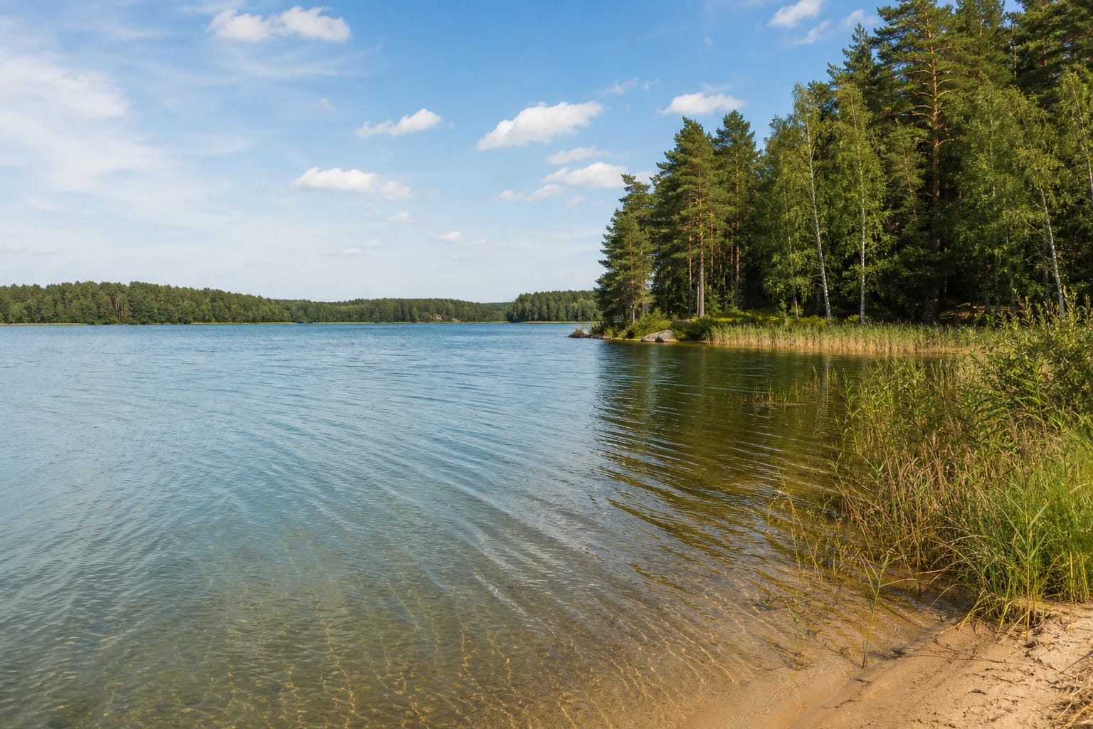
VLE gives an area of 1,054 hectares, a length of 5.9 kilometres, a maximum width of 2.7 kilometres, a maximum depth of 42 metres, and an average depth of 11.9 metres. The lake occupies two intersecting glacial troughs, so its shores and water spaces are not uniform around the whole basin.
VLE also gives a 22-kilometre shoreline, two islands, a broad southern connection to Lake Juodlankis, and the Alauša stream flowing out from the northern end. This is a large water body, best visited by choosing a particular shore rather than searching for one entrance suitable for the entire lake.
Sudeikiai, Bikuškis, and Maneičiai Hillfort form the lake's landscape axis
Sudeikiai stands on the southern shore of Lake Alaušas, while a long narrow peninsula on the western side carries the buildings of Bikuškis Manor. Maneičiai Hillfort, also known as Sudeikiai Hillfort, stands by the eastern shore, and the Dievalkis sacred site is associated with the southern side.
The area of 1,054 hectares and a shoreline of about 22 kilometres explain why maps show many different shore points for Alaušas. The official lake name identifies the whole water body, while beaches, campsites, the manor, and the hillfort are separate destinations.
Sudeikiai is the practical starting point for visitors looking for a settlement, beach, and public shore infrastructure. Bikuškis and Maneičiai Hillfort are separate stops, not one beach or one short continuous trail.
Shores, forests, and islands change the view from one side of Alaušas to the other
VLE distinguishes a high, steep north-western shore, a lower eastern shore, and a flatter, loamy western shore. Most shores are dry, although wet ground occurs near stream mouths. The littoral is broad and sandy, helping explain the lake's appeal for summer recreation.
The eastern side has broad belts of aquatic vegetation in places, while Ąžuolaušis Forest and Rukliai Forest frame the north-eastern and south-eastern surroundings. The two islands give the lake a sense of scale, but reaching them depends on the activity and the conditions at the chosen shore.
VLE gives summer water clarity of about 4-6 metres and an annual water-level variation of roughly 30-40 centimetres. These are general lake characteristics, not a promise about a particular beach or a particular day's water conditions.
Choose a specific official shore for swimming and water activities
In its 2026 bathing-water list, Utena District Municipality names a beach by Lake Alaušas in Sudeikiai and a recreation and camping site by the lake in Maneičiai. These are different shores, so the centre point 55.6116, 25.70056 is not a beach, driveway, or parking instruction.
In its review of tests taken on June 22, 2026, the municipality stated that the water at the Sudeikiai Lake Alaušas bathing site met hygiene requirements. That information applies to a specific monitored bathing site and period, so check the newest notices locally before swimming.
Swimming, boating, fishing, or stepping onto ice is safe only after checking that day's conditions, local rules, and lawful access intended for the specific activity. Planned municipal water-recreation infrastructure is not confirmation that every service is already operating.
The lake-centre point is for orientation, not arrival
The coordinate 55.6116, 25.70056 is a representative centre point for Lake Alaušas. It distinguishes the large Utena District lake from similarly named water bodies, but it does not mark a road, car park, beach, or entrance.
Look for public shore infrastructure in Sudeikiai or at the municipality-listed Maneičiai recreation and camping area. Elsewhere around the lake there may be private plots, natural slopes, or unprepared banks, so the shortest route to the water is not proof of lawful public access.
Because the lake has a long and varied shoreline, enter a specific destination into navigation: Sudeikiai beach, Maneičiai, Bikuškis Manor, or another lawful public access. This reduces the chance of arriving at private shore land or the wrong side of the lake.
Plan Lake Alaušas as a full-day Aukštaitija landscape trip
Half a day suits one Sudeikiai or Bikuškis shore area, but the lake's scale, Maneičiai Hillfort, the manor, and several stops can fill a full day. The shoreline is not one signposted circular route, so plan around road surfaces, public access, and the opening arrangements of separate sites.
In 2026 the municipality describes a public tourism infrastructure development project at Lake Alaušas in Sudeikiai. This signals planned or ongoing change, but it does not mean that every future facility is already operating. Check the municipality's latest information before travelling.
Bring your own drinking water, follow bathing-site and campsite rules, avoid private property, and take rubbish home. Supervise children near reeds, piers, deeper water, and water-activity areas; in winter, do not step onto ice without checking its safety.