- Place
- Zarasai District Municipality
- Region
- Zarasai District
- Type
- linear geological nature trail through the steep-sided Šavaša valley, with an unsurfaced path, metal steps, interpretation boards, and the archaeological Lūžiai stone stop
- Address
- Šavaša and Lūžiai forest area, Antalieptė eldership, Zarasai District, Gražutė Regional Park
- Coordinates
- 55.64182, 25.85332
- Visit duration
- about 2 hours for the officially stated 1.5 km interpretive section; allow 2-3 hours with the walk back, stops, and careful footing
- Best time
- late spring to autumn in daylight; the stream is more expressive after rain, but the natural surface, roots, and metal steps become more slippery
Šavaša Geological Nature Trail, Šavaša Trail
The official map pin marks a trail feature, not a guaranteed car park
Šavaša Nature Trail lies in the Šavaša Landscape Reserve within Gražutė Regional Park, in Antalieptė eldership. Coordinates 55.641818, 25.853316 come from the official Saugoma directions link. They almost coincide with the surroundings of the Lūžiai cup-marked stone, so the pin is a representative point on the nature trail rather than an entrance gate, a precise trailhead, or a parking bay.
Route descriptions place parking at a forest-road fork beyond Lūžiai Hillfort, followed by a short approach on foot. The national object record does not publish a separate car-park coordinate, capacity, or surface. Do not interpret its navigation pin as permission to drive all the way to the stone, block a forest road, or leave a vehicle on a soft verge.
Saugoma gives a trail length of 1.5 km and a walking time of around two hours. Independent track measurements give roughly 1.3 km and classify the route as linear; the difference probably reflects the chosen start and finish points. This is not a loop: visitors return by the same trail or a parallel forest road, so the full outing can approach 3 km.
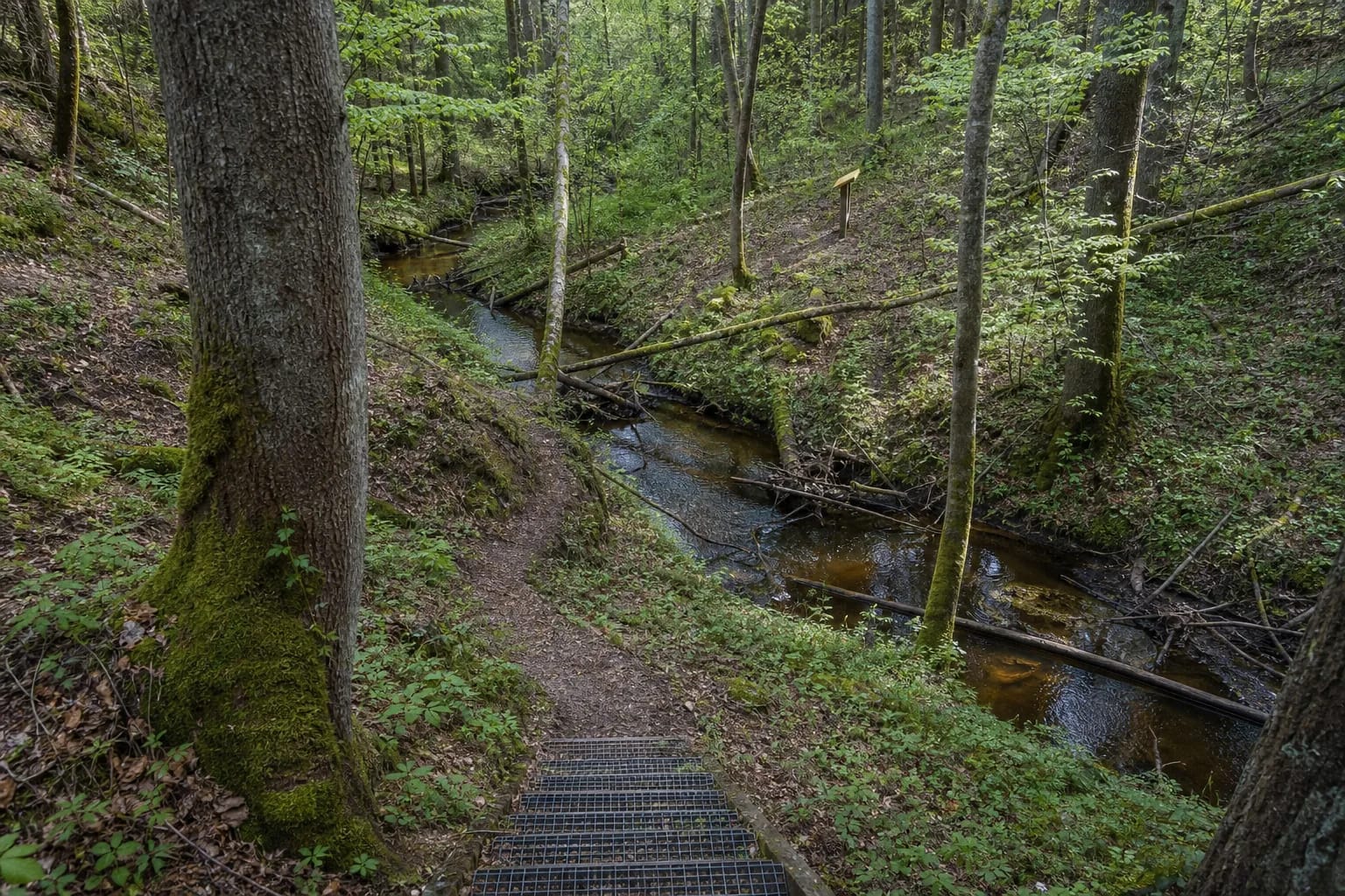
The lower Šavaša is small, but its gradient and valley create a mountain-stream impression
The official description says that water level falls by 8-11 metres per kilometre through the most scenic part of the lower course. Its gradient, stony channel, and high valley sides lead to frequent comparisons with a mountain river. That is an evocative analogy, not a claim that this small Aukštaitija stream belongs to an Alpine class of watercourse.
Three stations read the same valley in different ways. The petrological theme introduces rocks and the composition of erratics; the geomorphological station explains landforms and the development of the valley; and the fluvial station covers the erosive, transport, and depositional work of running water. Topographical maps connect the panels with the slope and bend visible in front of the visitor.
The character of the water varies sharply with rainfall and season. The current may be more lively in spring or after rain and much quieter during dry periods. Higher water also brings wetter roots, mud, and more slippery steps, so a more dramatic stream does not automatically mean an easier walk.
The reserve protects spring-fed habitats and sensitive species, not merely a scenic view
The 864 ha Šavaša Landscape Reserve protects the structure and landforms of the lower Šventoji, Sėlupis, and Šavaša valleys. Its value also includes steppe grassland, transition mire and quaking bog, non-calcareous springs and spring fens, broadleaved and mixed forest, and wet deciduous woodland. The trail reveals only one cross-section of that mosaic.
The reserve record names black stork, kingfisher, lesser spotted eagle, several woodpeckers, otter, great crested newt, fire-bellied toad, weatherfish, and brook lamprey among its protected species. These are values of the wider protected area, not guaranteed sightings beside the path. Quiet walking and remaining on the route give wildlife the best chance of being left undisturbed.
Interpretive panels draw attention to a beaver area, Lūžiai Forest, and a key woodland habitat. Fallen trunks, deadwood, and a beaver-altered reach are not necessarily signs of neglect: decaying timber supports insects, fungi, and birds. A windthrown tree across the marked route can still be a real obstruction and should not be bypassed by scrambling down an unmarked steep slope.
The Lūžiai stone is a genuine archaeological feature, but its date and function resist a simple story
The human-worked Lūžiai stone is an irregular cylindrical granite boulder measuring about 1.30 by 1.25 metres and 70-75 cm high. Chisel grooves survive on its sides, while a flat-bottomed cup measuring approximately 52 by 50 cm was cut into its top. Investigators recorded charcoal and burned material beside it in 1971 and interpreted the remains as evidence for a cult place used between the 13th and 18th centuries. The official object description still repeats that hypothesis.
In 2024, Klaipėda University archaeologists re-excavated 18 sq m around the stone and opened a 3.75 sq m test pit at a nearby stone cluster. They collected almost 60 kg of flakes from shaping the stone, identified a pit beneath it, and confirmed traces of small-scale, apparently episodic burning. A charcoal sample from the pit, however, produced the very broad range 1675-1942, while one sample from the separate stone cluster dated to 1282-1396.
These results confirm an archaeologically significant place but do not establish the whole setting as a built 13th-18th-century temple. The researchers discuss a possible old cult site and say that any relationship with the Christianisation of Antalieptė requires further investigation. Ritual interpretation and later tradition must therefore be kept separate from the directly observed shaping, pit, charcoal, and laboratory dates.
The nature trail opened in 2003, after which visitors placed coins on the stone and lit fires there. Heat cracks required intervention in 2018-2019. The excavated ground was backfilled and landscaped in 2024. Never light a fire, leave coins or other offerings, or climb on the stone: it is vulnerable cultural heritage, not an interactive prop.
Natural footing, steep slopes, and a linear route determine the real difficulty
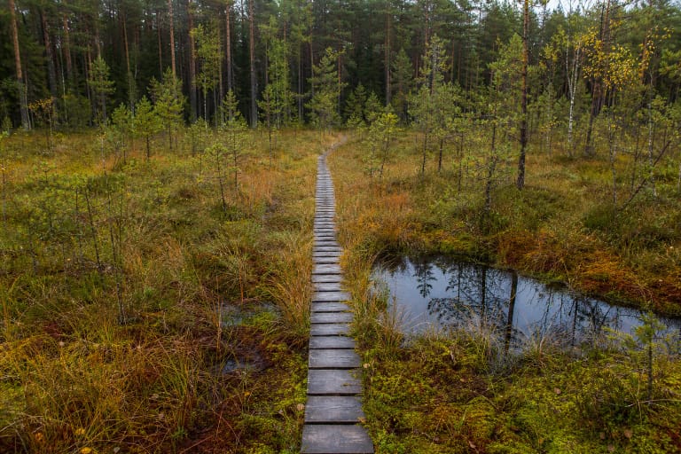
Most of the route is an unsurfaced woodland path with roots, stones, possible mud, descents, and climbs. Metal steps assist on steeper sections. The official description itself says that the valley demands some strength and hiking skill, so the 1.5 km figure should not mislead families, older visitors, or people unused to woodland walking.
The official trail record does not state that the route is wheelchair- or pushchair-accessible. Its terrain, natural surface, and steps indicate the opposite. With children, assess not only their willingness to walk but their ability to descend a wet slope safely and complete the full return journey.
The Aukštaitija Protected Areas Directorate's report confirms that Šavaša was among the Gražutė park sites maintained in 2024, but that is not a 2026 engineering inspection of every step. The official Saugoma page carried no closure notice when checked on 19 July 2026, while an independent route guide marked the former upper viewpoint as being in an emergency condition. Do not use it, and ask the Gražutė Visitor Centre for the latest situation before travel.
No admission charge or hours are published, but safe access still has limits
The official Šavaša trail page lists no ticket office, compulsory admission charge, or opening hours. It is an outdoor route, but that absence should not be read as a guarantee that every structure is open and safe at every hour. Walk in daylight, respect barriers on site, and turn back if steps, a bridge, or a slope are visibly damaged.
Before a long journey, call Gražutė Regional Park Visitor Centre in Salakas on +370 670 97265. The centre is a separate destination rather than the trail's ticket office, but directorate staff can clarify current conditions, access, organised-walk options, and protected-area rules.
Šavaša Nature Trail is not the same as the 11 km Selonian Sacred Trail. The longer route begins in Antalieptė and links Šveicarka Spring, the footprint stone in the Šavaša, Lūžiai Hillfort and barrows, the cup-marked stone, and the Dievaičiukas and Dievaitytė sacred hills. If you only want the 1.5 km valley section, do not follow the full sacred-trail signs without allowing for the extra distance.