- Place
- Švenčionys District Municipality
- Region
- Aukštaitija National Park
- Type
- glacial-runnel lake and ornithological reserve
- Address
- Lake Žeimenys, Švenčionys District Municipality, Vilnius County
- Coordinates
- 55.27211, 26.04082
- Visit duration
- 30-60 minutes for one lakeshore stop; 1-3 days for a water route through the lake district
- Best time
- May to September; choose a morning for birdlife and quiet shores, or a bright, calm day for boating
Žeimenio ežeras
Lake Žeimenys is a broad waterway rather than one resort shore
Lake Žeimenys lies in Švenčionys District Municipality, east and north-east of Kaltanėnai, beside the Ignalina District boundary. It is part of Aukštaitija National Park, but it should not be understood as one developed recreation area: its long shore passes forests, villages, and protected zones with different regimes.
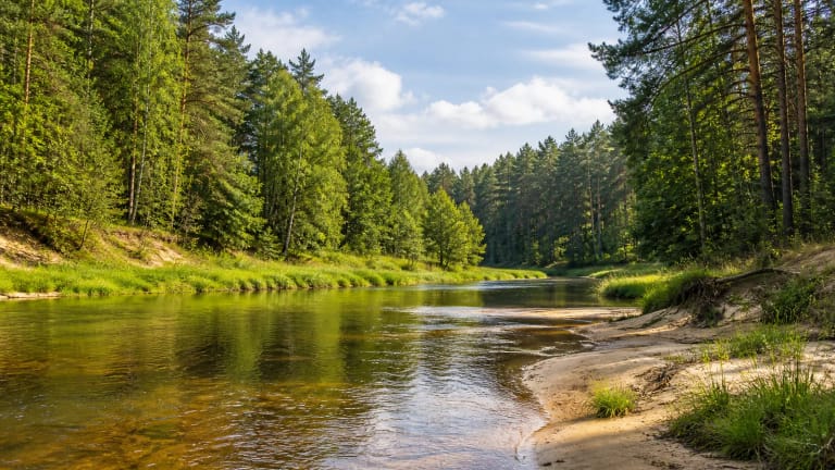
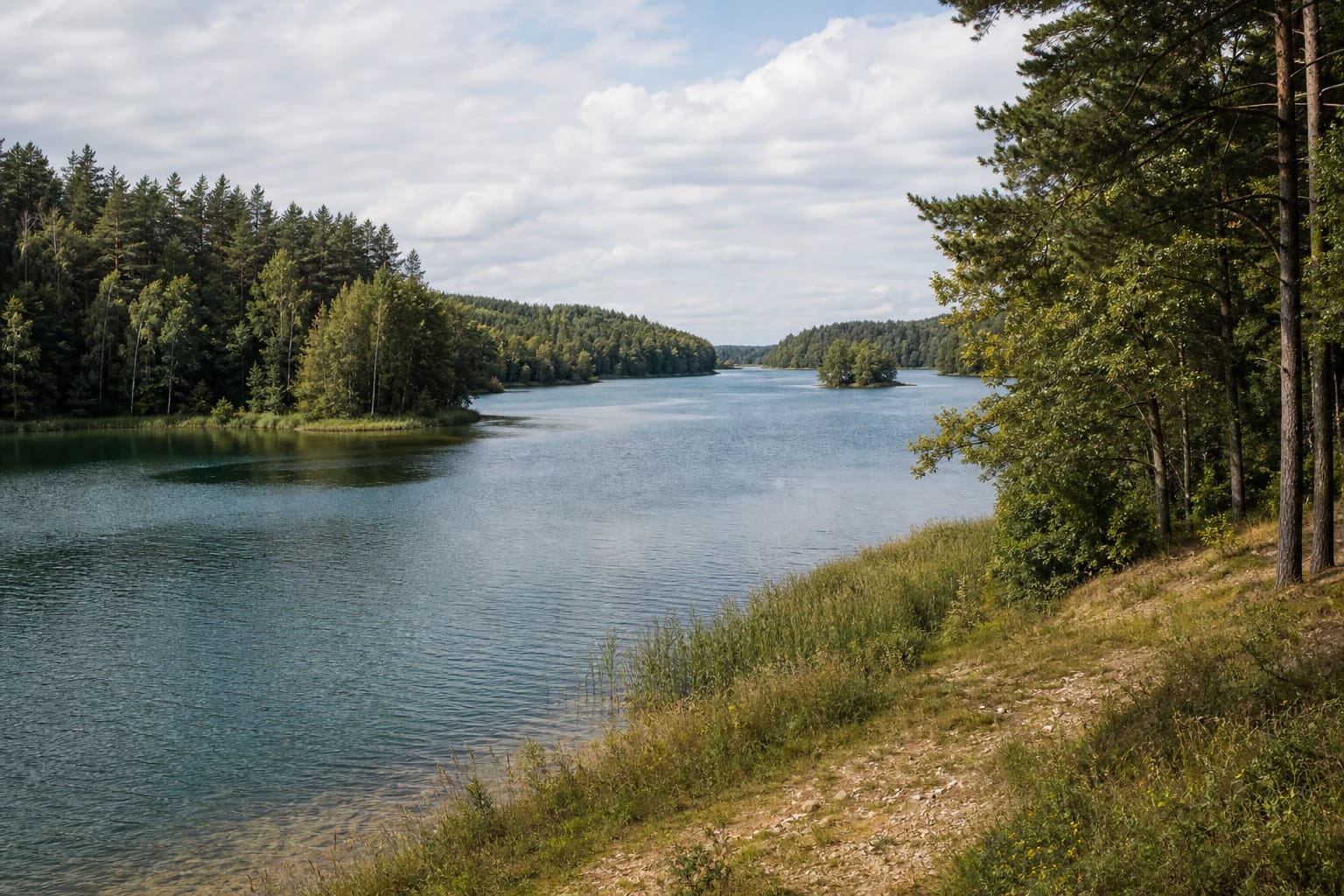
VLE describes it as a winding lake that resembles a river. A current can be felt in many places, while real photographs show wooded shores, calm blue-green water, low forested islands, and reed beds along natural banks. It is a landscape best read from the water or from several different shores, rather than through one universal viewpoint.
The map point 55.272115, 26.0408224 is honestly marked as a central lake point, not an entrance or car park. Before travelling, choose a particular shore, campsite, or water-route start and check whether that access is legally available that day.
A glacial-runnel basin with high shores and nine islands
Lake Žeimenys is a glacial-runnel lake. Its area is 436.3 hectares, it extends 12 kilometres from north to south, reaches a maximum width of 1.6 kilometres, and lies at an elevation of 138 metres. Its maximum depth is 23.5 metres, average depth 6.9 metres, and basin area 771.2 square kilometres. These figures explain why it feels more elongated and flowing than the round lakes familiar elsewhere in Aukštaitija.
The winding shoreline is 34.2 kilometres long. Shores are mostly high, with terraces in places, and forests surround the lake except along the north-western shore. The lake has nine islands with a combined area of 8.3 hectares. From a distance they can look like extensions of the forest, so boaters should not approach unmarked shallows or reed beds simply for a better photograph.
The littoral zone has sand and gravel, with mud deeper down. Reeds and bulrushes do not form one continuous belt, while bays and shallows support more aquatic vegetation. These are signs of natural shore rather than guaranteed bathing facilities: the edge may be soft, slippery, or suddenly deep.
The Žeimena flows from Lake Žeimenys
The Laukupė flows into Žeimenys from Lake Laukojis, the Kretuona from Lake Kretuonas, and the Jaurupė from Lake Prūtas. The Žeimena leaves from the southern end and is one of the key rivers in Aukštaitija's water system. In the north, the Šakarva stream links Žeimenys with Lake Šakarvai, making the lake one part of a wider network rather than an isolated body of water.
The Aukštaitija National Park Directorate's V1 Žeimena Headwaters route passes through Žeimenys and links Lakes Utenas, Utenykštis, Baluošas, Lūšiai, Šakarvai, and others with the Žeimena River. The official description gives the route as 49 kilometres and says a slower journey can be spread over about three days from Paažvintė or Rūgšteliškė to Kaltanėnai.
A current is no reason to dismiss wind or waves. Conditions differ between bays and open stretches of a long lake, so plan a water route around the actual forecast, your experience, life jackets, and preselected landing points.
An ornithological reserve calls for quiet visits
VLE states that Lake Žeimenys has been an ornithological reserve since 1967. Its bays, shallows, islands, reed beds, and woodland edges matter to birds, so the lake's value is more than a scenic panorama. Follow marked or legally permitted routes, keep noise down, and do not choose an isolated island for camping.
The visiting and boating regime in protected areas can depend on the specific reserve, season, and type of craft. The State Service for Protected Areas reminds visitors that boating in ornithological reserves is restricted, and exceptions depend on the status of the water body and published conditions. Before launching or planning to fish, check the park's current information rather than relying only on an old map label.
Do not leave line, plastic, or food waste on the shore, damage island edges, or enter reed beds unless that is necessary for a lawful route. A quiet voice and distance from birds are the simplest ways to reduce pressure on the reserve.
Plan a visit from a particular access point, not from the lake name alone
Lake Žeimenys has no single public entrance, ticket desk, or published opening hours for the entire lake. Access depends on the selected shore, campsite, village road, and land-use regime. Leave a car only in a marked or officially permitted place, never on a meadow, shore, or private access road.
The 2026 Aukštaitija National Park Directorate regulations define a public self-propelled water-tourism route Palūšė-Kaltanėnai-Palūšė through Lakes Lūšiai, Šakarvai, and Žeimenys. Its listed passenger boarding and disembarkation points are Palūšė, Ožkiniai, and the Kaltanėnai town campsite. These are points for a particular organised route, not a promise that every lakeshore can be reached by car.
If you only want to experience the Žeimenys landscape, allow 30-60 minutes for one lawful shore stop. The full water route needs much more time, transport logistics, and preparation. Visitors with reduced mobility should check the exact shore in advance: natural terrain and varying approaches are not an accessibility certificate for the entire lake.
Boating rules and the 2026 public-route limits
The regulations approved in June 2026 for Aukštaitija National Park allow self-propelled craft on the public sightseeing route through Lake Žeimenys from 1 May until the end of the navigation season, subject to stated conditions. The text concerns approved craft operated for public tourism, with total engine power no higher than 150 horsepower and capacity for at least 10 people, so it must not automatically be read as permission for a private motorboat.
The same regulations set a maximum speed of 20 km/h, restrict travel to daylight, and require minimum speed in the straits between Lakes Žeimenys and Šakarvai. Boarding and disembarkation on the public route are limited to the listed places. Check the Directorate's latest document before boating, follow signs, and wear life jackets.
The shores and approaches around Žeimenys differ, so one representative lake coordinate says nothing about the safety of a particular bank, water quality, or the condition of facilities. For boating or recreation, use an officially described start or other lawful access and check current park information.