- Place
- Klaipėda City Municipality
- Region
- Lithuania Minor
- Type
- first-millennium-to-13th-century Curonian hillfort with foot settlements and a wider archaeological landscape
- Address
- Žardupės St, Klaipėda
- Coordinates
- 55.65224, 21.20746
Kuncai Hillfort, Bandužiai Hillfort, Castle Hill, Žardė-Kuncai Hillfort
Reading the hillfort in today's landscape
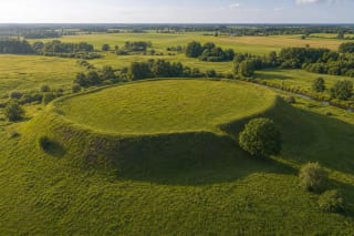
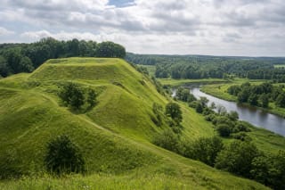
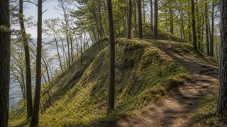
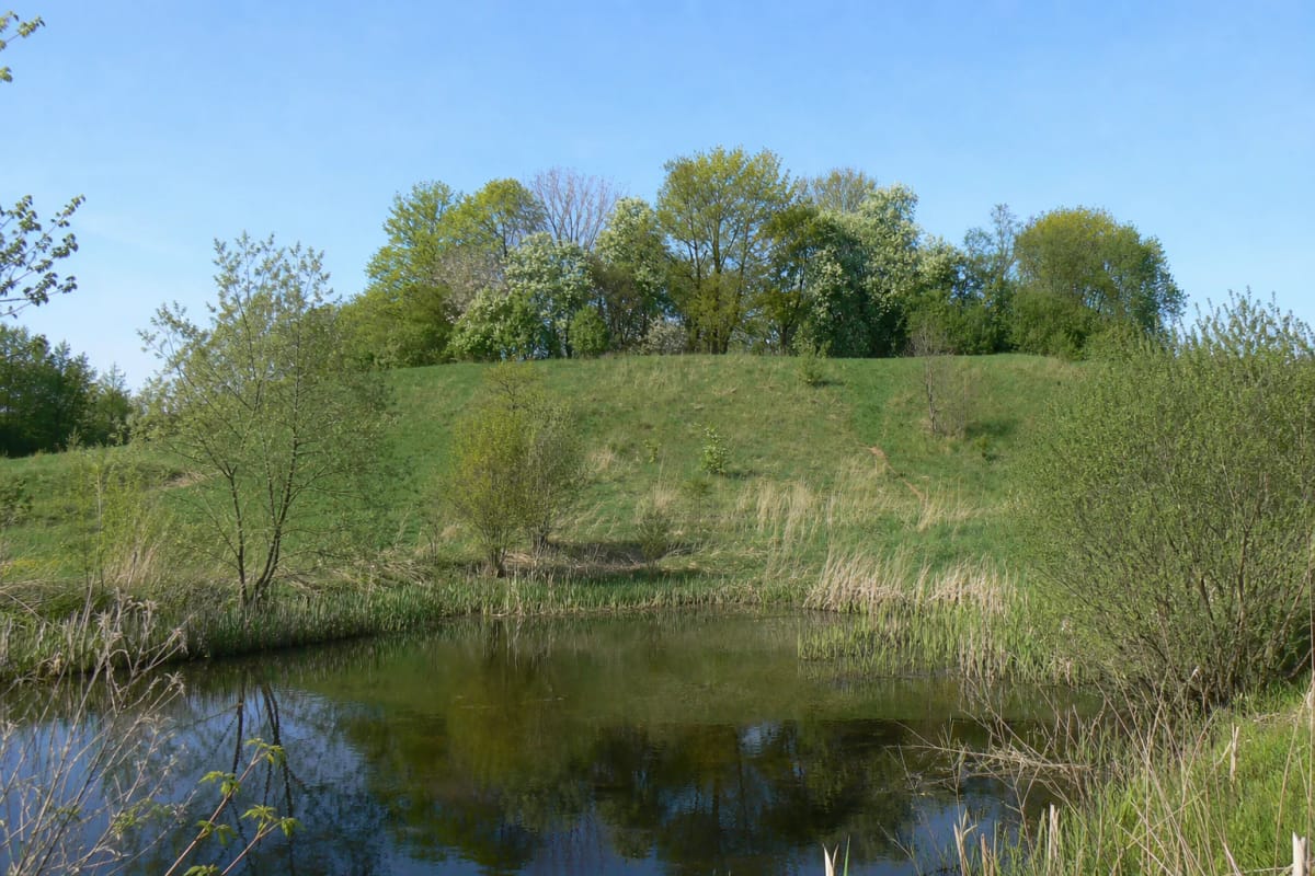
Žardė Hillfort occupies a substantial rise on the right bank of the Smeltalė. A pond borders it to the north-east, the river valley lies to the south, and the tree-covered summit stands above meadows on Klaipėda's southern fringe. This is not a monumental mountain: its defensive logic becomes clearest by walking around the foot and noticing the water, valley, and naturally steeper approaches.
VLE describes a circular platform approximately 30 metres across. It was enclosed by a rampart up to 1.5 metres high and about 15 metres wide, while the slopes rise as much as 8 metres. Grass and trees obscure parts of the form, so first look for the raised ring around the platform and the more distinct rampart relief on the western side rather than an obvious castle outline.
There are no reconstructed timber walls or replicas of finds on the summit. The authentic object is the terrain itself and the cultural layer beneath it, so use the established line of the path, avoid the steepest slope, and do not create shortcuts.
The Curonian castle of Žardė recorded in 1253
The hillfort is dated from the first millennium to the 13th century. VLE identifies it with the Curonian castle of Žardė recorded in written sources in 1253, while the Cultural Heritage Register uses the more cautious wording that the castle is believed to have stood here. The distinction matters: the documentary mention is certain, but locating the castle on this mound is a synthesis of historical, place-name, and archaeological evidence.
Žardė belonged to Pilsotas, the southern Curonian land. With nearby Laistai castle and surrounding settlements, it formed a centre beside water routes from which the Smeltalė valley and movement towards the lagoon could be watched. The hill was not merely a refuge from attack but the core of a larger inhabited and productive landscape.
The old centre declined in the 13th and 14th centuries during conflict with the Teutonic Order. Klaipėda's political and military focus then consolidated around the Order castle at the mouth of the Danė, making Žardė and the city castle site two contrasting stages in the region's centres of power.
A large settlement complex beneath the fields
The hillfort is only one part of the Žardė-Bandužiai archaeological complex. VLE identifies four foot settlements covering about 13 hectares south-west of the mound and the Bandužiai cemetery approximately 600 metres to the north. Other fortified and open settlements have been investigated across the broader landscape, so the field seen from the summit is not empty space around a solitary fort.
Archaeologists from the History Museum of Lithuania Minor and other institutions investigated the settlements intermittently from 1990 to 2011, followed by survey expeditions from 2015 to 2020. A cultural layer reaching 1.7 metres deep yielded building remains, hearths, bloomery furnaces for smelting iron, jewellery, tools, ship rivets, pottery, and animal bones.
Together the finds reveal construction, cooking, animal husbandry, crafts, connections, and iron production. The History Museum of Lithuania Minor displays hewn logs and stakes from Žardė, a ninth-to-12th-century ceramic vessel, and a late-eighth-to-late-tenth-century well used to wash iron ore. The museum is the best continuation of the visit because no artefacts are displayed on the hill itself.
Cemetery, trenches, and a landscape altered over time
The Cultural Heritage Register records damage from long-term ploughing and a cemetery established on the summit in the late 19th and early 20th centuries. Fragments of gravestones, metal railings, or other burial features may survive, so the top should be treated as both an archaeological and a memorial space.
Trenches were dug into the mound during both world wars, while later land use and natural overgrowth caused further change. Not every hollow is therefore the trace of an ancient building, gate, or defensive ditch; only archaeological investigation can distinguish the layers reliably.
Do not dig, move stones, use a metal detector, or pocket even a small pottery sherd. An object on the surface retains value through its precise context. Leave it in place, photograph it without moving it, and report a possible archaeological find to the Cultural Heritage Department or the museum.
The pond is habitat, not scenery alone
The pond at the north-eastern foot helps explain the hillfort's relationship with water and also functions as a living habitat on the urban fringe. Klaipėda's 2025 monitoring recorded green frogs and a common frog here, and identified the pond as one of the city's most suitable breeding habitats for green frogs.
Across the 2019 and 2025 surveys, the common frog was found at no other Klaipėda monitoring site. A protected natterjack toad was heard by the pond in 2019 but was not detected there in 2025, so the earlier observation is not a guarantee of the species' present occurrence.
In spring, listen from the bank rather than entering breeding shallows, and never catch frogs or tadpoles. Keep dogs close and remove food packaging, plastic, and glass even if an informal fire site is already present: neither fire nor litter is legitimate visitor infrastructure at a protected heritage place.
Current access: a project is not visitor infrastructure
In 2019 the municipality presented a project proposing paths, steps, rest areas, signs, and a boardwalk beside the pond. Yet the municipal implementation report approved in December 2025, which records the position through 2024, marked the Žardė and Purmaliai hillfort improvement measure as not started. Planned features must not be mistaken for existing ones.
Use 55.6522429, 21.2074638 near Žardupės Street for navigation. The final approach may be unpaved, with long grass, holes, or mud, and no dedicated official visitor car park could be confirmed. Leave a vehicle only where legal and never obstruct the field track or access to nearby homes.
There is no gate, published opening schedule, or admission ticket. Visit in daylight and dry weather, wear closed footwear with good grip, and use tick precautions in the warm season. Natural slopes, an unpaved approach, and unbuilt infrastructure mean the place is not reliably accessible to wheelchairs or visitors with limited mobility.