Apuolė, Aleksandrija Eldership, Skuodas District Municipality
Skuodas region
Curonian hillfort with a burial ground and foot settlement
56.24640, 21.67810
1-2 hours
summer or early autumn; during events for living history, quieter days for the landscape
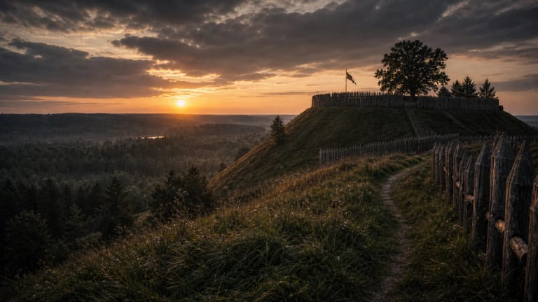
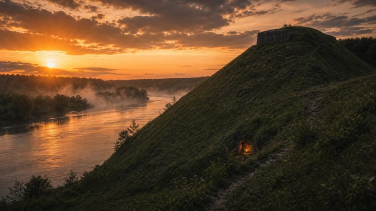
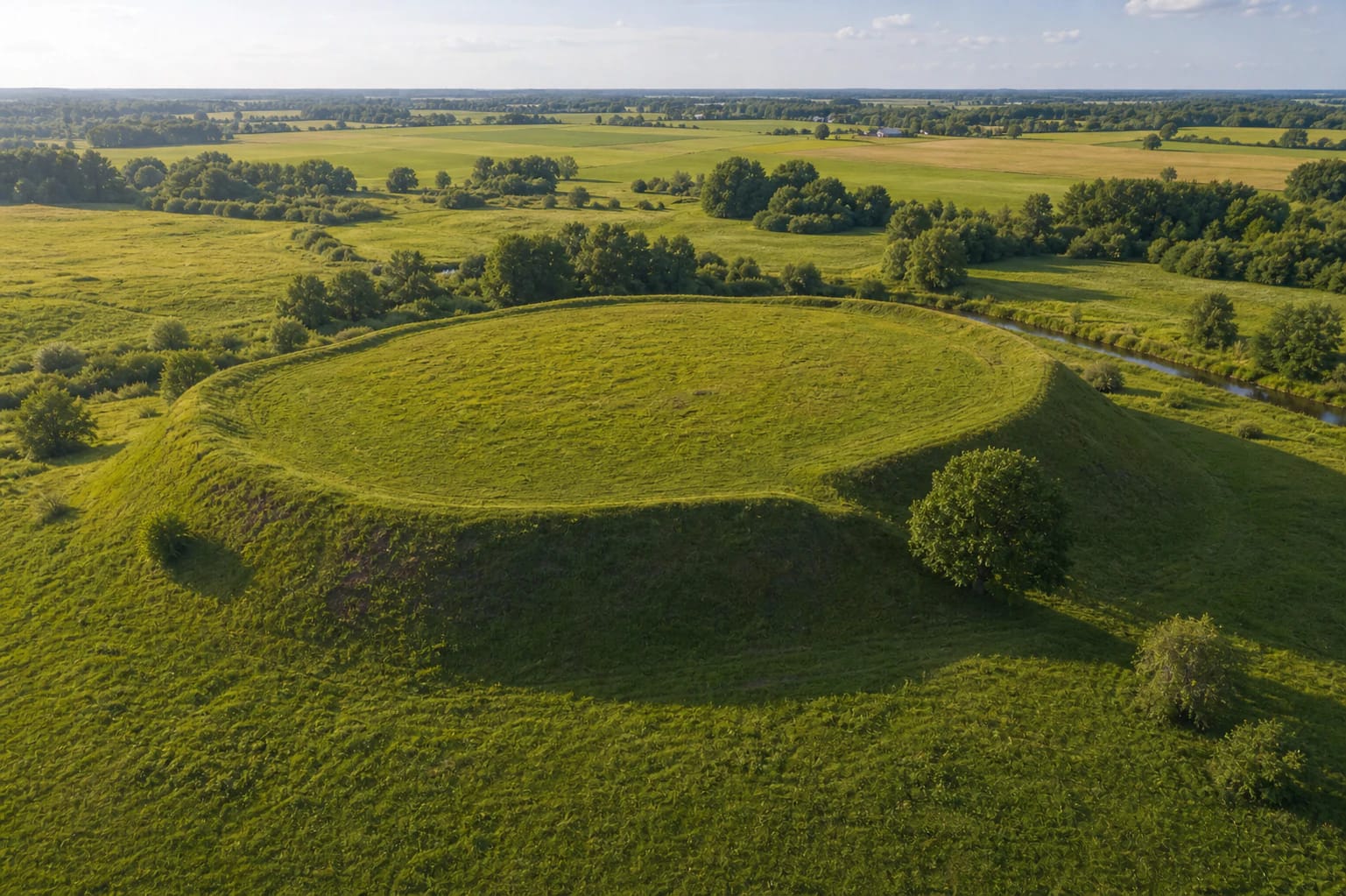
Apuolė Hillfort and burial ground, Apulia
Apuolė Hillfort: an early recorded Curonian site
Apuolė Hillfort is not important only locally. VLE writes that Rimbert, archbishop of Hamburg-Bremen, mentioned a Curonian place called Apulia in the Life of St Ansgar around 875, and researchers connect that Apulia with Apuolė.
That makes Apuolė one of the earliest places in present-day Lithuania known from written sources. Curonian history, Baltic Viking-age conflict, and later archaeology meet here in one field landscape.
Apulia and the Swedish campaign
VLE summarizes Rimbert's account: Apuolė had earlier belonged to the Swedes, then its inhabitants freed themselves from dependence; a Danish attack was repelled, and around 853-854 Swedish king Olaf attacked the Curonian town called Apulia with a large army.
The source also gives a huge number of defenders, about 15,000 warriors from five districts, though VLE notes that the figures are exaggerated. After a nine-day siege, negotiations began: the people of Apuolė paid a ransom in silver, gave hostages, and acknowledged Swedish rule.
The structure of the hillfort
VLE and Saugoma.lt place the hillfort at the confluence of the Luoba and Brukis, on a hill about 10 m high. The summit platform was about 80 m in diameter, though its northern and western edges have collapsed.
On the eastern side stands a rampart 75 m long and 7.5 m high. On the southern and partly western side, an 80 m long and 2 m high rampart survives. East of the hillfort was a forework measuring 90 x 30 m, with remains of a rampart and ditch at its end.
Foot settlement and burial ground
Apuolė is not just a hill with a rampart. VLE states that southeast of the hillfort, across about 12 ha, lies a foot settlement with an 80 cm thick cultural layer. This shows that the place formed a wider residential and defensive complex.
About 300 m northeast of the hillfort, on the right bank of the Luoba, is a burial ground. In 1931 B. Nerman investigated 63.3 sq m there and eight tenth- to twelfth-century cremation graves; finds included fragments of neck-rings and bracelets, penannular brooches, pins, beads, and earlier isolated second- to fourth-century finds.
Research and the return of finds
VLE writes that E. Volteris and J. Döring localized Apuolė as the Curonian castle Apulia in 1887. The hillfort and burial ground were investigated by E. Volteris in 1928-1930, by B. Nerman, F. Balodis, and Valdis Ģinteris in 1931, and by V. Nagevičius in 1931-1932.
The investigations covered 1,561 sq m and found the site of a wooden well, wooden remains of gates and building fortifications, hand-built and wheel-thrown pottery, many mainly Scandinavian iron arrowheads, clay loom weights, iron tools, and bronze ornaments. VLE states that the ramparts were strengthened in four stages from the fourth to the thirteenth century, while eight later sixteenth- to seventeenth-century graves were found in the great rampart.
Some 1931 finds were taken to Sweden and kept at the Swedish History Museum in Stockholm, then returned to Lithuania in 2009; they are now kept in Kaunas at the Vytautas the Great War Museum. Other excavation finds are held by the National Museum of Lithuania. Scientific books on the excavations were published in 2009 and 2022: Apuolė. Ausgrabungen und Funde 1928-1932 and Apuolė. Kasinėjimai ir radiniai 1928-1932.