- Place
- Igliauka Eldership, Marijampolė Municipality
- Region
- Suvalkija
- Type
- a lake beside Igliauka with a publicly improved shore and a bridge leading to the water
- Address
- Igliauka town and Paežerė village, Marijampolė Municipality
- Coordinates
- 54.57166, 23.66114
- Visit duration
- 1-2 hours; longer if you walk through Igliauka or spend unhurried time beside the water
- Best time
- daylight and dry weather from late spring to autumn; check the latest water-quality information before swimming in summer
Iglė, Igliauka Lake, Lake Ygla
Ygla, Iglė, and Igliauka Lake: keeping the names straight
The Marijampolė Municipality article calls the water body Lake Ygla, while the Encyclopaedia of Lithuania states that Igliauka lies beside Lake Ygla. The name Iglė also appears in local and older descriptions, so both variants are useful in search. They refer to the same small lake beside Igliauka, not two different bodies of water.
Some descriptions also use the name Igliauka Lake, but the official water-body name is Ygla. Check its position beside Igliauka before travelling so that you do not confuse it with another similarly named water body or a separate recreation site.
The map point used here is the lake's centroid, not a gate, car park, or exact end of the new bridge. Igliauka stands on one shore and Paežerė village is named on the other side, so waterfront access points may appear separately on maps.
A small lake beside Igliauka and the Paliai landscape
Lake Ygla belongs to the Suvalkija waterscape beside Igliauka. The Encyclopaedia of Lithuania describes Igliauka as an eldership centre by the lake and places the Paliai peatland about a kilometre east of the town. A visit therefore includes more than the water itself: it opens onto the low, wet landscape of southwestern Lithuania.
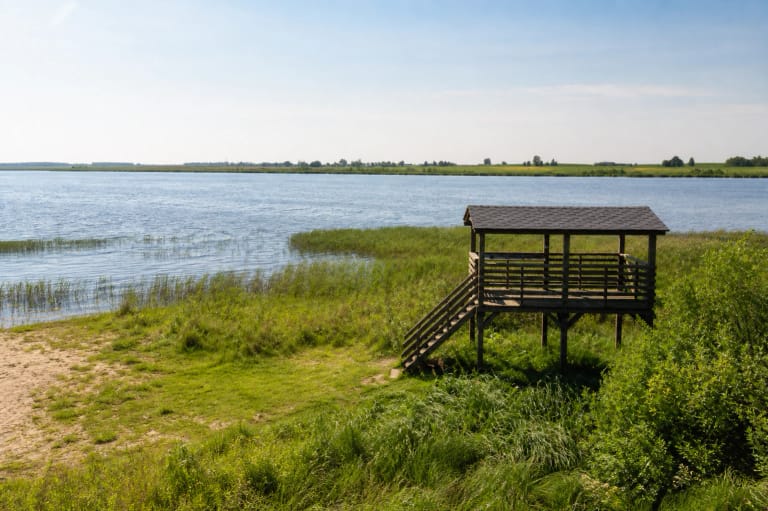
Real site photographs and shore views show calm water, reed belts, low grassy sections, and a wooded far bank. This is not a mountain panorama or a continuous boardwalk around the entire lake. Shore character can change with water level, season, and the access point chosen.
Water-body catalogues place Ygla in the Šešupė basin and identify the Yglė outflow. Such catalogue measurements are useful as orientation, but the visitor's practical fact is that the town and shore are close together, not that a single tourist route circles the lake.
A 63-metre metal bridge reached the water in 2026
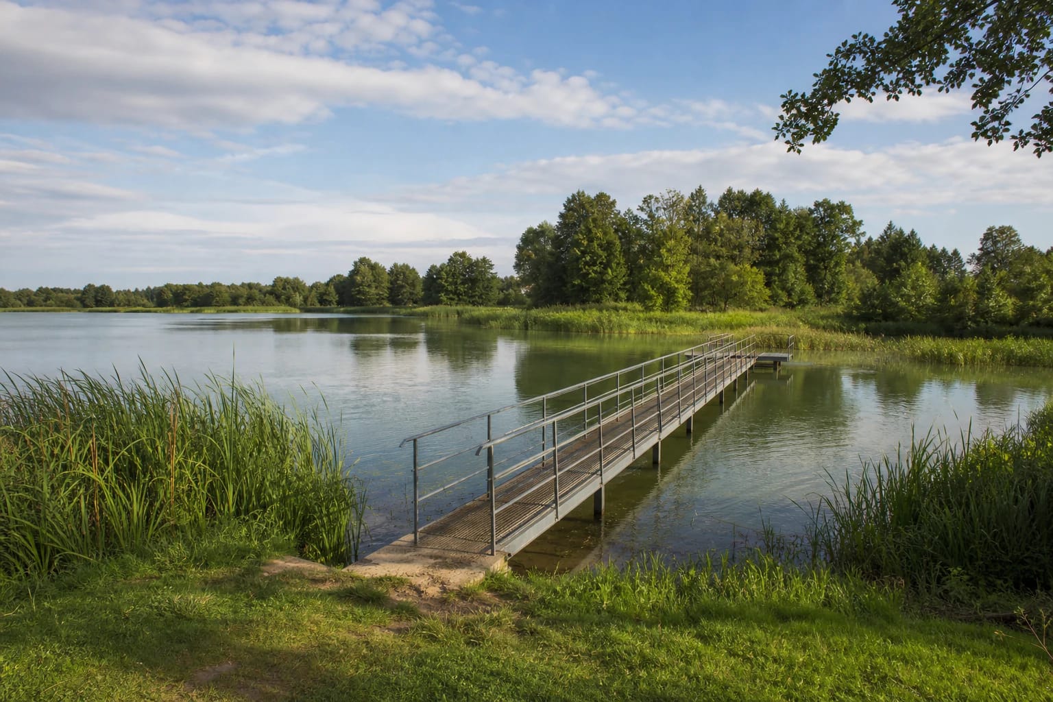
On 18 March 2026, Marijampolė Municipality announced a new 63-metre-long and 1.5-metre-wide metal bridge replacing an unstable wooden structure. The municipality describes it as a convenient way to reach the water and a place for boats to moor after arriving by water.
The bridge is practical infrastructure, not a decorative landmark. Its narrow deck and rails create a line above the water, but they do not promise that every shore or every approach is obstacle-free. After rain, access may be wet, while seasonal maintenance or a temporary closure always takes priority over an older photograph.
Treat the structure as waterside infrastructure: do not drive onto it, do not assume it is a boat-launch ramp without a sign saying so, and do not block other visitors. If arriving by boat, follow the signs on site and the current fishing and water-body rules when mooring.
Planned facilities are not today's Lake Ygla infrastructure
The municipality's project page gives the public tourism-infrastructure project a period from June 2026 to May 2028. The plan lists an access road with asphalt, a car park, shelters, a basketball court, an outdoor chess table, benches, changing cabins, portable toilets, and information boards.
One planned portable toilet is intended to be accessible to people with disabilities. That is a future design decision, not a confirmed accessibility guarantee for the shore on 1 August 2026. The same applies to planned shelters and changing cabins: they should not be written into the present visit as facilities already operating.
If travelling soon, check the municipality's project updates and signs on site. Construction can alter the approach, parking, or safe access to the water. Until the project is complete, keep the plan flexible and do not judge Lake Ygla by a recreation complex that is promised but not yet built.
Planning a short stop at Lake Ygla
Allow at least an hour: that is enough to orient yourself near Igliauka, reach a waterside access point, cross the bridge if it is open, and take in the reeds and wooded far shore. A longer stop can be combined with Igliauka's cultural places or a separate route towards Bukta Forest and the Žuvintas area.
The municipal sources checked do not publish a separate Lake Ygla ticket, admission desk, or opening hours. That is not permission to park in a meadow, cross private land, or light a fire anywhere on the shore. Use a lawful approach, protect grassy banks, and take rubbish with you.
Swimming, fishing, and boating conditions can change. Before entering the water, check the latest municipality notices about water quality; before fishing, check current recreational-fishing rules and whether a permit is required. The appearance of the shore alone is not a health or safety confirmation.