- Place
- Pašlavantys, Šilavotas Eldership, Prienai District Municipality
- Region
- Suvalkija
- Type
- a nationally significant hillfort with a foot settlement, a ring rampart, and a distinct folklore record
- Address
- Pašlavantys, Šilavotas Eldership, Prienai District Municipality
- Coordinates
- 54.62365, 23.74565
- Visit duration
- 30-60 minutes to read the mound, ring rampart, and foot-settlement landscape; allow longer if current works affect the approach
- Best time
- a dry day from spring to autumn, when the timber stair is safer and the truncated-cone mound and ring rampart read clearly in the open fields
Pašlavančio piliakalnis, Pašlavančio piliakalnis su gyvenviete, Pašlavantys Hillfort and Settlement
A detached mound rises in a landscape reshaped from former lake shores and the Šlavanta
Pašlavantys Hillfort lies in Šilavotas Eldership in Prienai District. The current KVR record assigns the complex to Pašlavantys village, while municipal planning documents use Pašlavančio for both the street and village name. The protected property itself is registered as Pašlavančio piliakalnis su gyvenviete, code 22589. It consists of hillfort 5538 and settlement 22590.
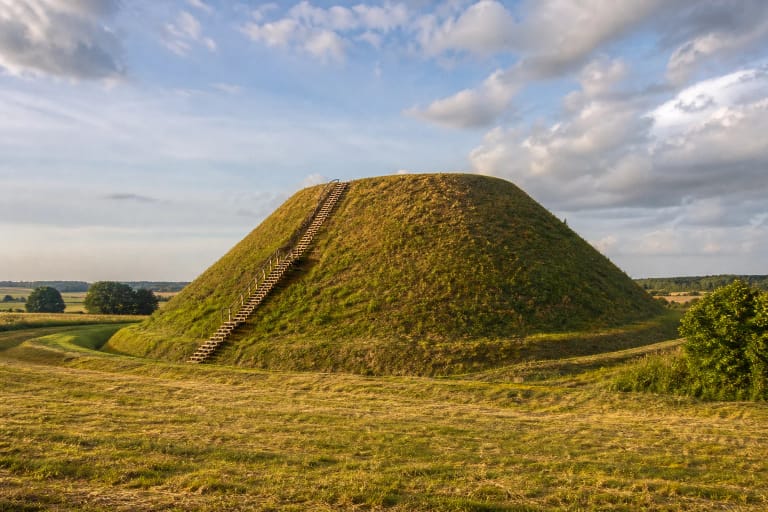
KVR describes a detached truncated-cone hill on the left bank of the Šlavanta. The stream is now a drainage channel, but it once connected two broad lake basins. Nearly level, gently undulating fields containing the ancient settlement surround the mound. Peaty former lake shores to the north and west help explain why the relatively low earthwork stands out so clearly in the open plain.
The exact Google Maps listing, place ID ChIJt3BLCRct50YRzD11HiRHt3A, marks 54.6236545, 23.7456525. Coordinates published by Prienai Regional Museum differ by only about two metres, independently confirming that the pin sits on the hillfort itself. It does not mark a verified car park or entrance. On 15 July 2026, the listing averaged 4.7 out of 5 from 24 reviews; both figures can change.
The 2021 KVR record gives a 14 by 8 m summit enclosed by a rampart on every side
The oval summit is aligned northwest-southeast and measures approximately 14 by 8 m. Its surface falls gently towards the west-southwest. A rampart approximately 7-12 m wide encloses the entire summit. It rises from about 0.5 m on the southwest to 2 m on the southeast, while construction of the ascent disturbed its western edge.
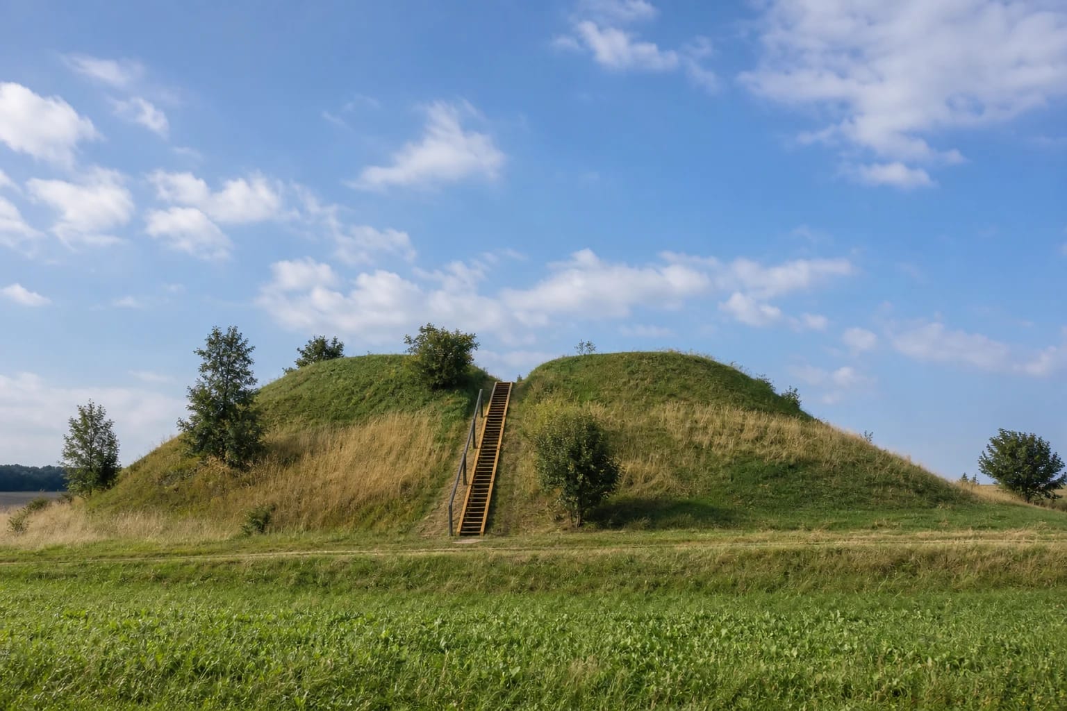
The slopes are steep and rise approximately 10-12 m. In 2021, KVR recorded a timber stair on the west-southwestern slope and only scattered trees and shrubs on the mound. There is no reconstructed castle, masonry, or building here. The site's visible evidence is the grassed landform, its compact summit, and the raised ring around it.
Prienai Regional Museum describes the summit as an oval measuring 13 by 8 m with a slightly lower western edge. This page treats the current KVR figure of 14 by 8 m as primary while retaining the museum's measurement as a genuine difference between official sources. KVR's registered area of 43,527 square metres covers the whole hillfort-and-settlement complex and must not be confused with the tiny summit.
Separate cultural deposits preserve activity on the summit and in the settlement around its foot
The current KVR record dates the hillfort and settlement from the end of the first millennium BC through the first millennium AD. Prienai Regional Museum gives a broader span from the first millennium AD to the beginning of the second. Because the two official accounts differ, it would be misleading to extend the current KVR range silently into the early second millennium.
The summit preserves a dark, charcoal-rich cultural deposit 0.6-1 m thick, containing burnt stones, clay daub, and archaeological finds. Around the foot, the settlement deposit reaches up to 30 cm. These are related but distinct parts of the complex. The summit thickness should not be applied to the surrounding settlement.
The museum lists clay spindle whorls, striated, roughened, and smooth pottery, and slag from the settlement. They document domestic activity and craftwork, but the inventory alone cannot name the community, identify one precise destruction event, or demonstrate unbroken occupation throughout the complete dating range.
From a priest's digging to the 2018 survey, the record documents damage as well as finds
KVR states that the Plutiškiai parish priest Kazakevičius dug into the hillfort in the mid-nineteenth century and reportedly found two knives and a tibia. This is an early account of amateur digging, not an excavation documented to modern archaeological standards. In the early twentieth century, the priest Antanas Radušis gave two spindle whorls found at the hillfort to the Lithuanian Scientific Society Museum.
An archaeological expedition in 1954 recorded the cultural layer in existing pits on the hillfort and collected finds. Surveys in 1954, 1977, and 1988 documented the deposit and finds around the mound. In 2018, work at the planned information-sign location on the southern foot again encountered a cultural deposit up to 30 cm thick.
Long-term ploughing, drainage, and other ground disturbance damaged the complex. Pits affected the summit and slopes, a field road cut into the western foot, and another track crossed the settlement. Much of the land is now fallow. The 2021 KVR act assigns national significance and identifies archaeological, important mythological, and landscape values.
Buried treasure and a sunken church belong to folklore, not demonstrated site history
KVR explicitly records tales of treasure hidden inside the hillfort or a church that sank into it. These stories help explain the site's important mythological value. In local memory, the mound was not simply an old fortification but an enigmatic landmark whose shape invited a narrative.
No archaeological or documentary evidence establishes a sunken church or a buried hoard. Burnt stones, clay daub, pottery, spindle whorls, and slag are specific finds; none confirms either legend by itself. The documentary and folklore layers should therefore remain clearly separate.
The 2025-2029 access project is in progress, so planned visitor facilities are not guaranteed
The municipality renewed the hillfort stairs in 2017, and KVR documented them on the west-southwestern slope in 2021. A new phase is now planned under municipal project 22-306-P-0001, which runs from June 2025 to August 2029. For Pašlavantys specifically, the official plan lists repairs to the approach from Pašlavančio Street and the stairs, plus a car park, pedestrian paths, and small visitor facilities.
These are planned or ongoing works, not confirmation that a car park, repaired stair, completed paths, or a universally accessible route is already available. Road and foot-access conditions may change while the project proceeds. Use the exact hillfort pin for navigation, park only where it is legal and safe, do not block a field track, and check the latest Prienai District Municipality notices before travelling.
The official sources checked publish no ticket office, admission fee, or gated opening hours. Google displayed 24-hour access on 15 July 2026, but this is changeable map guidance, not a guarantee of lighting, supervision, or safe entry. Visit in daylight and dry weather: the slopes rise 10-12 m, and wet grass and timber steps can be slippery.