- Place
- Skuodas District Municipality
- Region
- Samogitia
- Type
- a roughly 35-hectare town park of Bartuva waterways, paths, and recreation areas
- Address
- 8 Mokyklos Street, Skuodas, LT-98123, Skuodas District
- Coordinates
- 56.26831, 21.52680
- Visit duration
- 45-90 minutes for the central paths and water spaces; up to 2 hours for a longer circuit of the fitness trail
- Best time
- a dry day in late spring, summer, or early autumn; take care on compacted-stone paths, bridges, and water edges after rain, among autumn leaves, or during frost
Skuodo miesto parkas, Skuodas Town Park
A broad park, not a single town square
Official projects call this place Skuodas Town Park. It stretches across the western part of Skuodas, and planning documents show its path network running from the approaches to Mokyklos and Gedimino streets south-west towards the Bartuva and Skuodas Reservoir. This is a wide area divided by water channels, not a formally enclosed garden with one gate.
The Google Maps listing and this guide do not describe Skuodas central square, the cemetery, the school stadium, or the registered manor buildings. These are separate urban sites even where some stand near park approaches or appear on a longer walk. The point associated with 8 Mokyklos Street is a representative visitor reference, not a verified entrance, car park, or the park's geometric centre.
The coordinate 56.268309, 21.526798 matches the exact Google Maps listing named Skuodo parkas, whose place ID is ChIJhWNmv05F5UYRTFD8D01Ofss. Its rating checked on 2026-07-15 was exactly 4.7/5 (4.7 out of 5). This is a dated platform snapshot and may change after verification.
The 1968 park and its precise relationship to the manor site
The official EU investment record says Skuodas Town Park began in 1968 in the western part of town by extending surviving fragments of the Skuodas manor park. Trees and shrubs were planted, and a fitness trail was laid out in 1987. The whole town park is described as roughly 35 hectares with natural, ecological, aesthetic, and locally recognised value.
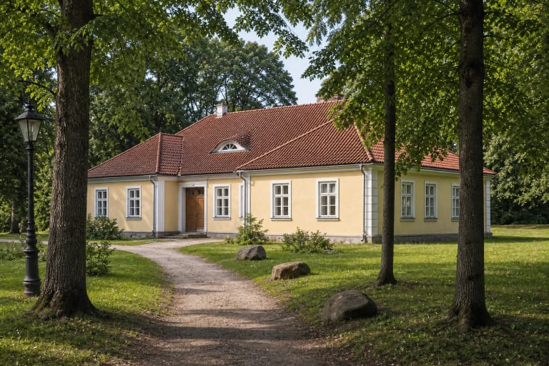
The registered heritage property called Skuodas Manor Complex Fragments, code 582, is a separate complex at 1 and 3 Šaulių Street. The Cultural Heritage Centre's manor database gives the former estate site as 4.1 hectares and records a park fragment and pond among its elements. These facts should not be extended to the entire 35-hectare town park or read as proof that every present-day path is inherited manor-park fabric.
Wooden sculptures were made for the fitness trail in 1987, but by 2022 the municipality reported that only a small share remained. A project for five new works by professional artists was planned that year, while the 2024 lighting notice provided separate spotlights for sculptures in the park. The surviving older woodcarvings and newer works should not be treated as one intact 1987 collection.
Bartuva water, looping paths, and several different bridges
The park's water setting is not one ornamental pond. The special plan and a later project's aerial mapping show Bartuva bends, branches, islands, and smaller backwaters, while the larger Skuodas Reservoir lies on the park's south-western side. Water can therefore appear as a narrow channel, a shallow plant-filled pool, or a broader reservoir view on different sections of the walk.
A project completed in 2018-2019 renewed the fitness trail with compacted crushed-stone screenings, built a wooden bridge over a stream, and added another screenings-surface path towards the old town. The municipality also recorded culverts, 14 benches, bins, 80 young trees, 30 bat boxes, 20 bird boxes, direction markers, and information boards. This is the documented output of that project, not a guarantee that every item remains in identical condition in 2026.
The 2013 plan marks several bridges, a suspension bridge, and a park dam, so the word bridge in local descriptions does not always mean the same crossing. Follow the present signs instead of assuming that every shortcut on an old plan remains open. After heavy rain, lower path sections and planted water edges can be damp, while bridge surfaces may ice over in winter.
The fitness trail, recreation equipment, and a new lighting phase
In 2022 the municipality listed a new pedestrian bridge, benches, a children's playground, and outdoor exercise equipment among the park facilities already improved. These are activity points distributed through the park rather than one compact attraction beside the map pin. Assess the equipment's condition, access, and age suitability on arrival.
The 2023 technical design covered the repair of about 330 metres of existing asphalt path, a new 115-metre asphalt section, and a 38-metre section surfaced with crushed-stone screenings. Designed widths of 1.8-2 metres confirm that the park does not have one uniform surface: a route may combine asphalt, compacted screenings, and older sections.
In October 2024 the municipality said new path sections were under construction, an existing section was being repaired, and a lighting network was being installed. The scheme provided 87 LED path lights, 15 LED spotlights for sculptures, cycle stands, extra benches, and bins at rest areas. No later public notice confirming completion of every item in this phase was found, so check the actual state of paths and lighting on site and in the latest municipal notices.
A practical route without promising one official entrance
Allow 45-90 minutes for a first loop linking water, the principal paths, and one or two bridges. A longer circuit of the fitness trail can take up to two hours. The representative map point near Mokyklos Street helps you reach the park side of town, but build the route on arrival around the signs, open paths, and the place where you intend to finish.
Asphalt sections are generally firmer, while compacted-stone screenings may soften or hold puddles after rain. Bridges, water edges, surface transitions, and seasonal leaves can make wheelchair or pushchair travel harder. No continuous certified step-free circuit across the whole park could be verified, so assess a shorter suitable section on arrival, particularly after rain or during frost.
The coordinate is not a parking place, so leave a car only where current road signs permit and keep path approaches clear. Skuodas bus station is at 34 Vilniaus Street, with the park reached on foot through town streets; check routes and times on the day of travel. No admission charge or set park opening hours could be confirmed publicly, although works, events, water levels, or safety barriers may temporarily alter access to a particular section.