- Place
- Kartena eldership, Kretinga District Municipality
- Region
- Samogitia
- Type
- 1.8-kilometre forest nature trail with a hillfort and Minija valley viewpoint
- Address
- By the old Dauginčiai cemetery, Dauginčiai village, Kretinga District
- Coordinates
- 55.95160, 21.53935
- Visit duration
- 1-1.5 hours for the loop; up to two hours with stops
- Best time
- a dry day from spring to autumn; natural ground, roots, and timber steps can be slippery after rain
Šilpelkės pažintinis takas, Dauginčių pažintinis takas, Šilpelkės miško pažintinis pėsčiųjų takas
The Šilpelkė trail starts by the old Dauginčiai cemetery
The official name is Šilpelkė Forest Nature Trail, while visitor descriptions also use the shorter Šilpelkė Trail and Dauginčiai Trail. These are names for one loop in Kretinga District near Dauginčiai village, not several different trails.
The starting coordinates 55.951600, 21.539350 lead to the area by the old Dauginčiai cemetery, where visitors leave a car and pick up the trail directions. The approach from the A11 highway uses local gravel roads, so drive carefully after rain and do not try to shorten the route on random forest tracks.
This page is about the route itself. Dauginčiai Outcrop is its main viewpoint and destination, but the outcrop coordinates are not the trailhead: visitors walk through the woodland to the cliff and then complete the loop back to the cemetery.
A 1.8-kilometre loop past a hillfort and the Minija bends
The current Žemaitija Protected Areas Directorate description gives the loop as 1.8 kilometres. It starts by the plague cemetery, passes Dauginčiai Hillfort, winds through Šilpelkė Forest, reaches the Minija valley, and returns to the start by a different section.
The landscape keeps changing: the beginning carries the memory of the cemetery and hillfort, the middle enters natural woodland and ravines, and the Minija section adds slopes and a valley view. It is a short but uneven walk, so the kilometre count does not describe the whole physical effort.
Information elements near the hillfort, outcrop, and hornbeam grove help visitors orient themselves, but this is not a city park with a marker at every junction. Follow the local directions rather than unmarked side paths.
Šilpelkė Forest and the Minija valley habitats
Šilpelkė, also called Dauginčiai Forest, is a Minija valley woodland near Dyburiai. Its value is not only visual: ravines, damp hollows, valley slopes, and naturally developed woodland form one connected valley ecosystem.
A park-like hornbeam grove stands out along the route, among the more northerly hornbeam stands in Lithuania. Beneath the canopy visitors can see deciduous trees of different ages, ferns, deadwood, and plants adapted to damper ground. Fallen branches are not trail furniture for visitors to rearrange.
A quiet walk beside the Minija may bring woodland and river birds within hearing, but wildlife is not a guaranteed attraction. Do not approach burrows or nests, shout across the valley, or try to lure animals with food or recordings.
Dauginčiai Hillfort, the plague cemetery, and the outcrop viewpoint
Dauginčiai Hillfort stands near the trailhead and is also known as Pilalė or Moon Hill. It recalls that the Minija valley woodland was used and inhabited long before the modern nature route existed. Crosses and small shrines near the start mark the sacred landscape of the old Dauginčiai cemetery.
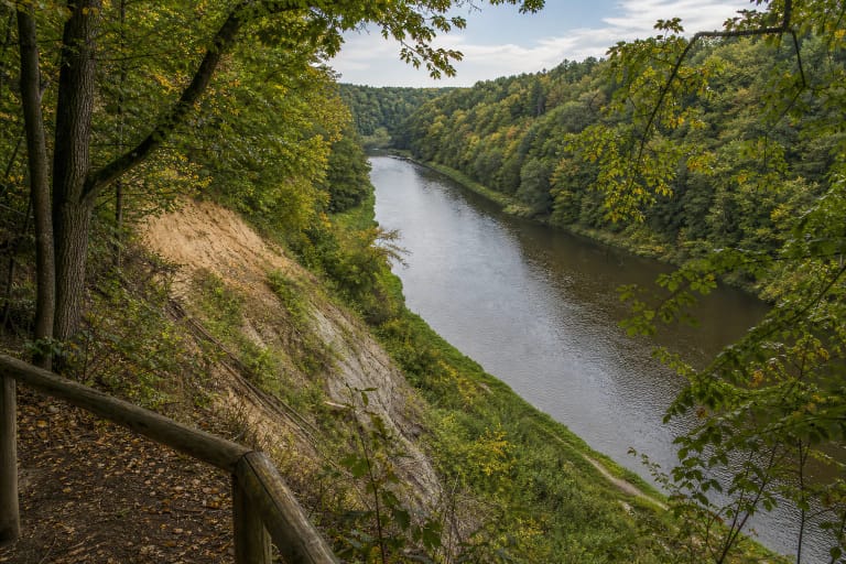
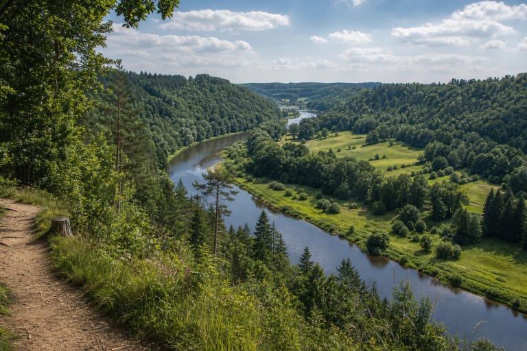
The loop reaches Dauginčiai Outcrop, a Minija-eroded cliff up to 22 metres high and about 44 metres long. A viewpoint at the top offers a safe look at the river bend and valley slopes. There is no reason to descend to the unstable cliff edge, whose surface changes through erosion.
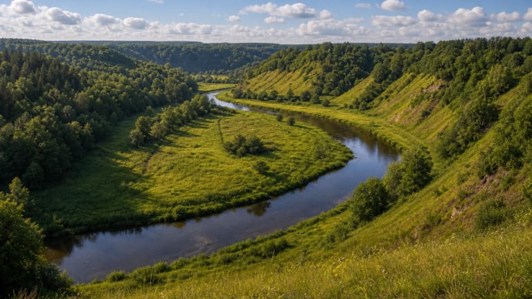
Local people call the Minija valley scenery Lithuanian Switzerland. This is a picturesque local comparison rather than an official geographical name: the impression comes from river loops, wooded slopes, ravines, and exposures, not mountain height.
Surface, steps, and planning a visit
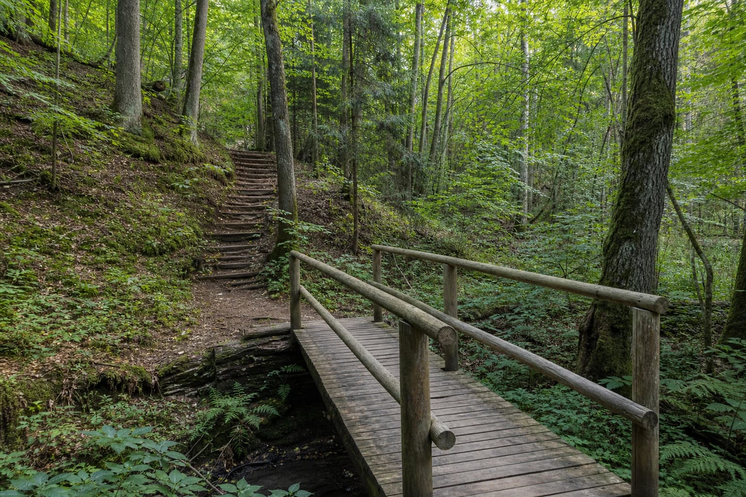
Much of the trail is natural woodland ground, with timber steps, footbridges, and rails on steeper sections. The final section back to the start is described as a forest road. After rain, boards, roots, clay, and low hollows can be slippery or wet, so wear shoes with good grip.
School-age children can walk the route with close adult supervision, but the complete loop is not suitable for a pushchair or independent wheelchair travel because of steps, slopes, and uneven ground. After a heavy storm, check for temporary barriers caused by fallen trees before setting out.
The official sources checked do not list a separate ticket, permanent toilet, drinking water, or café by the trail. Leave the car at the trailhead, allow about an hour to an hour and a half, take rubbish with you, and follow the signs on site.