- Place
- Kalnai village, Radviliškis District Municipality
- Region
- Tytuvėnai Regional Park
- Type
- 21-metre observation tower in the Gomerta Landscape Reserve of Tytuvėnai Regional Park
- Address
- Kalnai village, Šiaulėnai Eldership, Radviliškis District
- Coordinates
- 55.64553, 23.41952
- Visit duration
- 30-45 minutes for the tower and panorama; 1.5-2 hours with the trail to Kudinai Hillfort
- Best time
- a clear spring or autumn day, when visibility is good and the trail is drier
Šiaulė Observation Tower, Kalnai Observation Tower, Šiaulė Land Observation Tower
A cylindrical tower above the hills of Šiaulė Land
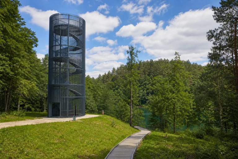
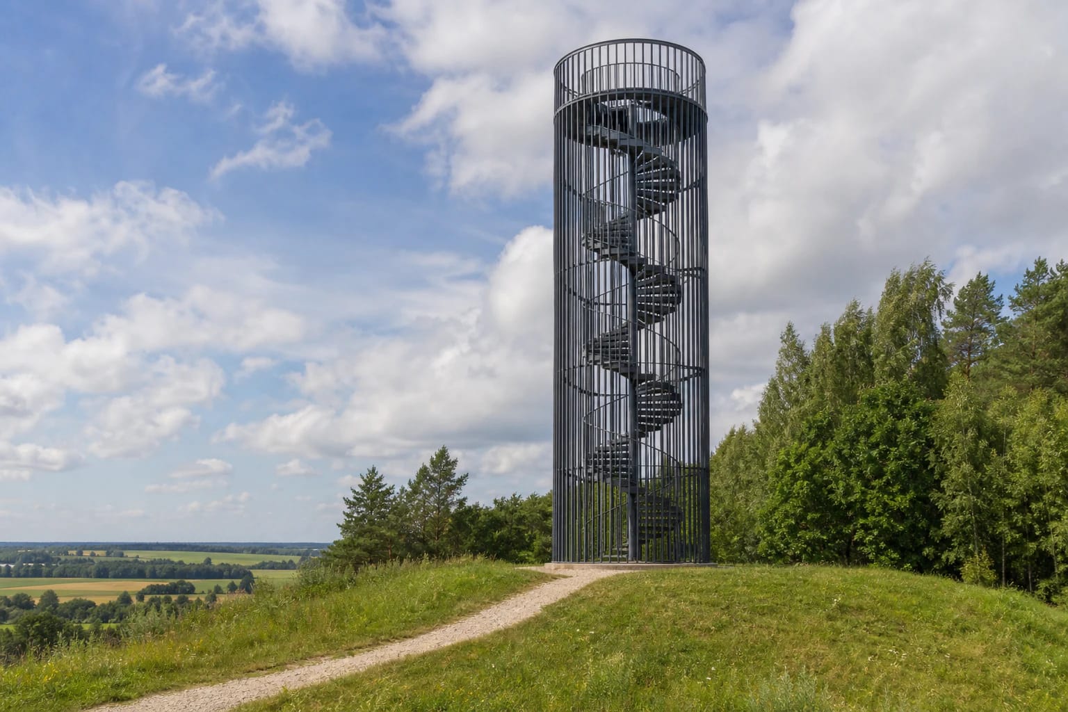
Šiaulė Observation Tower stands on one of the hills of Kalnai village, between the small towns of Šiaulėnai and Šaukotas. Its form is immediately recognisable: a tall cylindrical frame wrapped in close vertical slats, with a metal spiral staircase inside and a circular viewing deck at the top.
The official Saugoma.lt listing gives the tower's height as 21 metres. Because its base already occupies elevated, rolling ground, the view begins before the final platform, but the full patchwork of fields, forests, and peatlands only opens from the top.
This is an exposed structure with no shelter from wind or precipitation. Hold the rail, pass other visitors calmly, and secure loose belongings before climbing. Open steps and views through the structure may feel uncomfortable for visitors who are uneasy with heights.
A panorama of hills, villages, and peatlands
The tower lies within the Gomerta Landscape Reserve, part of Tytuvėnai Regional Park. Protection applies not merely to one scenic viewpoint but to the wider undulating landscape, with farmland, woodland, wet ground, and cultural heritage landmarks.
Saugoma.lt states that the platform overlooks nearby villages, rolling terrain, and working peatlands. In good visibility, the skyline can include Radviliškis, Rėkyva, and the tops of apartment blocks in Šiauliai. These are distant reference points and may disappear entirely in haze or rain.
For photography, the landscape mosaic matters more than a single direction. Spring separates the colours of cultivated fields, summer brings an unbroken green woodland band, and autumn trees define the relief. Midday gives clarity, while lower morning or evening light reveals the contours more strongly.
The trail from the tower to Kudinai Hillfort
A walking trail leads from the tower to Kudinai Hillfort, also called Šiaulė or Saulė Hill. Saugoma.lt dates the hillfort to the late first millennium and early second millennium AD, describing a separate hill with steep slopes 12-18 metres high. Varpinė Hill and the more distant Kartuvių Hill rise nearby.
The route lets visitors compare a modern viewing structure with an old defensive landform on the same outing. It crosses woodland and can remain wet after rain; tick protection is sensible in the warmer months. Radviliškis District Municipality has begun a visitor-access improvement project at the hillfort, so road or trail conditions may change during works.
Local stories speak of a strong castle, a town buried by blown sand, bells still sounding underground, and even the Battle of Saule taking place nearby. These are legends rather than facts established by archaeology. The tower's name belongs to the same narrative landscape but does not prove a particular battle location.
Reopened after repairs, but still governed by weather
The State Service for Protected Areas announced that Šiaulė Observation Tower had reopened after structural repairs. The earlier closure is a useful reminder to check the newest Saugoma.lt or Žemaitija Protected Areas Directorate notice before a long journey, particularly after storms or during maintenance periods.
The official listing gives neither fixed opening hours nor a mandatory admission fee. This is outdoor visitor infrastructure, but that does not make every condition safe. Postpone the climb during strong winds, thunderstorms, ice, or fog that severely reduces visibility.
The approach uses local roads, so the final section can be slower than navigation estimates suggest. Park only where appropriate, keep access clear, and never drive across meadows. The exact Google pin marks the tower itself, not necessarily the best parking position.
Who the visit suits and how long to allow
Allow about 30-45 minutes for an unhurried climb and the panorama. Add at least 1.5-2 hours if you walk to Kudinai Hillfort, adjusting for trail conditions. The outing suits visitors who want to read the rolling relief of Šiaulė Land rather than collect only a quick tower photograph.
There is no lift on the spiral staircase, so the upper platform is not step-free. The landscape remains visible from the hill and approach at ground level, but no detailed official accessibility audit was found. Contact the protected-area administration if you need current surface information or individual assistance.
Keep young children close, prevent running on the stairs, and consider how they react to open heights. Dogs should remain on a lead, especially on the woodland trail. Carry out all rubbish and do not shorten the route down slopes, because the reserve's vulnerable landscape is the attraction itself.