- Place
- Degučiai, Zarasai District Municipality
- Region
- Zarasai District
- Type
- 2 km nature trail with 14 interpretation stops in Degučiai Landscape Reserve
- Address
- Degučiai campsite by Lake Samanis, Degučiai
- Coordinates
- 55.65442, 26.05413
Degučių pažintinis takas, Degučiai Nature Walk, Degučiai Educational Trail
The trail begins at a campsite south of Degučiai, not at Google's cryptic address 179
Degučiai Nature Trail starts in the forest beside Degučiai campsite, on the southern side of Lake Samanis. From Degučiai, drive towards Salakas and follow the campsite sign and forest road. The protected-areas route link leads to 55.651618, 26.050537, while the public Google Maps entry is centred at 55.654421, 26.0541313. Both mark the same visiting area, but the official point is closer to the actual interpretive-route entrance.
The address 179 displayed by Google is not a clear street and building number, so search for Degučiai Nature Trail or use the official coordinates. The protected-areas authority says cars may be left at the campsite at the beginning. There is no need to drive beyond it onto the forest trail.
Degučiai lies beside the Kaunas-Zarasai road on Lake Samanis, approximately 15 km south-west of Zarasai. The trail itself enters Gražutė Regional Park and Degučiai Landscape Reserve, which explains why the village, campsite, and trail may appear as several neighbouring map pins.
The current official route is 2 km with 14 stops, although an old timber sign still records 3,300 m
For 2026, Saugoma.lt gives a length of 2 km, fourteen interpretation stops, and up to two hours for the walk. That time assumes an unhurried educational visit rather than an athletic pace, including reading panels, pausing at the bog pool, looking at plants, and climbing the hillfort. Most walkers will finish sooner without long stops.
Earlier walking accounts give 2.7 km, 3.3 km, or even 3.4 km, and an older official photograph clearly shows 3300 m carved into the entrance sign. This records an evolving route rather than an error in the current source. Plan around the latest 2 km and fourteen-stop description, and follow arrows and blue blazes on site instead of an old GPS track.
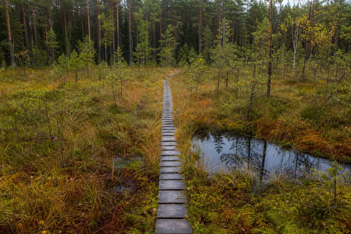
The route has been described as an irregular figure of eight, so paths intersect and an unmarked choice can lead onto a shorter or older branch. Most of the surface is sandy forest floor crossed by roots. Narrow timber sections carry visitors over the wettest ground; worn boards and small bridges were renewed in 2024, but this is not a broad continuous boardwalk with handrails.
Pine forest gives way to a transition mire, an open bog pool, and protected orchid habitats
The opening section passes through old, airy pines over a carpet of mosses and lichens. Near the wetland, the ground darkens and trees thin before a short slatted boardwalk reaches an open-water bog pool. This is not a swimming place: its margins may be unstable, and the constructed trail is the safe observation point.
Degučiai Landscape Reserve protects a complex of forest, wetland, and aquatic vegetation. Its officially identified European habitats include transition mires and quaking bogs, western taiga, ravine and slope forests, and bog woodland. This mosaic creates a surprisingly marked change of setting within only 2 km.
Marsh saxifrage, lesser twayblade, bog orchid, fen orchid, and early marsh and heath spotted orchids occur in the reserve. A visitor may not find or recognise each one, and flowering depends on the season. Do not pick plants or leave the trail to search for them: their mention explains the habitat's value rather than promising a guaranteed floral display.
Read the earthworks of Degučiai Hillfort in the forest rather than expecting an open panorama
The southern part of the route climbs Degučiai Hillfort, also called Ažusamanė Hillfort or Ažusamanė Castle. It is a state-protected archaeological site, number 5701 in the Cultural Heritage Register. A burial mound and cemetery stand nearby, making this stop part of a larger archaeological landscape rather than merely a scenic hill.
Zarasai Regional Museum describes an oval summit platform measuring 27 by 19 m, slopes up to 15 m high, and three rings of earthworks. The upper bank reaches 0.8 m in height and 5 m in width; a lower rampart is approximately 120 m long, 1.2 m high, and 5.5 m wide; the third is about 80 m long, 1 m high, and 6 m wide. Partly infilled ditches survive between them.
The platform, ramparts, and slopes are wooded, so in leafy months their defensive plan emerges gradually through changes in height rather than from one panoramic viewpoint. Traditional names call the place a castle, yet no masonry castle ruins are visible. The surviving evidence is the shaped earthwork and archaeological status, not an extant building.
Scent and sound are the trail's best guides, but sensitive species must not become targets to pursue
The protected-areas authority singles out the route's scents: dry pine air and the pungency of Labrador tea on a sunny day, mushrooms and wet moss after rain. Birdsong is strongest in spring and early summer, resinous and wetland aromas deepen later in summer, and autumn brings russet mire colours with fewer insects.
The reserve supports Eurasian bittern, crane, osprey, hazel grouse, Eurasian pygmy owl, Tengmalm's owl, black woodpecker, and white-backed and three-toed woodpeckers. This is not a zoo, so a rare bird may only be heard or remain absent. Quiet walking and patient listening are more rewarding than trying to approach wildlife.
Visitors are asked not to pick rare plants, damage anthills, disturb wildlife, or step from the boardwalk into the wetland. Fires belong only in an equipped campsite fire ring and only when current wildfire restrictions permit them. Carrying all waste away is the safest practice even when bins happen to be present near the entrance.
The trail is free and mapped as open around the clock, but daylight is the safe visiting window
Degučiai is open protected-area infrastructure: the official object page lists no gate, ticket booth, or mandatory admission charge. A voluntary protected-areas visitor ticket supports conservation but is not an entrance fee. Google Maps shows access 24 hours daily, yet the forest route is unlit. Walk in daylight and check official notices before travelling for repairs, wildfire danger, or temporary restrictions.
The route is intended primarily for walkers, but the authority also permits mountain bikes, dogs on leads, and skis in a snowy winter. A cyclist should dismount on narrow boardwalks, at interpretation stops, and in wet junctions. Keeping a dog leashed protects other visitors as well as ground-nesting birds and wild animals.
Roots, loose sand, the hillfort slope, and narrow rail-free boards mean the complete route is unsuitable for a standard pushchair or wheelchair. Children can manage it under adult supervision, but should remain close beside the bog pool and on wet timber. On 13 July 2026, the Google Maps entry named Degučiai Nature Walk had 168 reviews averaging 4.7 out of 5.