- Place
- Rokai Eldership, Kauno District Municipality
- Region
- Paraželiai and Rokai Eldership
- Type
- recreation area beside the Paraželiai ponds with a beach setting
- Address
- By the Paraželiai ponds, Paraželiai village, Rokai Eldership
- Coordinates
- 54.81246, 23.96043
- Visit duration
- 45-90 minutes for the beach and reachable recreation area
- Best time
- a dry, warm day from late spring through early autumn
Rokai Beach, Paraželiai Ponds Recreation Area, Rokai Recreation Area Beach
The Rokai recreation area is near Paraželiai
Rokai Recreation Area Beach lies near Paraželiai village, in Rokai Eldership, Kauno District, beside the Paraželiai ponds. The approximate site point is 54.812457, 23.960434, so navigation should use the specific beach name and the final road section should be assessed on site.
A Kauno District Municipality planning document lists a recreation area in Paraželiai village, Rokai Eldership. This confirms the intended recreation setting, but it does not describe every facility that may exist today, so plan around what you actually find when you arrive.
This is not the same as the centre of Rokai, Kaunas city’s Rokai area, or a generic attraction label for the entire Kaunas Reservoir region. The Paraželiai ponds setting is the useful distinction when choosing a destination.
A beach setting beside the Paraželiai ponds
The shore combines open water, grass, and belts of reeds. That setting suits a quiet stop, watching the water, and a short break more than a busy resort-style day. Stay on stable ground and do not enter reedbeds simply to reach the water.
The beach name identifies a waterside recreation place, but the official documents found for Paraželiai do not provide current water-quality results, lifeguard hours, or a permanent equipment schedule. Swim only after confirming that the particular place is intended for it and that conditions are suitable.
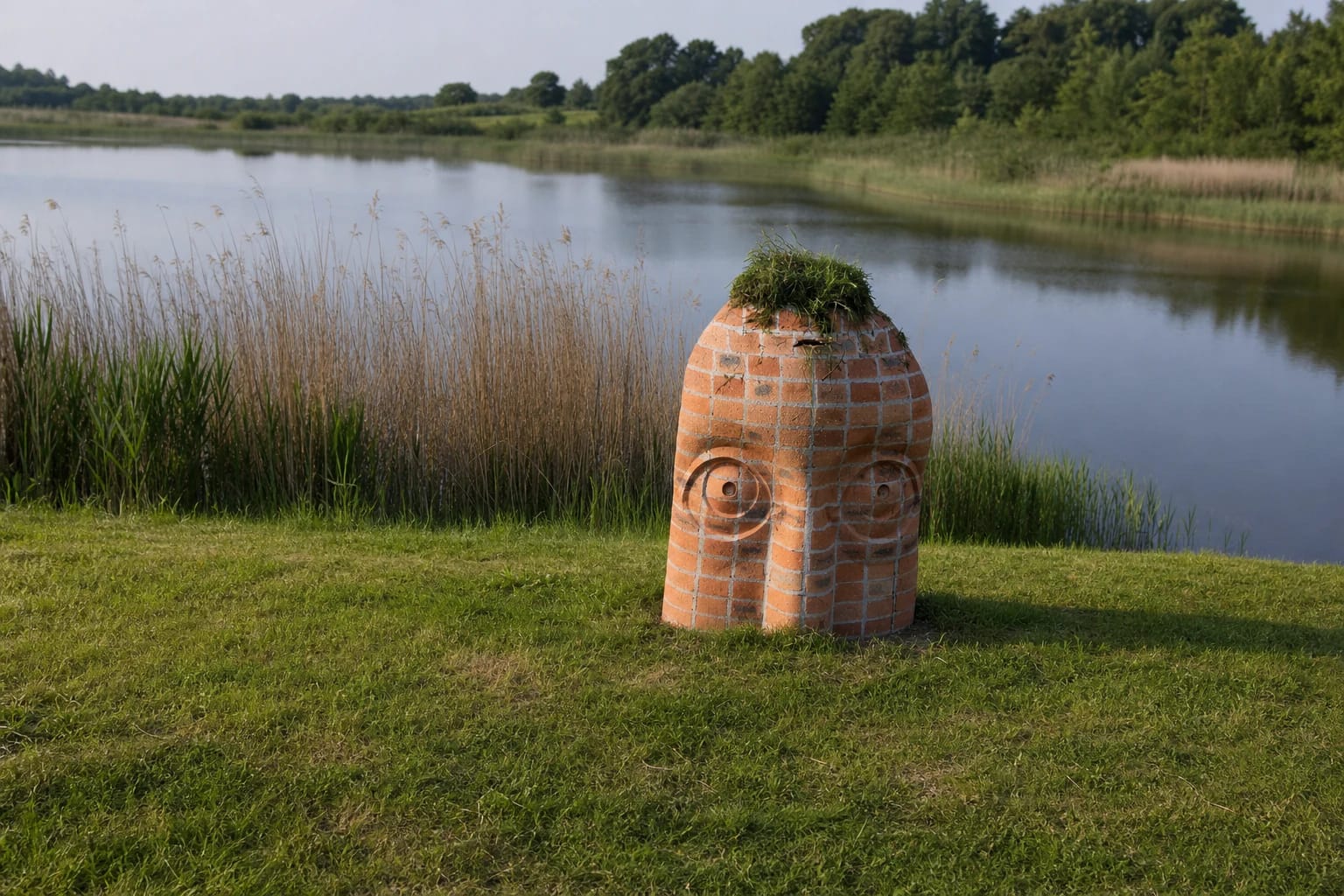
A small rounded red-brick marker stands beside the water, with two stylised faces built into its front and grass covering its top. The pond shore behind it is grassy and reed-lined. This is a place for taking in the shoreline as a whole rather than expecting every metre of the ponds to be landscaped in the same way.
What the recreation-area designation means
The municipality’s 2014-2019 planning material mentions the Paraželiai recreation area alongside other Kauno District leisure places. It shows that the site was included in municipal recreation-infrastructure planning, but an older planning entry is not a current inventory of equipment.
Do not assume that a shelter, toilet, benches, playground, changing cabin, or bins will be available. If a convenience is missing, do not improvise by parking on grass or entering private land.
The value of this recreation area is the water landscape and the chance to step away from busier places for a while. Quiet voices, limited noise, respect for plants, and taking litter away matter more here than a long list of amenities.
Approach pointers in the local road network
The official Kauno District local-road list records Volungių Street in Paraželiai and Rokai villages. It describes a section beginning at Nemuno Street and continuing to a plot boundary, making this road network a useful orientation point for the final part of the journey.
Another municipal document lists a trade and service location in Paraželiai village by the Paraželiai ponds. This confirms the place reference, but it does not mean that trade is always available at the beach or that parking spaces are reserved for visitors.
Drive slowly, follow local signs, keep off grass, and do not block residents’ access. If the final section is too poor after rain, leave the car only in a lawful safe place and walk the remaining distance without crossing private plots.
For a short break or a wider Kauno District day
Allow about 45-90 minutes for the reachable shore, a look at the water, and an unhurried break. More time is useful only when you deliberately combine the site with other Kauno District destinations.
For any active water use, bring only what you need and keep equipment off paths and the shore. Check the forecast before travelling, then assess bank stability, the water surface, and local signs when you arrive.
To change from waterside scenery to a forest or river-valley landscape, combine the site with Jiesia Landscape Reserve, Dubrava Arboretum, or another nearby destination. Give each site its own time and do not extend the beach into a large route if road conditions are uncertain.