- Place
- Raseiniai District Municipality
- Region
- Žemaitija
- Type
- nationally significant hillfort on an upper terrace of the Dubysa's right bank
- Address
- Padubysio kaimas, Raseinių seniūnija, Raseinių r. sav.
- Coordinates
- 55.39892, 23.24252
- Visit duration
- 45-90 minutes; longer when continuing on Dubysa valley paths
- Best time
- a dry spring or autumn morning when foliage reveals the ramparts and valley
Kaukuras, Kaukuras Hill, Kaimelė Hillfort
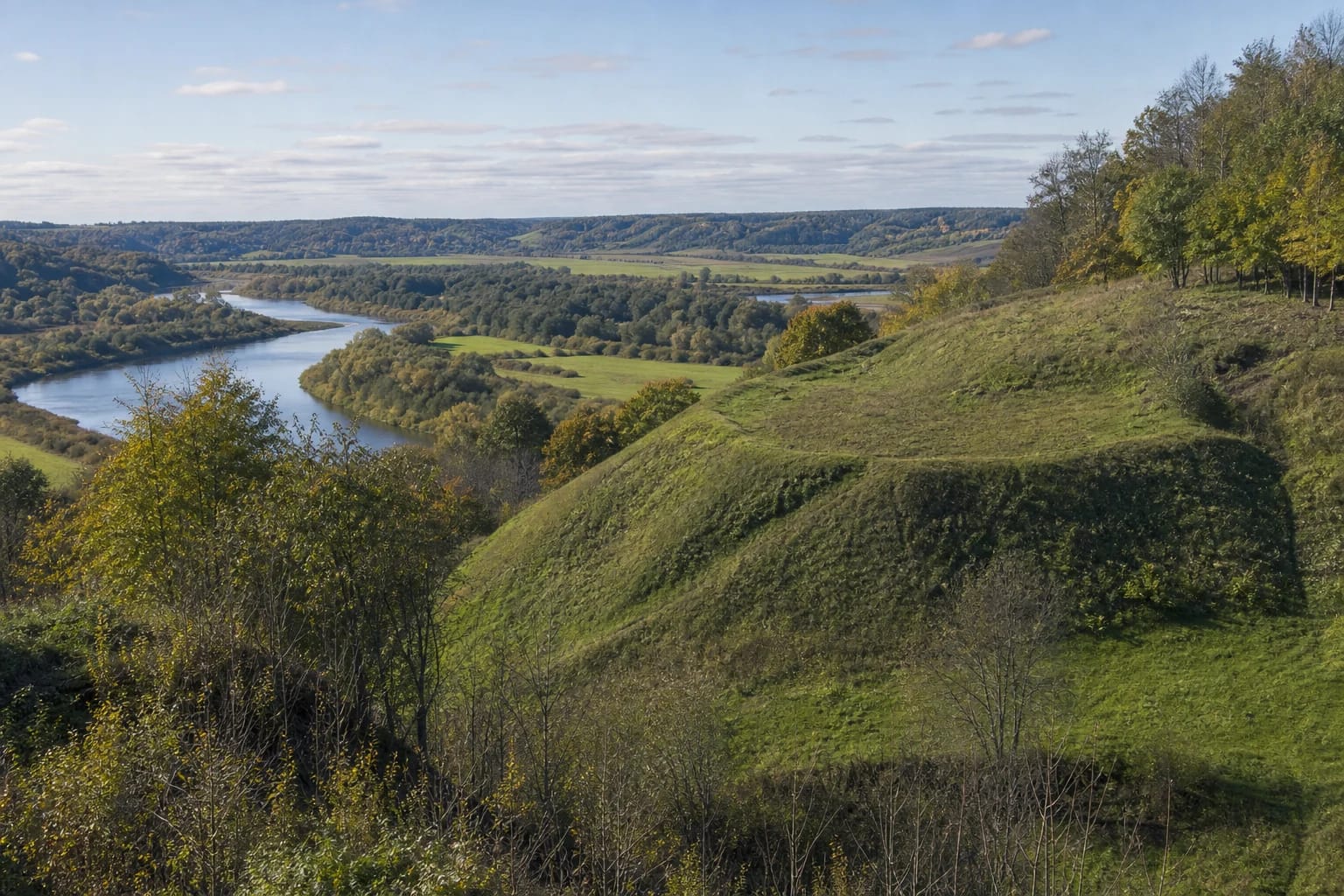
A promontory above the Dubysa valley
Padubysys Hillfort occupies a promontory on the upper terrace of the Dubysa's right bank. Its irregular quadrangular platform runs northwest to southeast, is about 60 metres long and varies from 10 to 32 metres wide. Steep slopes, now partly wooded, rise as high as 30 metres.
The height opens a broad valley view, but the site is more than a panorama. Promontory, slopes, and defensive earthworks show how natural relief was adapted for protection. Spring and late autumn reveal the form more clearly than dense summer foliage.
Ramparts, ditch, and terraces
At the southeastern edge, a rampart rises about 0.7 metres and is 12 metres wide, with a roughly nine-metre-wide terrace below. At the northwestern edge, another rampart is about two metres high and 13 metres wide; beyond it lies a ditch approximately 18 metres long, 10 metres wide, and two metres deep.
A further terrace survives on the southern slope. Ploughing damaged parts of the hillfort, while potato cellars once cut into the northwestern platform, so its present form is not untouched. Never disturb soil or search for objects: archaeological deposits remain protected even when no artefact is visible.
A first- to early second-millennium site with three names
Archaeological descriptions broadly date the hillfort to the first millennium and the beginning of the second millennium. That range is a cultural date, not a precise construction year. Reliable public sources do not justify attaching the site categorically to one recorded battle or ruler.
The register uses Padubysys Hillfort, also called Kaukuras. Archaeological and visitor descriptions also use Kaukuras Hill and Kaimelė Hillfort. They are alternative names for the same archaeological site, not three neighbouring hillforts.
National heritage within the Luknė reserve
The Lithuanian Heritage Register assigns Padubysys Hillfort code 5587, national significance, and cultural-monument status. In 2023, a Cultural Heritage Department council revised its valuable features and territorial boundaries.
The hillfort lies within the Luknė Geomorphological Reserve, which protects the broad eroded Dubysa valley, ravined slopes, old river-channel fragments, and valuable meadow and woodland habitats. A visitor therefore enters both an archaeological monument and a sensitive protected landscape.
Present access and the 2025-2029 project
Older visitor descriptions mention a nature trail and rest area, but documents for an official infrastructure project begun in 2025 describe Padubysys as difficult to reach, lacking stairs, signs, and directions. Do not rely on an old photograph or route account alone.
The project is scheduled to run until 30 September 2029, so works and access can change. Check current municipal or protected-area notices and follow signs on site. Wear footwear with grip, never climb an unmarked steep slope, and consider another day after heavy rain or during a thaw.