- Place
- Rubikiai and surrounding villages, Anykščiai District Municipality
- Region
- Aukštaitija
- Type
- large protected lake with islands, recreation sites, swimming, boating, and panoramic viewpoints
- Address
- Lake Rubikiai, Rubikiai, Anykščiai District
- Coordinates
- 55.50372, 25.29117
- Visit duration
- 1-2 hours for one shore or viewpoint; half a day for swimming or boating; a full day for a wider lake-district circuit
- Best time
- May to September for water activities and calm autumn days for views; check current water tests and weather before swimming
Anykštis, Rubikiai
A large lake does not have one entrance
Lake Rubikiai lies roughly 11 kilometres east of Anykščiai, with shores shared by Rubikiai, Aniūnai, Kriokšlys, Paežeriai, Mačionys, and other villages. This is a broad natural area rather than a fenced park with one gate. Different roads lead to a bathing site, campsites, launching points, Rubikiai village, or an observation tower set back from the water.
The coordinate 55.5037157, 25.2911673 is the centroid of the water body. It is useful for displaying the lake on a map, but it is not a car park, beach, or boat ramp. Always choose a specific shore and lawful access point for navigation.
Public water does not make the entire shoreline open to cars or camping. Do not cross private plots, park in meadows, or follow unmarked tracks through residential yards simply because they appear to be the shortest route to the lake.
The dimensions behind the Rubikiai landscape
VLE records an area of 939.7 hectares, a north-to-south length of 5.5 kilometres, and a maximum width of 3.4 kilometres. The deepest point, in the eastern part, reaches 16.1 metres and the average depth is 5.7 metres. About 24 kilometres of shoreline mean that no single bay reveals the full scale of the lake.
Its basin has a complex glacial origin. Long bays and peninsulas in the south and west create the impression of narrow channels, while gentle and sometimes marshy shores carry a broad reed-filled littoral zone. A sandy approach is not typical of every stretch.
The Anykšta, a left-bank tributary of the Šventoji, flows through the lake, joined by the Smulkė, Kriokšlis, Šilaupis, and Liudė streams. Channels in the south connect Rubikiai with Dusynas and Mūšėjas, making this part of a wider hydrological network rather than an isolated basin.
Sixteen islands within a protected lake system
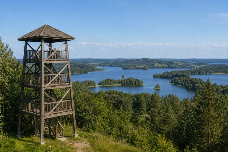
Lake Rubikiai has 16 islands with a combined area of more than 27 hectares. Named examples include Pertako, Bučinė, Didžioji, Aukštoji, Česnakinė, and Liepinė. The islands, bays, and channels are the principal reason the lake looks so expressive from higher ground on its southern side.
The lake forms part of Rubikiai Hydrographic Reserve, while Gečionys Botanical Reserve protects sections of the northern and north-eastern shore. Conservation therefore extends beyond an attractive view to the relationship between water, islands, channels, shores, and vegetation.
Rubikiai hillfort stands on Pertako Island, but its presence on a map does not imply free or developed access from land. Approaching, landing, and remaining on islands are subject to protected-area, land-use, navigation, and fire-safety rules. Lawfully accessible shores and Bijeikiai Tower provide a reliable way to appreciate both the heritage landscape and the lake without that uncertainty.
Where to experience the lake from shore and above
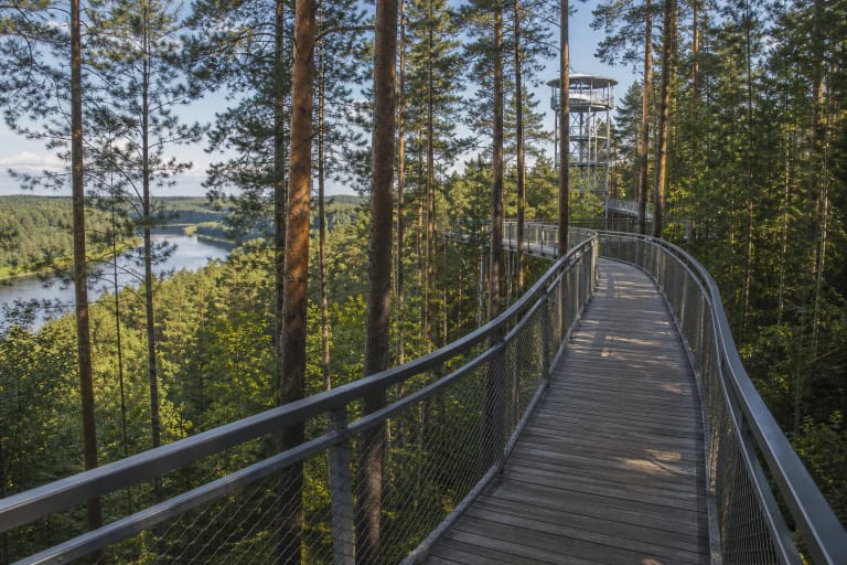
Bijeikiai Observation Tower stands on a hill at the southern edge of the lake district. Its platform is 15 metres high, while the hill itself rises to about 163 metres above sea level. The view takes in Rubikiai and Dusynas, their islands, Bijeikiai hillfort, the Storiai hills, and distant church towers.
Rubikiai village on the western side is the historic point of arrival. The narrow-gauge railway from Anykščiai terminates here. Passenger seasons and timetables change each year, so consult the railway's official schedule instead of relying on a weekend pattern published for a previous summer.
The Kriokšlys shore has a municipality-monitored bathing location within the regional park recreation zone. A laboratory result describes conditions when the sample was taken, not the whole summer. Check the municipality's latest notice before swimming, especially after heat or heavy rain.
Boating, fishing, and safe recreation
The islands can make the water look sheltered, but wind can raise waves quickly across the lake's open reaches, and a starting point hidden behind a peninsula becomes harder to find. Wear a suitable buoyancy aid, monitor the forecast, carry a means of communication, and allow enough strength for the return against the wind.
Launch boats only at a designated or lawfully used point. Rules for petrol and electric motors, navigation seasons, and protected waters can change through regulation, so consult current Environmental Protection Department and protected-area guidance before setting out.
Recreational fishing requires the appropriate permit unless a statutory exemption applies. Species, minimum sizes, closed seasons, and permitted tackle are also regulated. Use fires and tents only at designated sites, remove all waste, and avoid disturbing wildlife around islands and reed beds.
VLE records that a Rubikiai sailing regatta has been held around Midsummer since 1984. It remains part of the lake's living water culture, but dates, the launch area, and the programme vary and must be checked with organisers.