- Place
- Kelmė District Municipality
- Region
- Samogitia
- Type
- state-protected hillfort with a foot settlement
- Address
- Kubiliai village, Tytuvėnai Area Eldership, Kelmė District
- Coordinates
- 55.61421, 23.08550
- Visit duration
- 35-60 minutes for the climb and landscape
- Best time
- a dry late-spring or early-autumn day when vegetation reveals the earthworks
Papušynys Hillfort, Birutkalnis, Birutė's Hill
A hillfort at two rivers
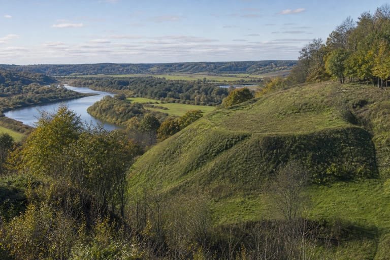
The fort occupies a promontory between the Dubysa's left bank and Gryžuva's right bank. Slopes up to about 24 m and river valleys provided natural defence. The summit measures roughly 78 by 43 m, with traces of a low rampart and terraces around its edges.
The protected complex covers about 5.44 ha and its visual buffer is larger still. Archaeological value extends beyond the summit to the foot settlement and confluence landscape.
A first to early second-millennium site
Kubiliai Hillfort dates from the first millennium and early second millennium. The state-protected complex has archaeological, historical, landscape, and mythological significance. Papušynys reflects the neighbouring locality, while Birutkalnis belongs to local cultural memory.
No reliable evidence identifies a named castle or ruler here, so the name should not support invented claims. The site demonstrates long occupation and defensive use of terrain rather than one documented battle.
Why the earthworks are softened
The hillfort was ploughed for years, a road cut into its slope, and parts were planted with spruce and pine. The north-eastern summit lies fallow. Ramparts and terraces are therefore less crisp than at reconstructed hillforts.
Do not create shortcuts, dig soil, or drive onto the summit. Even small ground disturbance destroys irreplaceable archaeological information.
Access, footwear, and safety
The map point identifies the protected site, not a guaranteed car park. Leave vehicles only where they do not block homes or farm machinery. Grass and natural paths become slippery after rain.
Wear shoes with grip, check for ticks, and supervise children near steep edges. Earthworks read best outside the tallest summer growth. Annual Midsummer events change normal access and parking conditions.