- Place
- Kelmė District Municipality
- Region
- Samogitia
- Type
- nationally significant hillfort and foot settlement in Kražantė Hydrographic Reserve
- Address
- Burbaičiai, Kukečiai Eldership, Kelmė District
- Coordinates
- 55.66411, 23.03752
- Visit duration
- 45-90 minutes; allow flexibility during construction and never pass barriers
- Best time
- a dry spring or autumn morning after checking municipal updates on the 2025-2027 works
Piliukas, Burbaičiai Hillfort and settlement
Piliukas above the Kražantė confluence
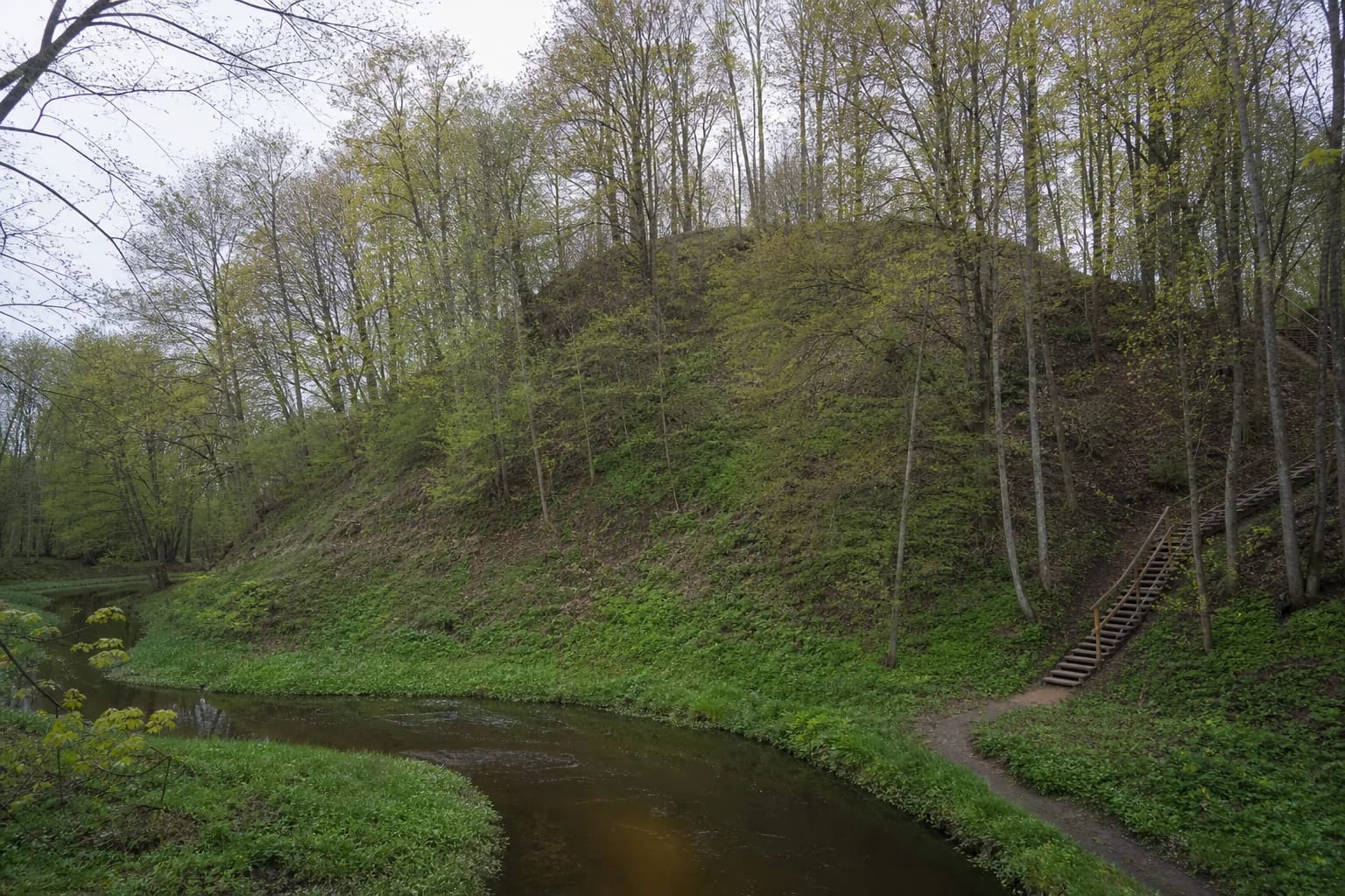
The hillfort stands on the right bank of the Kražantė at an unnamed stream. River and ravine form steep slopes about 24 m high, making the natural defensive advantage clear even in woodland. The site lies within Kražantė Hydrographic Reserve.
The upper platform is nearly circular and roughly 18 m in diameter, bounded by a powerful eastern and southern rampart with a ditch below. Another 18 by 20 m platform lies on the western slope about 14.5 m lower. Read these separate elements instead of seeing only one hill.
Archaeology and date
VLE dates the hillfort from the first millennium to the beginning of the second. Ludwik Krzywicki surveyed it in 1903 and the Institute of History conducted exploratory investigation in 1967. Hand-built pottery with smooth and roughened surfaces was found in the cultural layer.
An ancient settlement at the south-eastern foot shows that protection extends beyond the summit. The entire complex is nationally significant Register property 24507. Do not dig, use a metal detector, or drive on the slopes.
2025-2027 works alter access
Kelmė District began a project in 2025 with a planned completion on 30 April 2027. It is intended to restore access across the Kražantė, build a bridge, replace critically deteriorated steps, improve paths and information, and connect with the Dzindziukas footbridge.
During the work, a route shown in old photographs may no longer exist. Fences, dismantled steps, and a closed bridge must not be bypassed. Check the newest municipal notice and obey contractor and safety signs on site.
Legend is not archaeological fact
Local tradition tells of a giant at Piliukas and other stories explaining the hill's origin. Such narratives are valuable folklore but do not identify builders, a named castle, or a particular battle.
Documented interpretation rests on relief, cultural layer, pottery, and recorded investigations. Enjoy the legend as a layer of local imagination clearly separated from the archaeological date.
Protecting the slopes
Visit in daylight and use only the marked access. Clay and wooded slopes become very slippery after rain, and the Kražantė can rise. Wear grippy shoes and keep children close beside water and steep ground.
When the official route is open, 45-90 minutes allows time for the climb, platforms, and valley views. There is no ticket booth or fixed opening hour, but during reconstruction actual access depends on the work phase. Do not plan from old reviews alone.