- Place
- Jurbarkas District Municipality
- Region
- Samogitia
- Type
- state-protected hillfort with a foot settlement
- Address
- Bišpilio Street, Jurbarkas
- Coordinates
- 55.08591, 22.75617
- Visit duration
- 35-60 minutes for the hillfort and Imsrė Valley
- Best time
- spring or autumn, when urban greenery obscures the rampart and slopes less
Jurbarkas Hillfort, Bišpilis, Višpilis, Viešpilis
A hillfort on the left bank of the Imsrė
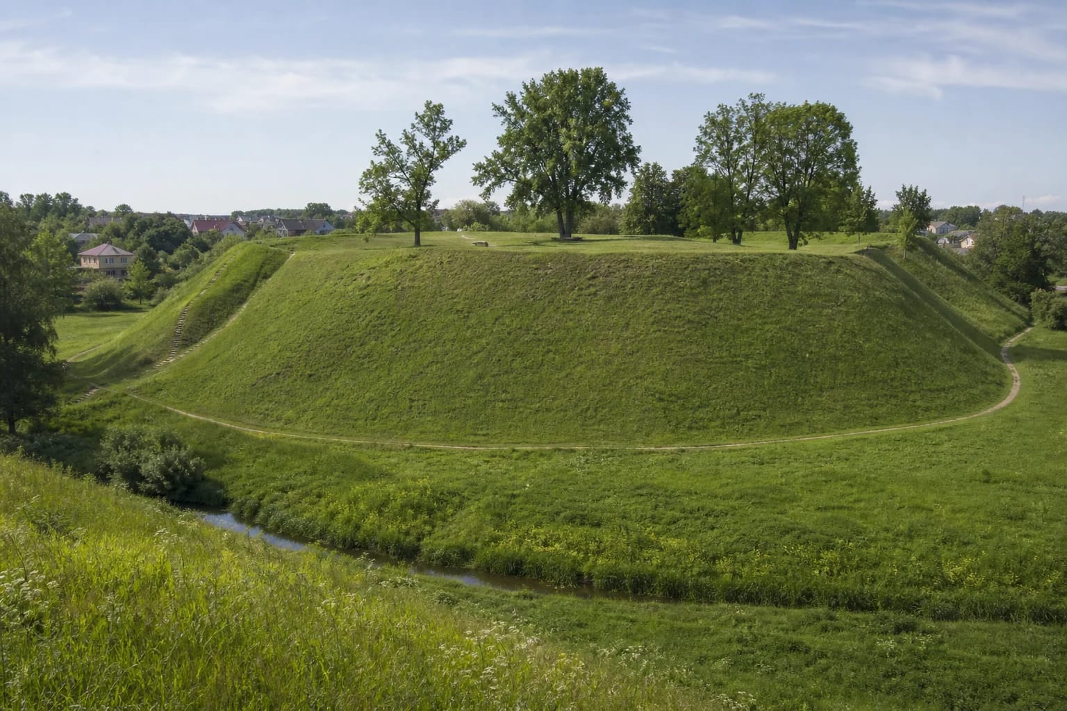
Bišpilis stands at the north-western edge of Jurbarkas on the Imsrė's left bank. The stream valley and ravines enclose the hill to the north, west, and south-west, while the east joins the upland. Slopes rise 17-20 m.
The irregular quadrangular summit measures about 58 by 28 m. A rampart roughly 5 m high separates it from the eastern upland. Walk around the foot as well: only from below is the Imsrė Valley's role as a natural defensive barrier fully legible.
The 11th-14th-century archaeological layer
The Institute of History surveyed the hillfort in 1960. Wheel-thrown pottery and arrowheads from bows and crossbows date it to the 11th-14th centuries. A settlement of the same period lay at the foot, but urban expansion, gardens, a school, and its stadium damaged part of it during the Soviet era.
The Vasilchikov family, once owners of Jurbarkas, also searched around the hillfort. The museum mentions burnt material, pottery, weapon and household fragments, and an unconfirmed report of a silver coin ingot, but the fate of most finds is unknown. These old excavation stories require caution.
Did Kolainiai Castle stand here?
Kolainiai Castle is commonly located at Bišpilis. Lithuanians led by Surminas defended it against the Teutonic Order in spring 1290; the castle was later abandoned and burned by the Order in February 1291. The identification is not beyond dispute, so it is most accurate to say the castle may have stood here.
Do not confuse Bišpilis with Bišpiliukai at Kalnėnai. The latter is associated with the Order's Georgenburg Castle, built in 1343 and finally destroyed in 1403. Similar place names conceal two distinct archaeological places and fortifications of opposing sides.
Visiting an urban hillfort
The site is reached through town streets, but the map point marks the archaeological property rather than guaranteed parking. Do not block driveways and use established paths. Grassy slopes become slippery after rain.
There is no admission charge, but this is a state-protected archaeological property. Do not dig, use a metal detector, or drive on the slopes. About an hour is enough to circle the foot, climb to the summit, and compare the Imsrė-protected sides with the rampart guarding the eastern approach.