Karūžiškė, Laukuva Eldership, Šilalė District Municipality
Varniai Regional Park
hillfort and kūlgrinda in the Samogitian Uplands
55.61667, 22.37458
1-2 hours
a clear day for panoramas; summer evening or early autumn for the Samogitian hills
Medvėgalis, Pilies kalnas, Medvėgalis Castle
Medvėgalis and Pilies kalnas
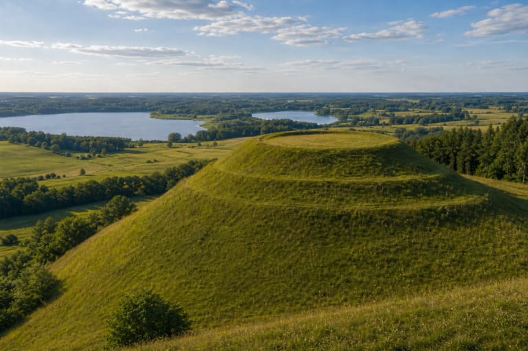
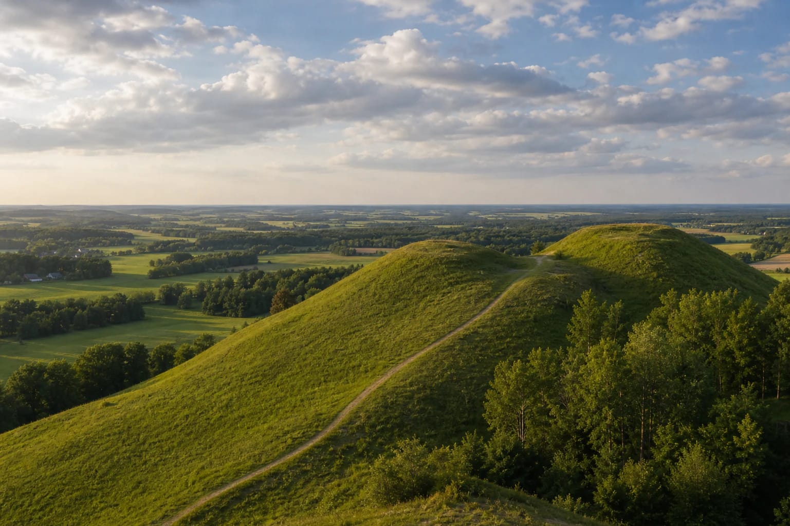
Medvėgalis is often introduced as the highest place in the Samogitian Uplands, but visitors should understand that the name covers a wider hill complex. VLE states that Medvėgalis has two summits: the higher one is the 234.64 m high point of the Samogitian Uplands, while the lower one, called Pilies kalnas, holds Medvėgalis Hillfort and the kūlgrinda.
That makes Medvėgalis both a geographical and historical object. One part draws visitors with panorama and Samogitian relief; the other holds the layers of Medvėgalis Castle, defensive systems, and the archaeological complex.
A centre of Samogitian defence
VLE states that Medvėgalis Castle stood on the hillfort, was mentioned in 1316, and belonged to the Samogitian defence system. Saugoma.lt calls it the central, most famous fortress defending Samogitia from Teutonic attacks.
Saugoma.lt also gives the 1329 episode: after fierce fighting, the combined army of the Teutonic Order and King John of Bohemia overcame the castle's defenders, devastated the region, and baptized the inhabitants, who soon returned to the old faith. This story explains why Medvėgalis is often understood as a symbolic place of Samogitian resilience. VLE adds that Medvėgalis Hillfort is thought to have been the centre of Medininkai land, one of the most important regions of Samogitia.
Hillfort fortifications
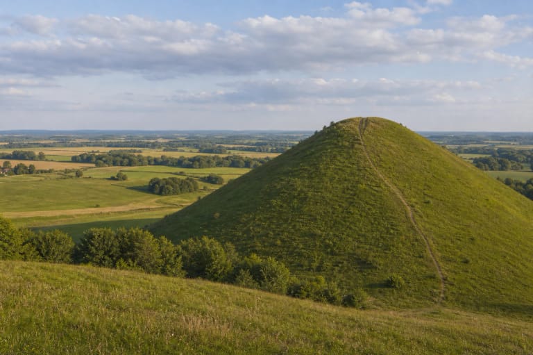
VLE gives a very concrete description of the hillfort. The slopes are steep and 25-26 m high, while the platform is trapezoidal and measures 30 x 90 m. It was fortified with three ditches, ramparts, and a defensive system whose fragments can still be read in the relief.
The rampart that encircled the platform now reaches 1-1.5 m in height. Below it are ditches and a second rampart, and below them a third ditch 40 m wide and 4 m deep. This is not simply a hill with a view: the logic of defence is written into the earth forms.
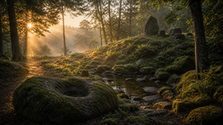
Kūlgrinda and surrounding hills
The Medvėgalis archaeological complex is wider than the main hillfort. Saugoma.lt mentions Medvėgalis, Pilies, Pilioriai, Alka, Ąžuolai, and Sumonai hills with a kūlgrinda. VLE singles out the outer bailey: Pilioriai Hill, also called Lapkalnis.
North of the outer bailey, a 50 m long dam-like rampart turned the lowland into a shallow pond, and the kūlgrinda led across it. This is one of Medvėgalis's most interesting practical layers: defence was not only walls and ramparts but also water, wet lowland, and a hidden road. Southwest of the hillfort is a hill called Alka, recalling old-belief ritual places.
VLE states that the foot settlement, about 3 ha, was investigated in 2006 under Zenonas Baubonis. Archaeologists found a cultural layer up to 1.5 m thick, rough and wheel-thrown pottery, iron and bronze pins, a stone quern, and animal bones. These finds date from the middle of the first millennium to the 14th century, so Medvėgalis was inhabited long before the castle's first written mention in 1316.
How to visit Medvėgalis Hillfort
Medvėgalis rewards a slow visit: climb the highest hill for the panorama, then give time to Pilies kalnas and the reading of the relief. On a clear day the Samogitian landscape opens widely, so it is worth stopping rather than only climbing and descending.
After rain the slopes can be slippery, and wind feels stronger on the open hills. Use marked paths, protect the rampart slopes, and do not reduce the hillfort to a picnic hill: this is an archaeological complex where much is visible only through relief details.