- Place
- Žemaičių Kalvarija, Plungė District Municipality
- Region
- Žemaitija National Park
- Type
- first-millennium-to-thirteenth-century hillfort with a foot settlement and two Stations of the Cross chapels
- Address
- St John's Hill, Žemaičių Kalvarija, Plungė District
- Coordinates
- 56.10620, 22.01130
- Visit duration
- 30-60 minutes for the hillfort; approximately 3 hours for the complete Stations of the Cross route with its hymns
- Best time
- a dry day from spring to autumn; avoid the largest July pilgrimage crowds if your priority is a quiet archaeological visit
Šv. Jono kalnas, Varduva Hillfort, Gardai Hillfort, Gardai
St John's Hill is both an archaeological monument and a living pilgrimage place
Žemaičių Kalvarija Hillfort stands on the eastern side of town, on the right bank of the Varduva near its meeting with the Pagardenis, also called the Cedron. It is known as St John's Hill, Varduva Hillfort, and Gardai Hillfort. The official Saugoma.lt directions point, 56.1062, 22.0113, marks the hill itself rather than a verified car park or one prescribed trailhead.
The site is unusual because its old defensive landform is not simply an abandoned archaeological surface. Two chapels of the Žemaičių Kalvarija Passion route occupy the summit, bringing together the memory of a Curonian castle, seventeenth-century reshaping of the sacred landscape, and a devotional circuit that is still walked. Visitors should read both layers without reducing either one to scenery for the other.
You do not have to complete the entire devotional circuit to inspect the hillfort, but the chapels are not ordinary park shelters. During services, processions, and the Great Žemaičių Kalvarija Festival, the hill becomes an active place of worship. Do not interrupt prayers, avoid close photographs of people without consent, and wait quietly when a group is using the station.
A 35 x 40 metre summit preserves the terrain of Gardai castle, recorded in 1253
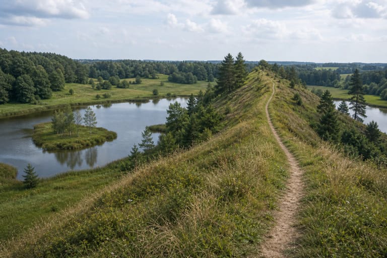
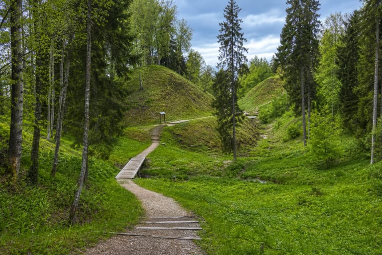
The hillfort occupies a projecting spur. VLE describes a quadrangular summit measuring 35 x 40 m and steep slopes up to 12 m high. A rampart at the southern edge is 35 m long, approximately 2 m high, and 28 m wide. Read these features by circling the summit and looking beyond the chapels to the edge of the platform, the southern rise, and the sharp descent towards the Varduva valley.
The hillfort dates from the first millennium to the thirteenth century and is identified with the Curonian castle of Gardai mentioned in written sources in 1253. That is a documented medieval place name and castle-site identification, not merely a later legend. Do not, however, expect surviving masonry: Curonian fortifications used timber and earth, and the landform and archaeological deposits are what remain visible today.
Construction of the Calvary in the seventeenth century disturbed the hillfort, so its present shape is not an untouched model of thirteenth-century defences. The southern rampart and steep slopes remain significant, but chapel construction, foot traffic, long use, and natural erosion changed parts of the surface. This is why sacred buildings stand directly on the archaeological summit rather than beside it.
The foot settlement and archaeological surveys reveal more than the eye can see
A settlement covering approximately 0.5 hectares lies north-east of the hillfort. Archaeologist Ludwik Krzywicki surveyed the site in 1903, researchers from the Lithuanian Institute of History followed in 1964, and an expedition led by Bronius Dakanis worked here in 2004. Published summaries mention pottery fragments but do not provide a complete excavated plan of castle buildings, so the positions of gates, houses, or towers should not be invented.
VLE also describes a cemetery about 250 m to the north, but this is a separate archaeological site, not a burial ground on the hillfort summit. A small excavation in 2002 found cremated remains, jewellery, and household objects dated to the ninth-thirteenth centuries and attributed to the Curonians. The cemetery broadens the account of Gardai's surroundings, but it should not be conflated with the Christian chapels above the hillfort.
The finds and the record from 1253 support an account of a Curonian centre, yet authoritative sources do not reconstruct every phase of its life or a dramatic final battle. Stories of tunnels, hidden treasure, or specific sieges should not be added without evidence. The documented landscape is already substantial: castle, settlement, separate cemetery, and a later sacred layer.
From the first St John chapel in 1619 to today's third and fourth Passion stations
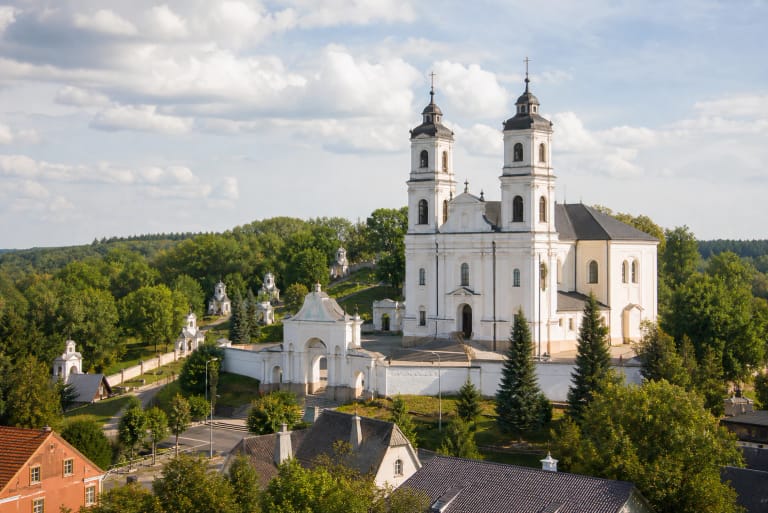
The shrine's official history states that Grand Duke Vytautas granted the Gardai lands to the Bishop of Samogitia in 1417, a chapel was built on St John's Hill in 1619, and the parish was established in 1622. Bishop Jurgis Tiškevičius invited the Dominicans to Gardai in 1637, and they created a Passion route across the hilly town. The former castle hill consequently became one of the early points in Lithuania's New Jerusalem landscape.
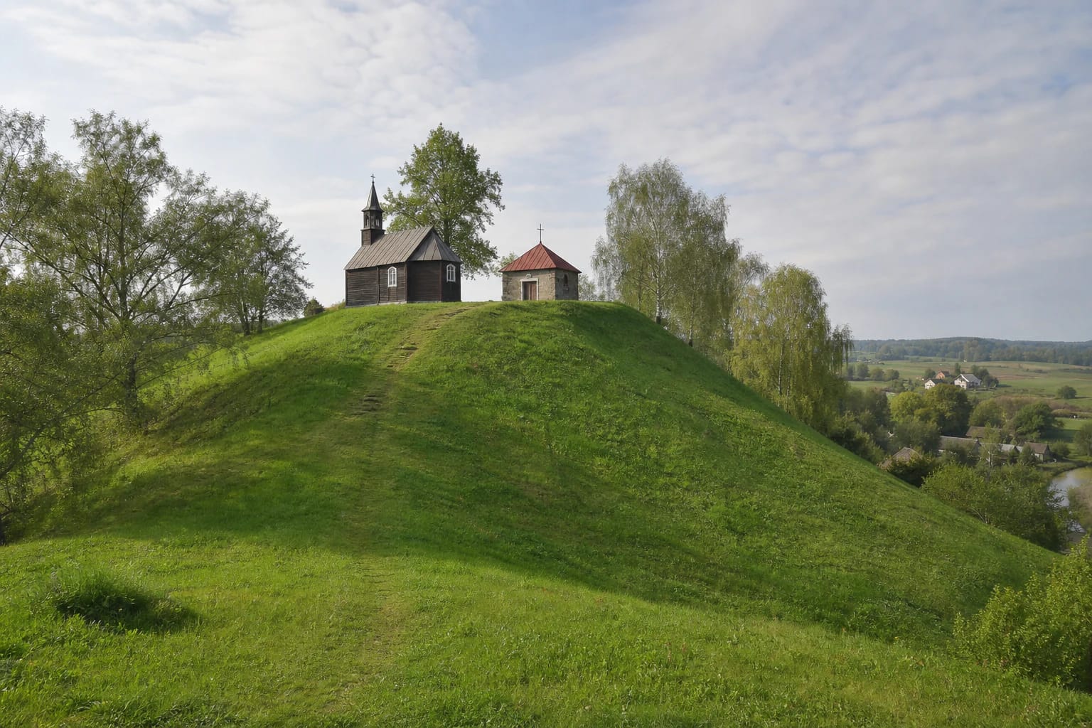
On the current official route, the hill holds the timber third-station chapel, Jesus Prays in the Garden of Olives, and the masonry fourth-station chapel, Jesus Is Arrested. The timber chapel has a rectangular plan, three-sided apse, and small tower; the low masonry building beside it creates a contrasting pair of material and form. They are two of nineteen chapels containing twenty stations along the seven-kilometre Passion route.
St John's Hill symbolically represents the Mount of Olives in Jerusalem, while the Pagardenis stream is called the Cedron. A tradition says that the Varduva took its name when baptised Samogitians received new names here and that the hill was therefore associated with John the Baptist. The official shrine history explicitly presents this as a legend, not proven etymology or evidence for one specific baptism event.
Begin with the slope, then read the symbolism of the chapels
First step back far enough to see the complete green slope and both summit chapels. Notice the gradient, which reaches 12 m, as you climb; at the top, follow the edge of the 35 x 40 m platform and identify the southern rampart. Only then compare the timber and masonry chapels. This order prevents the sacred architecture from entirely concealing the older defensive landform.
Allow 30-60 minutes for the hill itself. The complete Žemaičių Kalvarija Passion route is approximately 7 km long; the shrine says that walking it with all the hymns and two sermons takes about 3 hours. That is a separate undertaking requiring more time, suitable footwear, and an understanding that the circuit is a religious practice rather than simply a fitness trail.
The hillfort combines naturally with the basilica, the Gardai Esker trail, or the nearby Gegrėnai Hillforts. Do not compress every place into one short hour: services at the basilica, the complete devotional route, and the nature trail each have their own pace. Pair the hill with Gegrėnai for an archaeology-focused day, or with the basilica and more stations for the pilgrimage context.
There is no hillfort ticket, but the slope is steep and chapel doors are not guaranteed
On 20 July 2026, official object pages published neither separate opening hours nor an admission charge for the hillfort. Its outdoor terrain and chapel exteriors can be seen from public space, but that does not mean both chapel interiors are always open. Verify services, festival arrangements, maintenance, and interior access on the official shrine or park website before travelling.
No detailed step-free access audit was found in the authoritative information checked. The slope is steep, the approach is predominantly outdoors, and grass and worn paths can become slippery after rain. Visitors with limited mobility should ask about the nearest level viewpoint before travelling rather than assume that the summit route is accessible.
Leave vehicles only where parking is legal in the town; never drive onto the archaeological surface or up to the chapels. Follow an existing path, do not cut fresh lines across the slope, dig, or stand on fragile rampart edges. Expect much heavier pedestrian and vehicle traffic during the July festival, and check its dates in the official calendar each year.