- Place
- Užuperkasis, Valkininkai eldership, Varėna District Municipality
- Region
- Dzūkija
- Type
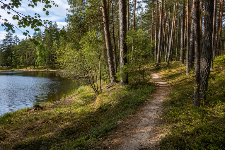
- an approximately 1-1.5 km woodland nature trail beside a bend of the Merkys, a sandy bluff, and a viewing platform
- Address
- Užuperkasis, LT-65438, Varėna District Municipality
- Coordinates
- 54.35193, 24.84084
- Visit duration
- 45-90 minutes for an approximately 1-1.5 km route, allowing extra time for navigation and a pause beside the Merkys
- Best time
- a dry day from spring to autumn; make a first visit in daylight and keep away from the loose bluff edge after heavy rain or a thaw
“A Word to a Friend of the Forest” Nature Trail, Žodis girios draugui Nature Trail, Valkininkai Forest Trail
The trail is at Užuperkasis, and a range describes its length more honestly than one number
The exact Google Maps listing places the trail at Užuperkasis in Valkininkai eldership, at 54.3519295, 24.8408387. Varėna District Municipality's 2022 infrastructure study records the same site as ME.6 on the left bank at kilometre 92.60 of the Merkys water route, with LKS coordinates X 6024012 and Y 554249. It is not in the centre of Valkininkai town, even though English and Lithuanian searches commonly call it the Valkininkai nature trail.
The ME.6 table gives no walking distance. Older descriptions say about 1 km, while a current field directory describes a 1.5 km loop. Those figures may count different approach or connecting sections, so they should not be presented as measurements of an identical line. For practical planning, allow roughly 1-1.5 km and 45-90 minutes.
The map pin on this page identifies the trail site, not an officially confirmed sole entrance or car park. If navigation tries to take a vehicle deeper along a forest road, judge the signs and surface on the ground, do not leave a car in a narrow through-route, and keep private entrances clear.
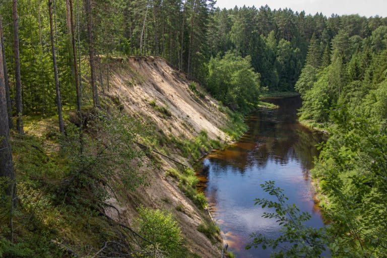
White Hill is a sandy bluff washed by the Merkys, not a high rock cliff
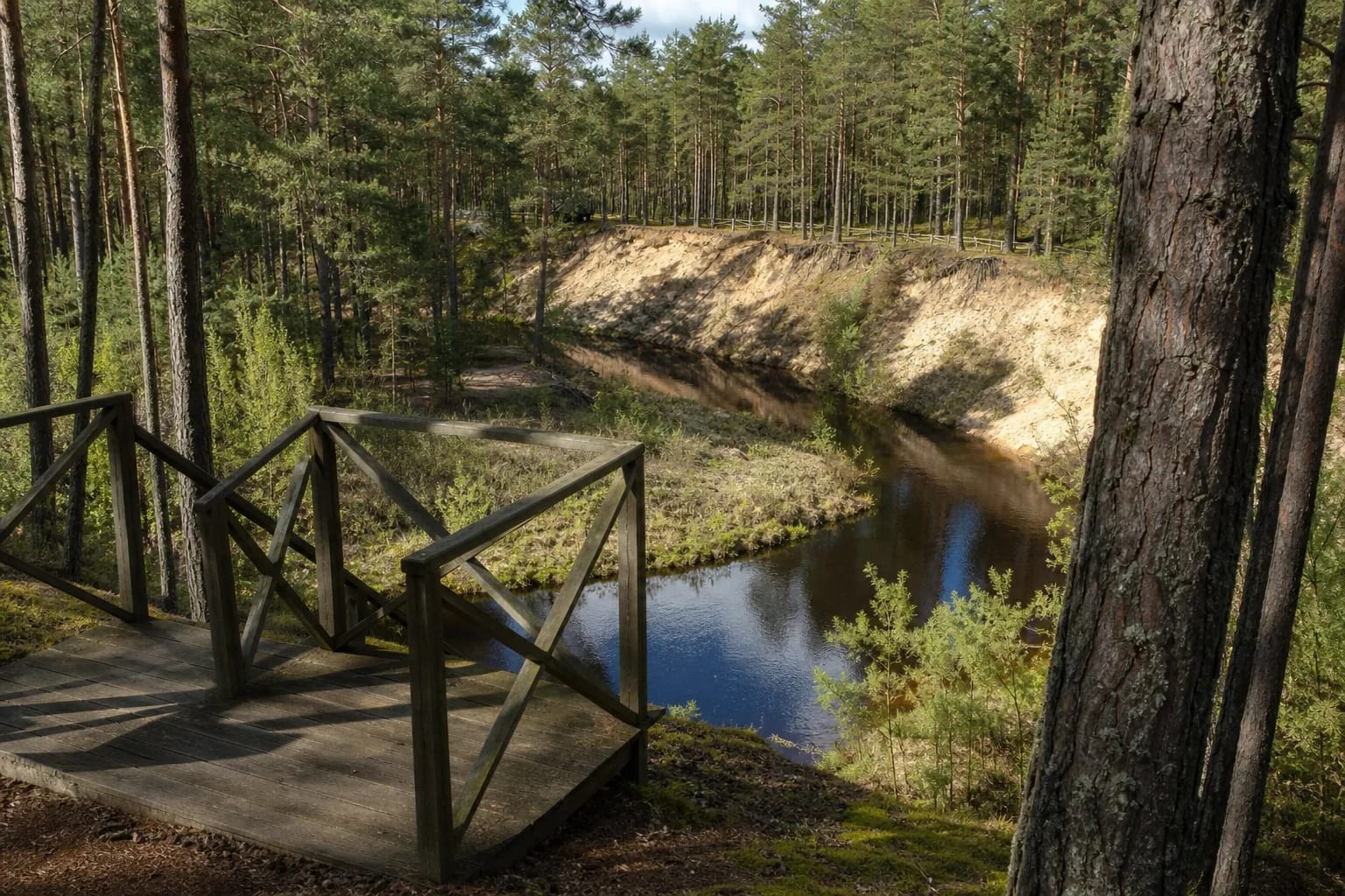
A 2025 municipal notice explicitly places “Žodis girios draugui” at Užuperkasis beside the striking Merkys bluff that local people have long called Baltas kalnas, or White Hill. The name describes the exposed pale sand, not a separate summit or a wall of rock. From the pinewood viewpoint, visitors look across a narrow river bend towards its eroding outer bank.
The municipality's 2022 study recorded a viewing platform at ME.6. Older photographs show a simple dark timber deck and stairs among pines, but their condition can change much faster than the landscape. Before stepping onto them, examine the decking, rails, and stair boards; do not use a structure that looks loose, broken, or undermined.
Do not descend over the open sand or stand on an unprotected upper lip. Loose ground can slip after rain, thawing, or repeated trampling, while improvised descents accelerate erosion and create new paths where none should exist. Keep children close beside the bluff even when the formal viewpoint appears sound.
The 2022 record documents infrastructure then, not a guarantee of its condition now
The ME.6 row names the site as the existing campsite and “Žodis girios draugui” nature trail. In 2022 it listed a viewing platform, outdoor furniture, benches, an information board, shelters, outdoor exercise equipment, and a fully formed visitor route. This is a valuable dated snapshot, but it is not a technical inspection from 2026.
In the same row, a water-route sign, a new information board and direction sign, two sets of outdoor furniture, two benches, a section of terraced path, vehicle barriers, a changing cabin, and a portable toilet appear under planned works. The study also proposed treating 100 sq m of existing erosion. No later official confirmation that every item was completed was found, so none should be promised to a visitor.
In February 2025, participants in an 11 km walk described by Valkininkai Library reached a rest area on this trail, showing that at least one gathering place was in use. Visitor reports from June 2025 and June 2026, however, mention missing route marks, removed boards, and neglected elements. They are not an official engineering survey of the whole site, but they are reason enough to check fresh conditions and not rely on old photographs.
The Merkys Ichthyological Reserve protects far more than a view
Saugoma.lt records that the Merkys Ichthyological Reserve was established in 1974 and covers 2,276 ha. Its objectives include protecting spawning grounds for brown trout and grayling, together with asp, European bitterling, European bullhead, spined loach, brook lamprey, otter, and several other protected animal species.
Protected habitats include flowing river sections with water-crowfoot communities, calcareous sand grasslands, alluvial and hay meadows, and alkaline fens. White Hill is therefore not merely a photographic backdrop. It forms part of a sensitive river and riverside system whose value continues below the viewpoint and beyond the visible bend.
Do not let dogs chase wildlife at the water's edge, disturb the sandy slope, strip bark, or create new fire sites. If an old rest or fire area appears abandoned, do not assume that it remains safe or authorised for use. Carry all litter out and leave as little trace as possible beside the river.
An offline map and daylight matter more than old accessibility or opening-hour labels
Field accounts warn that waymarking may be incomplete. Save the exact Google card and an offline map before leaving mobile coverage, and photograph junctions that you will need on the return. If the tread disappears, go back to the last clear point instead of cutting across the bluff edge or forcing a route through undergrowth.
Older descriptions claimed that the route was suitable for pushchairs or people with limited mobility, but no current authoritative confirmation for the full trail was found. Natural sand, roots, stairs by the viewpoint, and changeable small infrastructure can all create barriers. If step-free access is essential, contact the State Forest Enterprise's Varėna Regional Unit before travelling and ask about conditions on the specific day.
The official sources checked give no separate trail ticket, gate, or controlled opening timetable. Google labels the place as open 24 hours, but that is not a manager-confirmed safety regime or a promise of lighting and maintenance. Visit in daylight. On 15 July 2026, the exact card, place ID ChIJCxpH_tDj3UYRZy31UkjVqD0, averaged 4.6 out of 5 from 107 reviews; both figures can change.