- Place
- Rusnė Eldership, Šilutė District Municipality
- Region
- Pamarys
- Type
- Nemunas Delta island with a town, fishing villages, and polder landscape
- Address
- Rusnė town, Rusnė Island, Šilutė District
- Coordinates
- 55.29722, 21.37778
- Visit duration
- 3-6 hours for the main island stops; a full day for a slow cycling route or longer visits
- Best time
- May-September for travelling around the island and birdwatching; spring for flood landscapes only after checking conditions
Lithuania's largest island, Rusnė
A 43.5 sq km island between the Atmata, Skirvytė, and lagoon
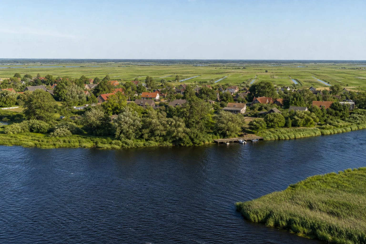
Rusnė Island is part of the Nemunas Delta between the Atmata, the Skirvytė with the Tiesioji, and the Curonian Lagoon. Its area is 43.5 sq km, making it Lithuania's largest island. The Skirvytė along the southern edge carries the border between Lithuania and Russia's Kaliningrad region.
The map marker is a representative visitor point in Rusnė town, not the island's geometric centre or only entrance. This is a large travel area: getting from the bridge at the eastern edge to Uostadvaris and the Atmata mouth in the west requires local roads, while river branches often prevent direct movement.
The surface is almost completely flat, averaging roughly 0.5-1.5 m in elevation. Official sources disagree about the island's lowest point: the current protected-area presentation gives 0.27 m below sea level, while VLE gives 1.3 m. Treat the roadside marker as a landscape interpretation stop rather than a geodetic benchmark.
Water, floods, and the polder landscape
The Pakalnė, Vorusnė, Rusnaitė, and other channels thread across Rusnė, alongside oxbows and small water bodies locally called žiogiai. Delta sediments formed the island, while spring water deposits silt on flood meadows. Even in a dry summer, it is clear that the river created and continues to shape this landscape.
A system of embankments, polders, canals, and pumping stations sustains life at and just above or below sea level. A polder is not naturally dry ground: its water level is managed, making straight drainage channels, pump houses, and embankments as characteristic of the island as natural river channels.
The spring flood is impressive but should not be romanticised as a guaranteed attraction. The viaduct improved access on the main road, yet lower local roads, trails, and approaches may still be inundated. Check the latest Šilutė District and protected-area information before travelling, and never attempt to pass a closed section.
From a medieval route to fishing and timber trade
Rusnė's documented history reaches the late fourteenth century: an itinerary through Rusnė appeared in Teutonic military route descriptions of 1386-1388, and a church and parish were established here in 1419. This is a settlement recorded by sources at an important water and land crossing, not a legendary foundation.
Rusnė's position between Königsberg, Tilsit, and Klaipėda encouraged the fish trade, while from the second half of the eighteenth century the settlement expanded with timber rafting towards Klaipėda. In 1792 Rusnė gained the right to hold a weekly market and operate a ferry over the Atmata. Nineteenth-century sawmills, bookshops, libraries, and fish businesses make the island's story broader than traditional fishing alone.
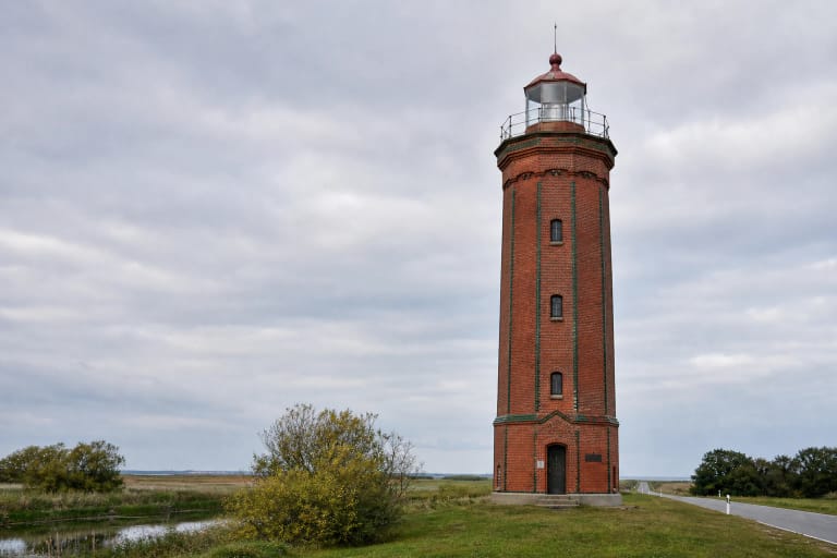
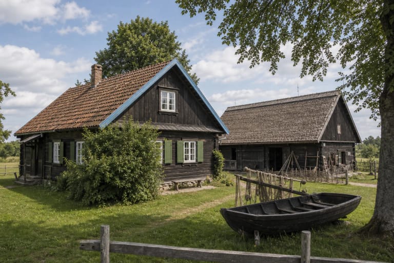
Today the old layer is clearest in Rusnė town's street plan and timber houses, the Evangelical Lutheran church, Skirvytėlė fishing village, K. Banys Homestead, and Uostadvaris Lighthouse and pumping station. Each attraction has its own visiting arrangements, so plan the island route before setting out.
A route through Rusnė, Uostadvaris, and Pakalnė
On a first visit, begin in Rusnė town: walk through the centre, riverfronts, and church surroundings, then continue towards Uostadvaris. In the island's western part, the lighthouse, historic pumping station, Atmata navigation, and broad delta panorama come together in one locality.
On the return, follow the Pakalnė direction and stop only in official car parks or clear public approaches. Narrow local roads are everyday access for residents, not viewing platforms, so never leave a vehicle on the carriageway or in a meadow.
Cycling makes particular sense because it reveals the distances between channels, polders, and old villages. However, wind over open meadows, gravel surfaces, insects, and limited shade can slow the journey considerably. Carry water, a repair kit, and an alternative route in case a section is wet or closed.
Bird migration and sensitive flood meadows
Rusnė Island lies in Nemunas Delta Regional Park and on the Western Palearctic-Europe-Africa bird migration route. Open meadows, shallow water, reedbeds, and channel banks matter to nesting and migrating birds, so binoculars provide more value here than trying to drive as close as possible.
Watch from public roads, riverfronts, and marked places, keep noise low, and do not walk into meadows after a flock. A mown or apparently empty meadow may still be a protected habitat, and in spring birds may be nesting there.
Morning and evening generally bring more bird activity and softer light, but wind and temperature change quickly beside water. Even in summer, carry a windproof layer together with sun and insect protection.
Opening times, tickets, and safe travel
Rusnė Island has no shared opening hours or admission ticket. It is a lived-in area of public roads and protected landscape. Museums, exhibitions, guided tours, boat trips, and other services may charge separately, and their current prices and schedules should be checked on official pages before travel.
Allow at least half a day for the island, or a full day for a slow cycle, a museum, and longer birdwatching. The public Google Maps card showed a 4.8 out of 5 average on 14 July 2026; ratings change and do not reflect seasonal road conditions.
The southern part of the island is an external state-border area, so follow all signs, barriers, and official instructions. Do not enter border waters or marked restricted zones for a photograph, and verify current rules before any water route.