- Place
- Rietavas, Rietavas Municipality
- Region
- Samogitia
- Type
- a public urban riverside space for rest, bathing and active recreation
- Address
- Vingo Street, Rietavas
- Coordinates
- 55.72463, 21.93835
- Visit duration
- 45-90 minutes for the path, beach and recreation features; 2-3 hours with the Rietavas Oginskiai museum, manor site and church
- Best time
- a warm, dry day from late spring to early autumn; swim only after checking the municipality's latest water results and signs on site
Rietavo rekreacijos erdvė prie Jūros upės, Rietavas recreation area by the Jūra, Rietavas multifunctional recreation area
A Vingo Street riverfront, not Rietavas Manor Park
Rietavas Recreation Area lies beside the Jūra on the Vingo Street side of town. Coordinates 55.724626, 21.938351 give a representative point on the developed riverfront. Because the beach, path, sports areas and seating occupy a broader site, the pin is not an exact vehicle entrance, car-park bay or sole gateway.
The official project title says that the area was created beside the former estate of the Rietavas Dukes Oginskiai. Beside is the important word: this is a modern public waterfront, not historic Rietavas Manor Park, the museum or the surviving estate buildings. The places fit one short walk but retain separate map markers and identities.
The public visitor record gives Vingo Street, while the EU project application describes the zone as lying by the Jūra near Vytauto Street. Those labels may refer to approaches at different edges of the same spread-out site. Use the riverfront coordinate for orientation, then follow current road and site signs on arrival.
A sandy beach, cycle track and several distinct recreation zones
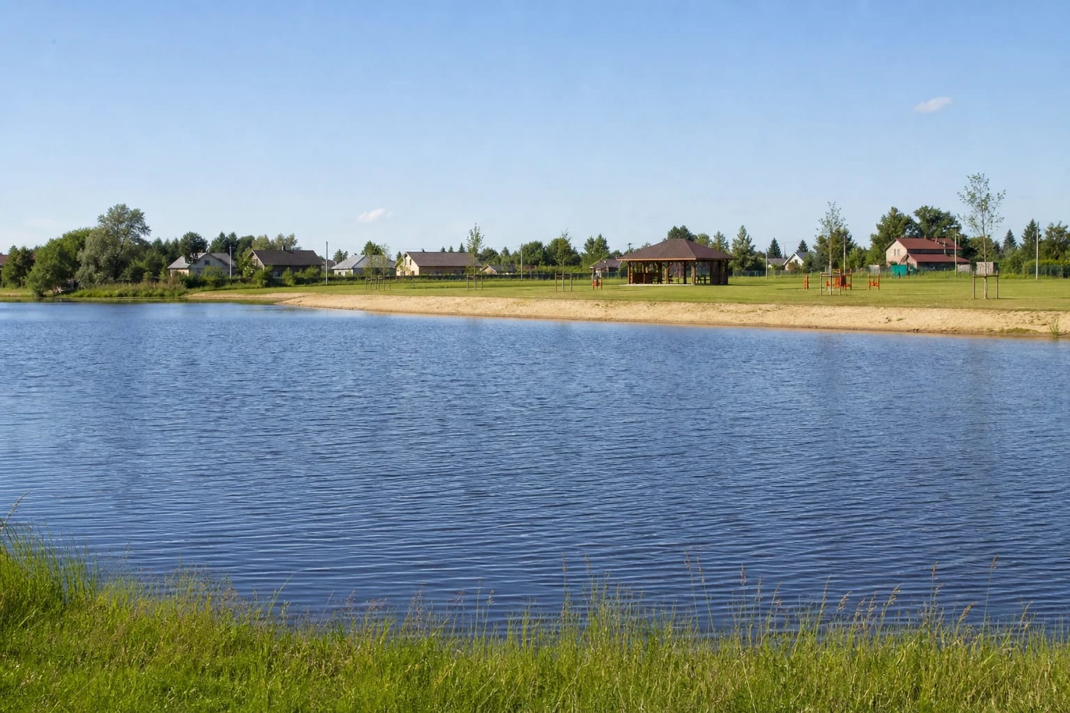
Rietavas Municipality's completion record lists a footpath, lighting, sandy beach, beach-volleyball and children's playgrounds, a pavilion, tables and benches, a fire pit, changing cabins, small landscape features, a water standpipe, information board, CCTV cameras and a cycle track. Landscaping formed part of the same project.
The EU investment-register description additionally provided for a car park and a path across an oxbow. That register confirms the infrastructure envisaged during delivery, but it is not a 2026 technical inspection of every item. Check the water standpipe, play equipment, lighting and cycle-track surface as you find them rather than assuming everything is operational.
The official Lithuanian description uses the broad term velotrasa, or cycle track, without publishing dimensions, difficulty grades or riding rules. It should not automatically be advertised as a professional pump track. The appeal is the range of choices on one open bank: sand, play, movement or a quieter seat beside the water.
A 2015-2021 project and two figures from different budget stages
Rietavas Municipality dates the project from December 2015 to July 2021. Its later updated page gives a completed-project value of €332,927.99, made up of €280,627.22 in European Union funding, €24,761.23 from the national budget and €27,539.54 from the municipality. The European Regional Development Fund supported the scheme.
The official EU register preserves the earlier application and contract chronology. The application was received on 30 October 2018, the contract was signed on 18 January 2019 and its validity ended on 21 July 2021. Project 07.1.1-CPVA-R-905-81-0009 is marked as completed.
The register's application value of €411,863.19 exceeds the €332,927.99 later published by the municipality. These are not two different Rietavas waterfronts; the sources preserve financial figures from different project stages. The municipality's later total is the more appropriate figure for describing the completed space, while the register remains valuable for its contractual timeline.
Swimming in the Jūra and what one water test really establishes
A broad, calm-looking reach can resemble a pond in photographs, but the official project and bathing notices call this watercourse the Jūra River. On 28 July 2025, the Klaipėda division of Lithuania's National Public Health Surveillance Laboratory tested bathing places on the Jūra and at Tverai and Daugėdai. The municipality reported that intestinal enterococci and E. coli values complied with hygiene norm HN 92:2018 and that no floating waste was observed.
A parasitological test of sand at the Jūra beach on the same date also met HN 92:2018. This is a useful, precisely dated result from 2025, not a guarantee for another day or the 2026 season. Check the latest Rietavas Municipality notice and signs before entering the water, particularly when time has passed since the most recent published sample.
The official pages reviewed did not publish a permanent lifeguard service, the bathing-place depth or a buoyed boundary guaranteed for every season. A sandy beach should therefore not automatically be treated as supervised. Keep children close, never dive into water of unknown depth and obey conditions and prohibitions posted that day.
Hours, admission, parking and step-free access
This is a public outdoor space. As of 20 July 2026, authoritative sources did not publish a separate admission ticket or permanent gate hours. Lighting still does not guarantee unrestricted use around the clock: maintenance, an event, a storm, flooding or damaged equipment can temporarily change access. Current signs take precedence over a general online description.
The EU project description includes a car park, but no dependable separate current pin, capacity or parking regime was found. The coordinates on this page mark the recreation area rather than a place to stop the car. Park only where signs allow, keep access routes clear and do not drive onto lawns or the footpath.
A purpose-built footpath offers a smoother route along part of the waterfront, but no detailed current accessibility audit was located. Surface condition, gradients, kerbs, the connection from parking and seasonal wear can vary, while sand, grass and the cycle track do not form one continuous step-free route. Wheelchair users and families with pushchairs should assess the live conditions on arrival.
A fire pit does not make a campsite, and Rietavas rewards a longer circuit
A fire pit appears in the municipality's list of completed features, but its presence is not permanent permission to light a fire in every condition. First check local rules, temporary fire restrictions and whether the feature is open for use. The official project sources do not call the area a campsite or advertise overnight, campervan or tent facilities.
For a short stop, follow the path, look across the beach and choose one recreation zone. At busier times, cyclists, ball players, children and people resting beside the water share the site, so leave others a safe margin around the cycle track, volleyball area and shore. The pavilion and benches suit a picnic, but handle every item of rubbish according to the rules on site.
The riverfront works best as part of a day in Rietavas rather than as the sole reason for a long journey. The nearby Oginskiai Cultural History Museum opens the story of the manor, music and Lithuania's first power station; St Michael's Church adds the town's architectural history; and the manor park should be visited as its own historic landscape.