- Place
- Vilkaviškis District Municipality
- Region
- Suvalkija
- Type
- a large regulated lake in the Šešupė basin with an officially monitored public bathing site
- Address
- Lake Paežeriai on the western edge of Vilkaviškis, Šeimena Eldership, Vilkaviškis District Municipality
- Coordinates
- 54.64611, 22.98722
- Visit duration
- 1-3 hours for the beach and shore; half a day if combining swimming, sailing, or Paežeriai Manor Park
- Best time
- late May to September for the beach, after checking the latest water result; daylight in any season for lakeshore views
Paežerių ežeras, Paežeriai Lake near Vilkaviškis
Its 398.4-hectare surface is a result of impoundment in 1983
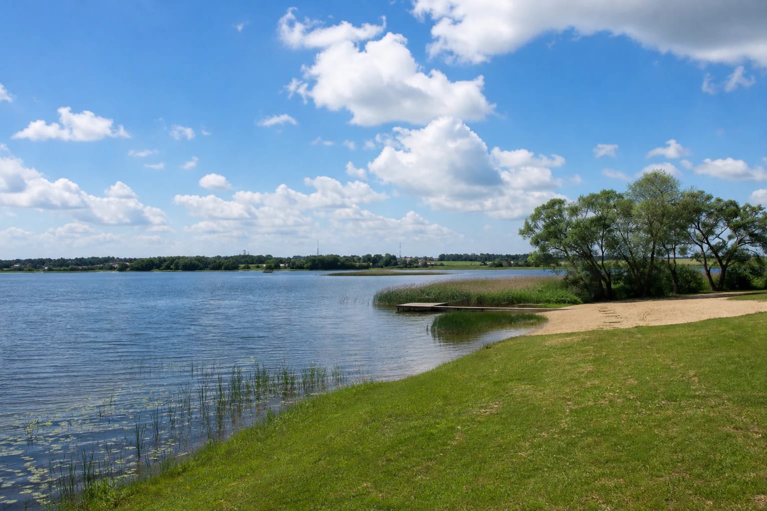
Lake Paežeriai lies on the western edge of Vilkaviškis, north of the Marijampolė-Kybartai road. VLE gives an area of 398.4 hectares, an east-west length of 3.4 km, and a maximum width of 1.4 km. Its surface is about 53 metres above sea level, maximum depth reaches 15 metres, mean depth is 5.1 metres, and the catchment covers 10 square kilometres.
The present size is not simply the measure of an untouched natural basin. The lake was impounded in 1983. A Vilkaviškis District tourism-planning document explains that its surface was enlarged in an effort to slow the water body's decline. An older account of a smaller lake and today's 398.4-hectare figure can therefore both be correct, but refer to different periods.
Google's exact listing, named Paežerių ež., marks the centre of the water at 54.6461066, 22.9872178. On 15 July 2026, it averaged 4.5 out of 5 from 181 reviews. The pin identifies the lake but is not a beach entrance, car park, or safe boat-launch point.
The Kastinė links the lake to the Šeimena and the wider Šešupė system
The Kastinė flows through the lake before joining the Šeimena as a left tributary. The Mergupis, the Kisinė, and three further unnamed streams also enter the water body. Lake Paežeriai belongs to the Šešupė basin and has a throughflow of about 10 per cent, making it part of a regulated drainage system rather than a closed bowl.
Four dams regulate its water regime. That matters to visitors as well as hydrologists: calm-looking water beside hydraulic structures is not necessarily safe. Municipal beach rules prohibit swimming in undesignated or dangerous places, including near dams and equipment installed in the water.
The shoreline runs for 12.8 km and has broad bends, with peninsulas projecting into the south-western and north-western parts. Some margins are marshy, and clayey silt covers the bottom. A soft or reedy shore is not an invitation to enter; use the public beach or another lawful access and never cut through private land.
The lake centre and the official bathing site are separate navigation points
The Institute of Hygiene's bathing-water profile places the official monitoring point for Paežeriai beach at 54.6470, 23.0075 on the eastern shore beside Vilkaviškis. It is more than a kilometre east of Google's central lake pin. If you are travelling to swim, navigate to the beach access rather than trying to reach a coordinate in open water.
The 2024 profile identifies the beach as public. It records roughly 600 metres of imported sand, an average bathing depth of 1.5-2 metres, volleyball and children's play areas, two toilets, recycling and refuse containers, and a yacht harbour 300-400 metres away. It lists no showers. This is a dated inventory, so check current conditions and signs before setting out.
The district planning document also records a yacht harbour and the Škvalas sailing club beside the town beach. Sailing is central to the lake's recreational identity, but a bathing area is not automatically a boat launch. Remain outside buoyed swimming water when operating craft, and check current arrangements with the harbour or activity operator.
Excellent bathing-water quality and poor ecological potential describe different tests
The Institute of Hygiene's 2024 profile classified bathing-water quality as excellent for that year. It was good in 2020 and 2023 and excellent in 2021-2022. These classifications chiefly summarise microbiological indicators relevant to bathing at a particular monitoring point and over a defined period.
The same document rated the ecological potential of the wider water body as poor because total phosphorus failed the threshold for good ecological condition. That is a broader ecosystem assessment, so it can differ from the beach's microbiological class. An algal bloom, unusual colour, foam, or dead fish is always a reason to stay out and notify the responsible authority.
The profile records short-term E. coli pollution on 31 August 2021 and several short-term episodes in 2023. It says contamination after heavy rain may clear within one or two days, but that is not automatic permission to return. Wait for the follow-up official result and for any warning or recommendation to be formally withdrawn.
The 2026 timetable contains nine checks, but each result applies to its own date
The official 2026 bathing-water schedule sets sampling for Lake Paežeriai on 21 May; 4 and 18 June; 2, 16, and 30 July; 13 and 27 August; and 10 September. A timetable tells you when testing is planned, not whether a particular sample passed.
Before swimming, consult the newest notice from Vilkaviškis District Municipality or the Institute of Hygiene and read the beach information board. After intense rain, an update several weeks old deserves particular caution. The same care matters most for children, pregnant people, older visitors, and anyone with increased health vulnerability.
The lake has no single ticket office or universal opening schedule, and the official documents checked list no separate admission charge for the shore. Municipal rules still require visitors to observe any locally posted beach hours, buoys, and temporary restrictions. Daylight, safety notices, and current water information matter more than a generic map label.
Choose one lawful shore zone instead of assuming the entire lake can be circled
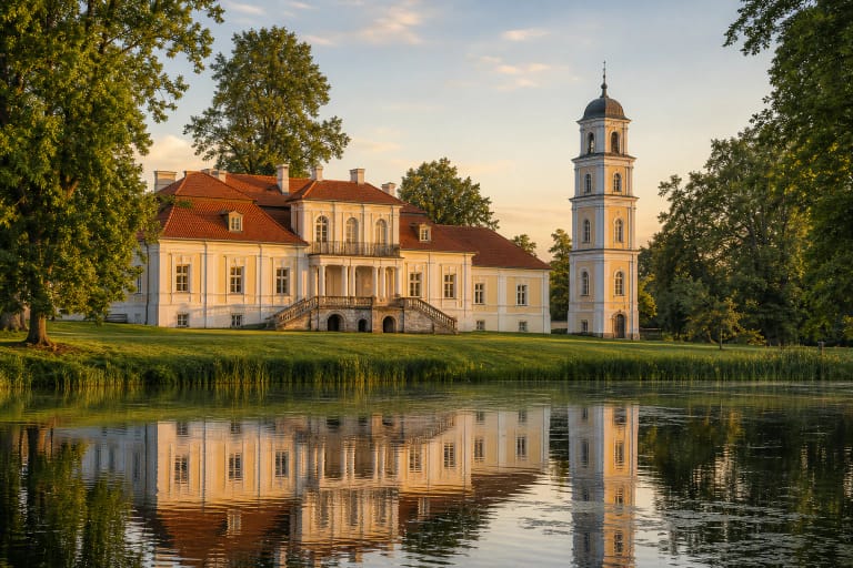
For a short outing, use the public beach on the town side, where bathing and recreation facilities are concentrated. Paežeriai Manor and its park offer a different relationship with the lake from the south-western shore, framing the water as a cultural landscape. These are separate stops rather than one continuous promenade.
Official planning papers have discussed a route around the lake as a development need or future project. That is not confirmation of a complete, continuous, waymarked 12.8 km shore circuit today. Do not improvise through crops, reeds, or private homesteads merely because the water looks close on a map.
Fishing, navigation, and water sports remain subject to current national rules, seasonal restrictions, and the operating conditions of individual facilities. Check licences and access before launching a boat or casting a line, and stay outside the buoyed bathing area. Carry rubbish out, leave reed beds intact, and protect shallow margins used by birds and young fish.