- Place
- Rokiškis District Municipality
- Region
- Aukštaitija
- Type
- nationally significant archaeological monument with concentric defences and an extensive foot settlement
- Address
- Piliakalnio g. 5, Moškėnai village, Rokiškis District
- Coordinates
- 55.96826, 25.43925
- Visit duration
- 45-75 minutes for the climb, enclosure, and visible defensive rings
- Best time
- dry weather from late spring to autumn; earthworks are clearer without leaves, but steps may then be slippery
Laukupėnai Hillfort, Moškėnai-Laukupėnai Hillfort and Settlement, Moškėnų piliakalnis
The hill, enclosure, and concentric defences
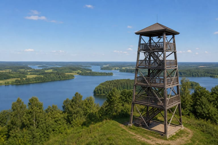
The hillfort occupies a separate massive hill on the left bank of the Laukupė. The stream, a channelised tributary, and low wet valley ground naturally defended its approaches, while steep 20-30-metre slopes made the summit difficult to reach.
The present nearly rectangular enclosure measures about 50 by 38 metres and runs southeast to northwest. A bank about 0.5 metres high and 5 metres wide survives best along the western edge, but the true scale becomes apparent when reading the relief farther down the slope.
The first ring includes a bank roughly 210 metres long, up to 1.8 metres high and 8 metres wide with a ditch; the outer ring has a bank about 275 metres long, up to 2 metres high and 10 metres wide. The ditches appear shallow today because surface descriptions measure surviving relief, whereas excavations reached much deeper bottoms.
Occupation across more than one phase
KVR dates the complex from the late 1st millennium BC to the early 2nd millennium AD. This broad range reflects different phases rather than one continuous building event. Brushed pottery redeposited in a bank points to the earliest activity.
The first enclosure was smaller at approximately 32 by 20 metres and surrounded by a ditch about 1 metre deep and 6 metres wide. The ditch was later filled, the enclosure enlarged, and irregular stone paving laid along the edges in at least two phases. Today's defences are the outcome of long-term rebuilding.
A foot settlement of around five hectares extended on every side. Rough, smooth, pinched, and partly wheel-thrown pottery indicates occupation from the middle or later 1st millennium AD into the early 2nd millennium. This was not only a summit refuge but the centre of a wider inhabited and craft landscape.
Krzywicki's finds and the 2013 excavations
In 1909 and 1911, Ludwik Krzywicki excavated 860 square metres, mainly around the enclosure edges, and documented a cultural layer up to one metre thick. The 472 recorded artefacts included flint knives, stone axe and whetstone pieces, clay spindle whorls and casting moulds, bone tools, iron knives, spearhead fragments and sickles, and bronze ornaments.
The variety points to food preparation, weaving and spinning, metal casting and working, hunting or warfare. Animal bones and clay daub add the routines of everyday life, preventing the site from being reduced to a story of military defence alone.
Before visitor infrastructure was installed in 2013, archaeologists excavated 239.75 square metres and surveyed roughly another 103. Settlement finds included pottery, slag, daub, spindle whorls, and iron fragments; a socketed spearhead lay at the bottom of the first ditch. Finds went to Rokiškis Regional Museum.
Selonian context without overclaiming
Moškėnai lies within historical Sėla and is often presented as a place of Selonian heritage. Later phases of the hillfort and settlement may relate to Selonian communities, making this regional context useful.
The archaeological sequence begins centuries before medieval Selonians become clearer in written history. Not every layer can be assigned automatically to one tribe, and no primary text names a particular Moškėnai castle, ruler, or battle.
The idea that the late fortress defended against the Livonian Order fits the wider region's history but is not directly demonstrated for this site. It is more responsible to describe a long-lived fortified centre whose final phases can be discussed within historical Sėla.
Stairs, views, and a clearly separated legend
Visitors find a small gravel parking area, information board, and long wooden stairway with handrails on the southern slope. The climb is steep and not wheelchair accessible. Wear shoes with grip in dry weather and reconsider the ascent when rain, frost, or snow makes the steps unsafe.
The summit has managed grass, benches, and areas of tall pine. Summer foliage limits views but helps reveal the shape of the banks. Local people held Pentecost dances and youth gatherings here; that is documented later ethnographic tradition, not evidence for prehistoric rites.
A legend tells of the cruel Meškėnas, his daughter Laukupėlė, loyal son Tylutis, betrayal of the Selonians, and an oak castle destroyed by Perkūnas. Another claims Swedish soldiers carried the hill in their caps. Both are folklore; archaeology shows a natural hill reshaped over centuries with banks and ditches.