- Place
- Maisiejūnai, Kaišiadorys District Municipality
- Region
- Kauno Marios Regional Park
- Type
- two-hillfort archaeological landscape with an associated settlement and barrow cemetery
- Address
- Maisiejūnai village, Kruonis Eldership, Kaišiadorys District
- Coordinates
- 54.80044, 24.26833
- Visit duration
- 45-90 minutes for both hillforts; up to 2 hours when including the barrow-cemetery area
- Best time
- daylight and dry weather; the earthworks are clearer in spring or autumn
Maisiejūnai I and II Hillforts, Maisiejūnai-Surgantiškės Hillforts, Surgantiškės Hillfort, Piliakalniukas
Why the name is plural
The Maisiejūnai archaeological landscape contains two hillforts, not three. Kauno Marios Regional Park lists Maisiejūnai I Hillfort and its associated settlement, Maisiejūnai II or Surgantiškės Hillfort 130 m to the southwest, and the separate Maisiejūnai-Surgantiškės barrow cemetery within the Surgantiškės Archaeological Reserve. The cemetery is a third related archaeological feature, but it is not a third hillfort.
Registry and visitor-facing names do not align perfectly. A 2024 Cultural Heritage Department decision defines the registered complex ‘Maisiejūnai Hillfort with Settlement’ (code 24497) as Maisiejūnai I Hillfort (5003) and its settlement (24498), while the barrow cemetery has the separate code 5004. The regional park and the Kaišiadorys Museum archaeological compendium clearly document the second, Surgantiškės, hillfort as a separate mound.
Maisiejūnai I Hillfort and its associated settlement
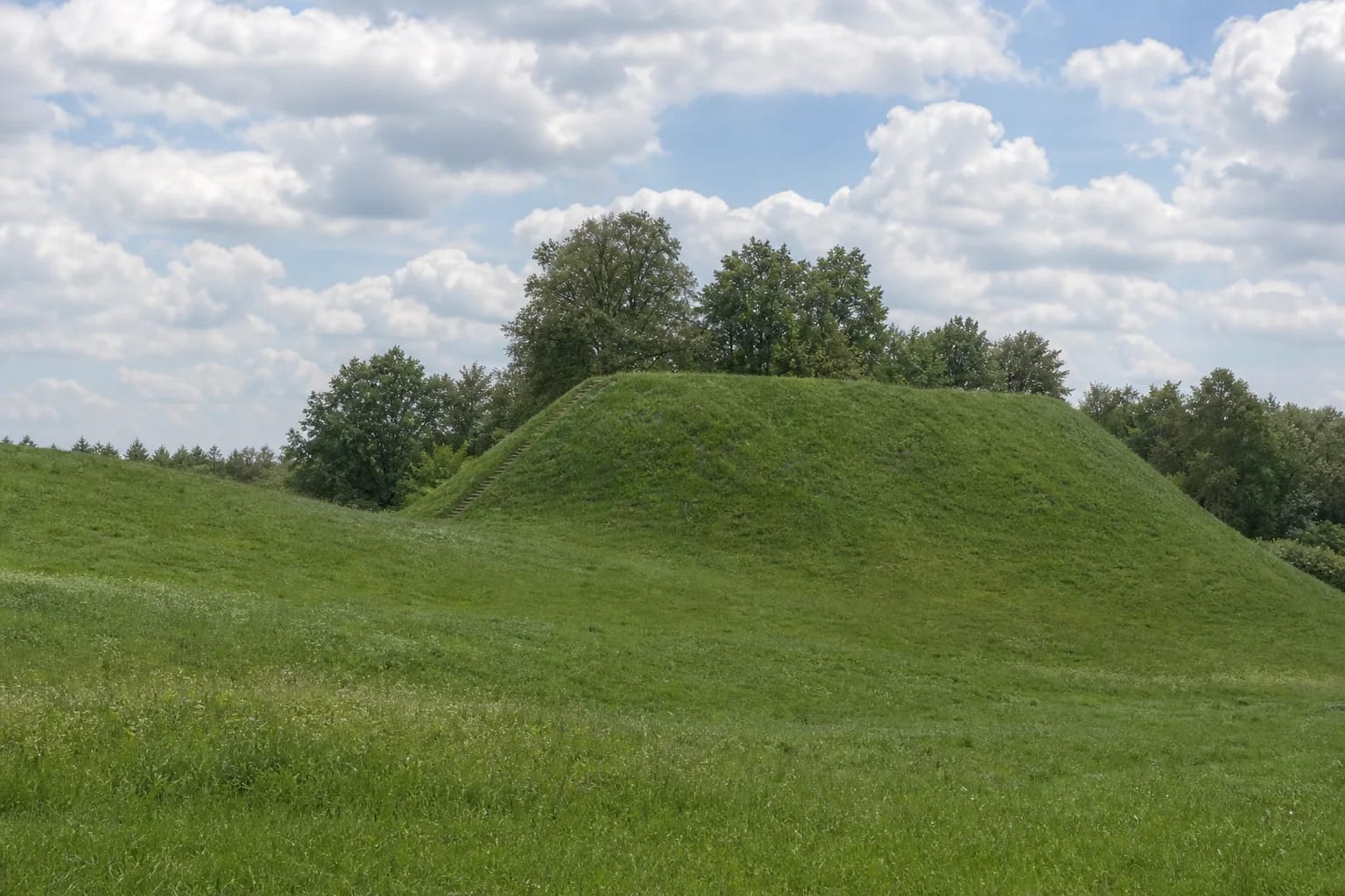
The first hillfort occupies the edge of an upland on the left bank of the Strėva. Its rectangular summit runs northeast to southwest and measures about 33 × 13 m. The slopes rise roughly 8-14 m, and a low rampart, up to 0.6 m high, survives around the summit edges. Archaeologists recorded a ditch about 25 m wide and 2 m deep at the southwestern foot. This compact, grass-covered mound with a distinct silhouette is the hill most often shown in official photographs.
An approximately 4 ha settlement spreads north and northwest of the hill. Finds include hand-built pottery with brushed, rough, and smooth surfaces, wheel-thrown ceramics, slag, and two grinding stones. In 1987, excavation closer to the slope revealed a cultural layer up to 1.2 m thick and stone paving, making the place important not only as a fortified mound but also as the setting of a long-used settlement.
Maisiejūnai II, or Surgantiškės Hillfort
The second hillfort lies about 130 m southwest of the first. The Kaišiadorys Museum compendium also records its local name, Piliakalniukas, meaning ‘little hillfort’. This mound is much lower and less conspicuous: slopes 5-10 m high surround an oval summit about 37 × 9 m, with a slightly raised centre and a higher southwestern end. The compendium's investigators did not identify clear traces of fortifications.
Long-term ploughing softened the landform, and a pit was dug into its southwestern part, so Maisiejūnai II is easier to overlook in the field than the first hillfort. The sources do not fully agree on its date. The museum compendium and Saugoma.lt place it in the first half of the first millennium, while VLE gives the broader first-millennium to early-second-millennium range. A narrower date cannot be stated confidently without further evidence.
Forty-three barrows and archaeological investigations
A barrow cemetery lies roughly 250-300 m northeast of Maisiejūnai I Hillfort. The Kaišiadorys Museum compendium records 43 closely spaced mounds, mostly 5-10 m in diameter and up to 1 m high. Some have been flattened, damaged, or robbed. Archaeologists investigated 22 mounds in 1971 and from 1986 to 1989, finding both inhumation and cremation burials.
The finds include spearheads, axes, a shield boss, knives, buckles, brooches, bracelets, pottery, and other objects. Published summaries differ slightly at the chronological edges, but agree that the cemetery was used in more than one period: during earlier centuries of the first millennium and again around the beginning of the medieval era. The earlier stone-reinforced barrows are associated with the Yotvingians, but that does not justify assigning the entire two-hillfort landscape to one tribe without qualification.
The 1348 Battle of Strėva: a hypothesis, not a fixed location
Saugoma.lt notes that some historians associate the Maisiejūnai Hillforts with the location of the 1348 Battle of Strėva. This is a significant interpretation because the battle took place in the Strėva region, but the official description does not present Maisiejūnai as an archaeologically proven, exact battlefield.
A visit therefore involves two distinct chronological layers. The hillfort, settlement, and cemetery evidence reflects a much longer history reaching back into the first millennium, while the 1348 connection is a hypothesis about locating a later historical event. Maisiejūnai remains archaeologically important even without treating that identification as settled fact.
Planning a visit
The map point on this page marks Maisiejūnai I Hillfort itself, not a verified road entrance or car park. The official Saugoma.lt description places the first hillfort about 1.15 km west of the junction between the Jieznas-Rumšiškės road and the Antakalnis road. Allow roughly 45-90 minutes for the two hillforts, or up to 2 hours if you also want to understand the barrow-cemetery area; the actual time depends on paths, vegetation, and ground conditions.
In 2025 Kaišiadorys District Municipality described repairs to the stairs, a car park, and small visitor facilities at the first hillfort as planned works. No official completion notice was found during research up to 2026-07-18, so this page does not promise that new infrastructure is in service. Check current municipality or regional-park notices before setting out. Research also did not confirm one continuously waymarked visitor route to Maisiejūnai II and the barrow cemetery. Visit in daylight and dry weather, stay on existing paths, respect cultivated land, and do not disturb protected archaeological features.