Dovainonys, Kaišiadorys District Municipality
Kaunas District
Kauno Marios cliff and Mergakalnis viewpoint
54.82460, 24.24410
30-90 minutes; longer with the trail toward the Uolė stream and hillforts
a clear day or evening, when the Kauno Marios panorama is most visible
Mergakalnis, Dovainonių atodangos Mergakalnio regykla
Mergakalnis Viewpoint
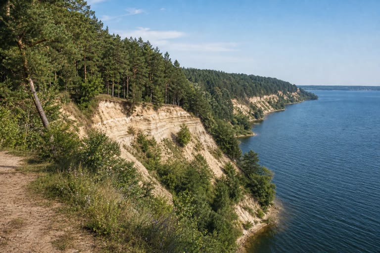
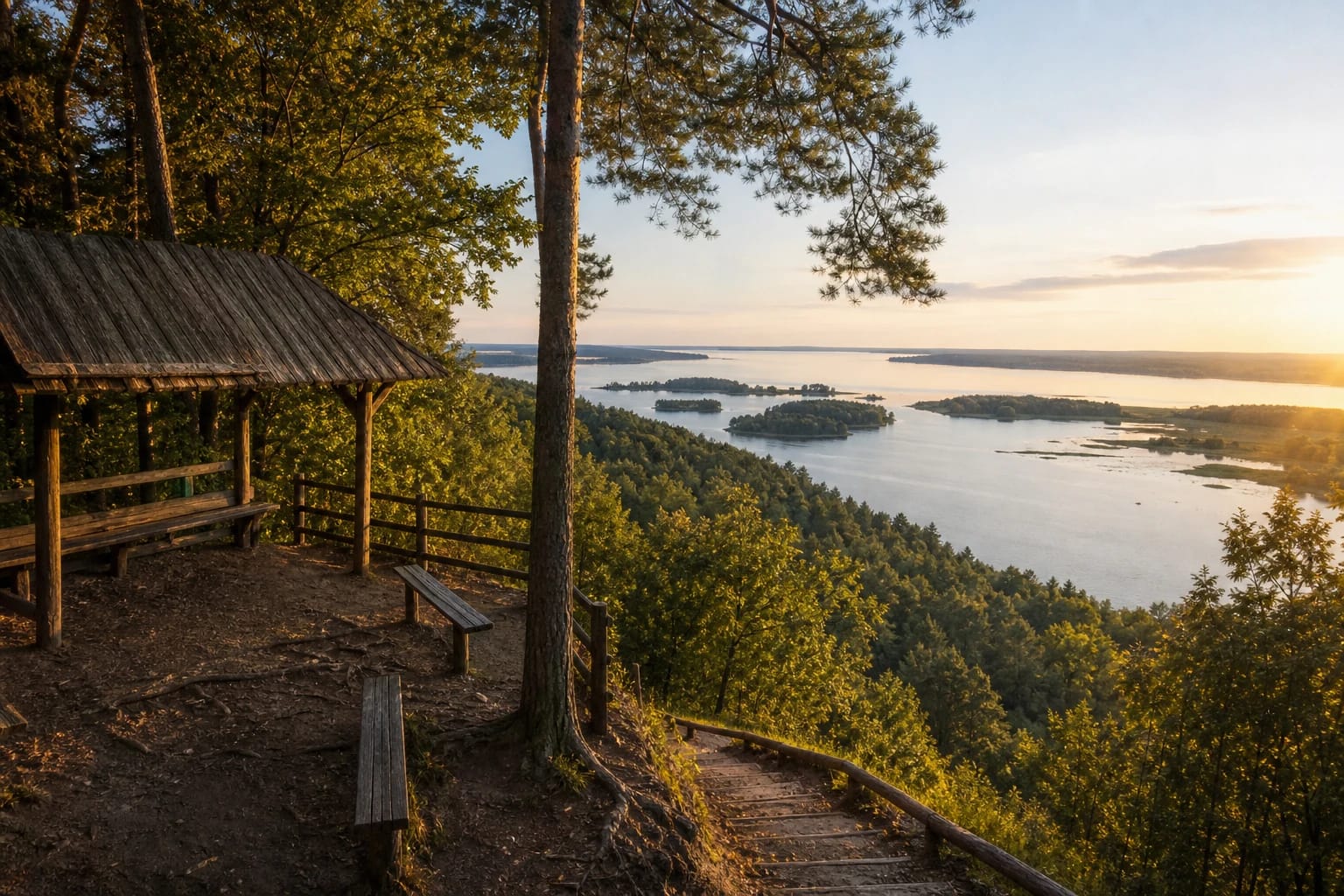
Dovainonys Outcrop is often called Mergakalnis. Saugoma.lt presents it as the Mergakalnis viewpoint of the Dovainonys outcrop in Kauno Marios Regional Park.
It is one of the strongest Kauno Marios panoramas, because the high cliff opens a view of water, forest, and islands. The place works both for a short stop and for a longer walk along slope trails.
The Size of the Outcrop
Research data describes Dovainonys Outcrop as about 42 m high and 500 m long. Those dimensions make it more than a small viewing platform: it is a large slope and geological feature.
Kauno Marios changed the former view of the Nemunas valley, so the landscape visible here is both natural and shaped by human activity. The cliff lets visitors read that relationship from above.
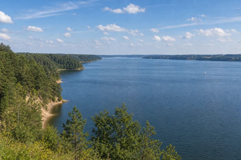
Panorama Toward Kauno Marios
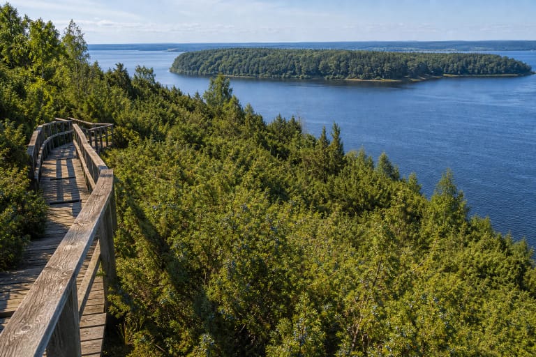
From the viewpoint you can see the waters of Kauno Marios, wooded shores, and the direction of the Bird Islands. On a clear day the panorama is broad, and in the evening the water and slopes become especially photogenic.
Still, this is not only a photo stop. Saugoma.lt mentions benches, rest infrastructure, a legend barrel, and trail directions, so the viewpoint also works as a route junction.
Trails Toward the Uolė and Heritage Sites
From the Dovainonys Outcrop area, trails lead toward the mouth of the Uolė stream, Dovainonys hillfort, and burial mounds. This means the natural cliff is also tied to an archaeological landscape.
If you have more time, do not limit yourself to the viewpoint platform. The descent and surrounding paths help you feel the height of the slope and the different layers of Kauno Marios Regional Park.
How to Visit Safely
The outcrop is a high cliff, so stay on marked paths and respect safety boundaries. Do not climb onto unstable slope edges or allow children to run near the cliff edge.
During research no separate ticket for the viewpoint was found, but Kauno Marios Regional Park is a protected area, so check the current protected-area visitor-ticket rules on Saugoma.lt.