Kulionys, Čiulėnai Eldership, Molėtai District Municipality
Molėtai District
hillfort with a foothill settlement by Lake Želvai
55.31694, 25.55083
30-60 minutes
dry spring or autumn, when ramparts and lake slopes are clearer
Kulionys, Kulionys Hillfort with Settlement
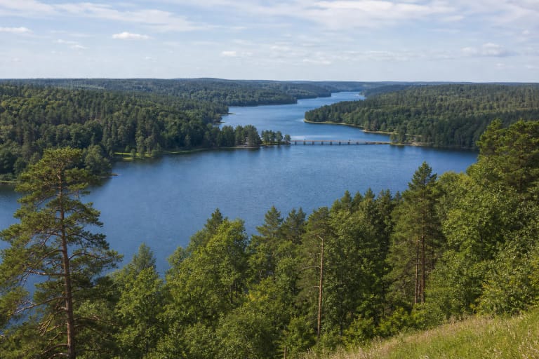
Peninsula hillfort between two lakes
VLE states that Kulionys Hillfort with foothill settlement is on the north-western edge of Kulionys village in Molėtai District, on the south-eastern shore of Lake Želvai, on a peninsula between Lakes Želvai and Trinktinis. It is a state-protected cultural property of national significance and an archaeological monument, declared in 1998.
Visitors sometimes search for this hill as an alkas near Kulionys, but authoritative sources describe it as a hillfort with settlement rather than a separately confirmed sacred site. This page therefore uses the official hillfort name and treats the alkas name cautiously. VLE notes that the hillfort occupies the highest point of the peninsula, 86 m above sea level, is wooded, is bounded by Želvai on the north and west, Trinktinis on the east, and fields to the south.
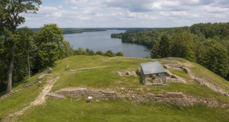
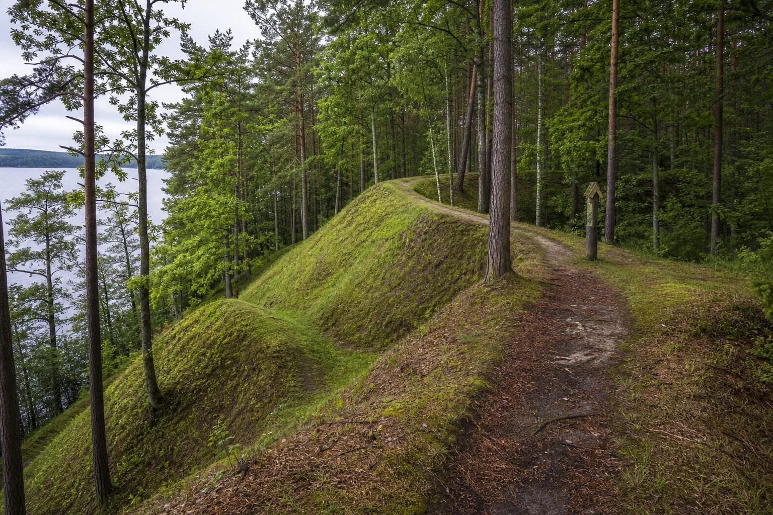
Platform and two defensive ramparts
VLE gives steep lake-side slopes about 30 m high, with the upper parts levelled. The platform has a raised centre, is rectangular, and measures 75 x 60 m. A low rampart remnant lies on the northern edge, and on the southern edge is a 22 m long, 1.2 m high rampart. Beyond it, 5.5 m below the platform edge, a second rampart 92 m long and 1.2 m high was built.
This is not a hillfort understood in one glance from the road. Walk the path and read the relief: the longer southern rampart protected the most accessible landward side, while the lakes defended the other directions.
Tarasenka's research and finds
VLE states that in 1931 archaeologist Petras Tarasenka excavated 10 sq. m in the south-eastern part of the platform. The cultural layer there is 0.5 m thick. Finds included hand-built pottery with brushed surfaces, wheel-thrown pottery decorated with wavy lines, animal bones, and small charcoal remains. The wheel-thrown wavy-ornament pottery shows that the site was used at the end of the first millennium and in the Middle Ages, not only in the early Iron Age.
The finds are kept at the Vytautas the Great War Museum in Kaunas. VLE dates the hillfort broadly from the 2nd-1st centuries BC to the 12th-14th centuries AD, placing Kulionys in a long layer of settlement and defence in the lake region.
Foothill settlement
VLE notes an ancient settlement at the north-western foot of the hillfort. Such a foothill settlement is a normal part of a hillfort complex: the hill was the defensive and authority core, while everyday life took place below, near water and fields.
For visitors this matters because a foothill settlement usually has few dramatic visible forms. Its value is archaeological and lies in the soil, so no one should dig or search for finds independently.
Legends of a sunken church
Legends recorded near Kulionys Hillfort tell of a sunken church, bells heard by people, and a bridge that once crossed the lake to the castle. These are not archaeological proof, but they are important for local memory: the hill was understood as an unusual place where the ground hides former life.
It is worth separating documented facts from legend. The facts speak of a hillfort, foothill settlement, two ramparts, and pottery; legends show how local people explained the hill's origin and its relationship with the lake.
How to reach the hillfort
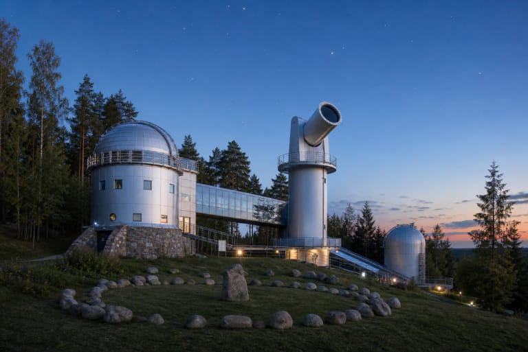
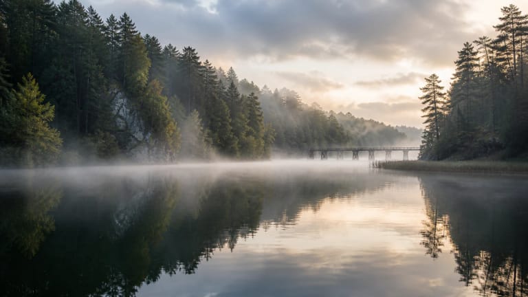
The hillfort is reached in Kulionys from the side of Molėtai Astronomical Observatory and the Lithuanian Museum of Ethnocosmology. In practice, before reaching the administrative building on the hill, turn into a forest path and walk several hundred metres, often crossing a lake-bay footbridge.
Paths and bridges in the natural setting can change, and after rain the steep lake slopes can be slippery. Dry spring or autumn is most convenient, when ramparts are clearer. If you plan the museum or observatory the same day, check their opening hours separately.