- Place
- Kelmė District Municipality
- Region
- Samogitia
- Type
- roughly 4-4.5 km circular nature trail around the partly overgrown Lake Juodlė
- Address
- Lake Juodlė, near Šaukėnai, Kelmė District
- Coordinates
- 55.81798, 22.92414
- Visit duration
- 1.5-2.5 hours for the circuit, longer for birdwatching and the 12 interpretation stops
- Best time
- an early morning from April to July for birds, or a dry October half-day for woodland colour
Lake Juodlė Nature Trail, Juodlė Wetland Trail
Why official sources give different distances
Saugoma.lt currently describes a 4 km route, the protected-area directorate's guided-walk information gives 4.2 km, and older descriptions commonly use 4.5 km. The difference may come from measuring methods, the chosen start, or whether the wetland spur is included. For planning, treat it as a roughly 4-4.5 km circuit.
There are 12 themed stops, so distance alone does not predict the visit. Reading panels, watching birds, and moving cautiously over wet ground can make this a slower outing than an ordinary walk of the same length.
A lake becoming wetland and reed bed
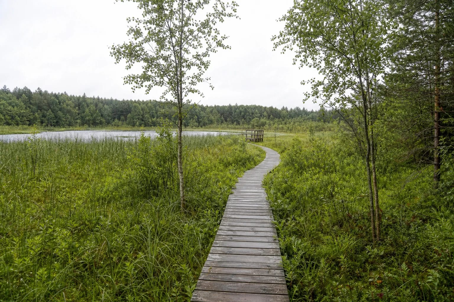
Open water now occupies only part of Lake Juodlė; dense reeds and wetland cover much of the rest. A single circuit therefore reveals the boundaries between forest, marsh, reed bed, and water. Ilga Landscape Reserve protects the overgrowing lake basin, wind-shaped sandy landforms, the Juodlė forest ecosystem, and rare species.
In sandy woodland sections, look for inland-dune relief and signs of older forest habitat. Stay on the boardwalk through the wetland: its surface is fragile, while the ground below can be deep, unstable, and hazardous.
Birdwatching sites
Saugoma.lt identifies April through July as the best birdwatching period. Ducks, grebes, common terns, black-headed gulls, swans, and herons may be seen around the lake and reeds. Marsh harriers hunt above the reed beds, and the booming call of a great bittern can sometimes be heard towards evening.
Move quietly in the morning, keep voices low, and leave speakers switched off. Do not feed birds or approach nests. Binoculars are much more useful than leaving the marked route to take a phone photograph.
Surfaces and realistic accessibility
Most of the circuit follows natural woodland tracks and paths, with timber boardwalks and viewing points in the wetland. After rain, earth becomes muddy and boards slippery, and gaps may occur between planks. Closed footwear with a reliable tread is essential.
Saugoma.lt says the bridge to the island viewing platform can be accessed by visitors with mobility impairments. That statement does not make the entire 4-4.5 km circuit wheelchair accessible. Ask the regional park visitor centre about the present condition and the precise limits of the shorter accessible section.
Preparing for the circuit
Parking at the trailhead is limited, so do not block forest roads or barriers. Save the route map before arriving, carry water and tick and mosquito repellent, and take every item of litter away. Do not expect a permanent shop or public toilet along the route.
The trail is free and has no gate with fixed opening hours, but storms, forestry work, or a damaged boardwalk can restrict access. Never bypass a closure through the wetland. Keep dogs on a lead, particularly during the bird-breeding season.