- Place
- Tauragė District Municipality
- Region
- Tauragė Region
- Type
- state-protected archaeological hillfort with a foot settlement
- Address
- Ivangėnai village, Skaudvilė elderate, Tauragė District
- Coordinates
- 55.42094, 22.60586
- Visit duration
- 35-60 minutes; 1.5-2 hours for both hillforts and the Suvirkštė valley
- Best time
- spring or late autumn, when foliage hides less of the bank and ditch
Karšuva II Hillfort, Second Ivangėnai Hillfort
A separate spur in the Suvirkštė valley
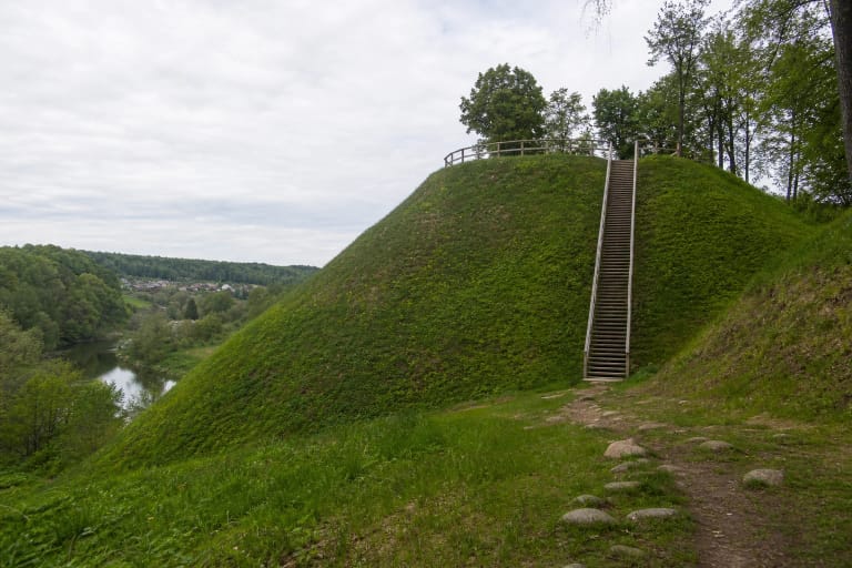
The Ivangėnai archaeological complex contains two hillforts, a foot settlement and a cemetery. Hillfort II stands about 100 m southeast of the main Pilaitė hillfort on a spur of the Suvirkštė's left bank.
The map point marks the separately mapped Hillfort II site and does not indicate a car park. Do not confuse this smaller site with Hillfort I, whose oval platform and larger earthworks appear more often in general photographs of the complex.
A trapezoidal platform, bank and broad ditch
The platform runs east-west for 27 m and is 17 m wide at the east end and 20 m at the west. A bank 3 m high and 18 m wide protects its eastern side.
Beyond the bank lies a ditch 15 m wide and 1.5 m deep; the bank's outer slope reaches 4.5 m. The natural slopes are steep and about 10 m high, so read the relief from the existing approach rather than climbing directly.
Outwork or separate fortress - an open question
The arrangement raises the possibility that Hillfort II was a more distant outwork, but it may instead be chronologically separate. The complex was surveyed in 1996-1997 and parts of the foot settlement were investigated in 2016-2017, yet this work did not conclusively establish Hillfort II's function or relationship to the main fortress.
The complex is broadly dated from the middle of the first millennium to the fourteenth century. A roughly 1 ha foot settlement occupies low ground on both banks, and the fourth- to seventh-century Vėluikiai cemetery lies about 520 m away.
Erosion and safe access
Ploughing damaged the hillfort, erosion affected its side slopes, and a pit was dug into the top of the bank. Dense deciduous trees and scrub hide the landforms in summer.
Access is free, but the approach can be steep and slippery. Do not dig, use a metal detector, climb an eroding face or drive onto the archaeological site.