- Place
- Marcinkonys eldership, Varėna District Municipality
- Region
- Dzūkija
- Type
- a mire-filled thermokarst lake basin in Dzūkija National Park
- Address
- a forest-and-mire hollow east of Marcinkonys, reached on official park routes
- Coordinates
- 54.07542, 24.43186
- Visit duration
- 20-40 minutes as a route stop; about 3 hours for the 10.9 km Per šventas agles route, longer for the 13.8 km Zackagiris Trail
- Best time
- in daylight with footwear suited to wet ground; paths may be waterlogged after rain or snowmelt, and there is no need to enter the mire basin
Aklaežeris, Akležeris
Aklažeris, Aklaežeris, and Akležeris all identify the same infilling basin
The State Service for Protected Areas uses Aklažeris on the dedicated attraction card. Dzūkija National Park and route texts also use Aklaežeris, while the exact Google Maps card is named Akležeris. These spellings identify one place east of Marcinkonys, not three separate lakes.
The name is explained through infilling: the official attraction card says the lake is becoming overgrown and is now mire. The word lake survives in the name as a memory of open water, although today's visitor sees a mosaic of water, sphagnum, sedges, shrubs, and young trees.
Google's point at 54.0754157, 24.4318621 and the rounded Saugoma.lt coordinate 54.076, 24.432 fall within the same basin. This is a representative attraction pin, not a car park and not an instruction to walk towards it in a straight line across forest or wetland.
A buried block of ice left a thermokarst lake almost 10 hectares in area
The story of Aklažeris begins with processes at the end of the Ice Age. A block detached from a glacier was buried beneath sand and other sediment. When it eventually melted, the depression it left filled with water. This form of hollow and lake is described as thermokarst.
Saugoma.lt and the park route description give almost 10 hectares as the area of the former lake. That figure should not be read as the present open-water surface. Mire succession has already transformed most of the lake, so its appearance changes with the season and may include only separate pools of visible water.
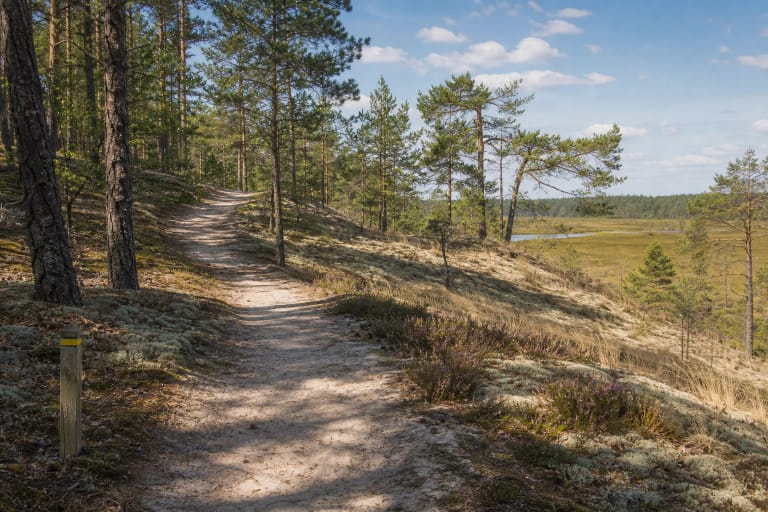
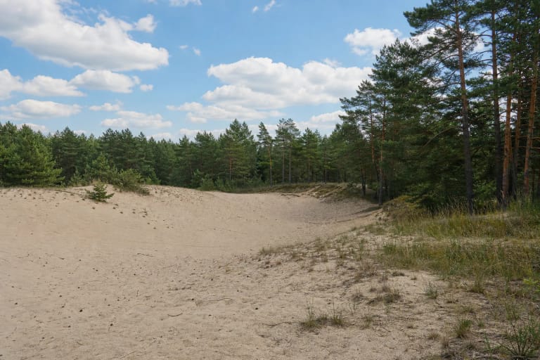
Aklažeris adds an important counterpoint to the sandy Dainava Forest. Dry inland dunes and pinewoods dominate the surroundings, but buried-ice hollows held water and created wet islands in the dry landscape. The same route can therefore reveal both the exposed sand of Gaidžiai Dune and the waterlogged Aklažeris basin.
Official sources call the present habitat both raised bog and transitional mire
The dedicated Saugoma.lt card invites visitors to see an unmodified natural raised bog at Aklažeris. The same authority's Zackagiris page, however, calls Aklaežeris a transitional mire. The Dzūkija National Park route description uses the broader word mire.
The sources checked do not say whether this difference reflects a habitat mosaic, ecological succession, mapping boundaries, or editorial terminology. It is therefore most accurate for a visitor page to call Aklažeris a mire-filled thermokarst lake basin and retain the two more specific official classifications as an unresolved documentary difference.
Saugoma.lt records abundant mountain arnica and sand pink on the slopes around the basin. Do not pick them or trample vegetation to find a better photograph. The mire surface is not a meadow either: sphagnum and low plants can conceal water and unstable ground.
People still swam here and kept dugout boats on the shore fifty years ago
The official attraction card preserves a striking account of landscape change: roughly fifty years ago people could still swim at Aklažeris, Prussian carp lived in the lake, and dugout boats stood along its shores. This is local environmental memory presented by the park, not a promise that the present mire is suitable for swimming or fishing.
These details make mire succession understandable on a human timescale. Open water remembered by local people has filled with vegetation and peat-forming organic matter over only a few decades. The name and the story of the dugouts preserve the former lake, while today's wetland represents a later state of the same hollow.
The sources give no annual measurements of water area or precise date when the lake officially became mire. The approximate fifty-year recollection therefore cannot define exact historic shorelines or prove that succession has ended. Infilling continues, and the amount of visible water also varies by season.
Two officially described routes reach Aklažeris, but their variants must not be confused
Saugoma.lt says the Zackagiris Nature Trail passes Aklažeris. The full trail is 13.8 km, with 7 km and 10.5 km alternatives from the Marcinkonys visitor centre. The official text does not specify which shorter loop reaches Aklažeris, so open the current map before hiking rather than relying on the trail name alone.
The national-park authority also includes Aklažeris on a separate loop called Per šventas agles. It is 10.9 km long, described as easy, and takes about three hours. This route is not marked on the ground but has been digitised, so visitors should download the official map or GPX in advance and know how to use it.
Both routes begin around Marcinkonys and share part of their landscape, but their lengths and waymarking should not be mixed. Even if Aklažeris is your only objective, do not create an improvised shortcut from the nearest forest road. Ask the visitor centre which current route is appropriate on the day of travel.
The 5.0 average comes from three reviews, and the mire has no separate timetable
The exact Google Maps card Akležeris, place ID ChIJO04GqF4Y3kYRNgoKc-EA1zc, showed 5.0 out of 5 from three reviews on 15 July 2026. This clears the required 4.5 threshold, but a three-vote sample is extremely small and one new rating could noticeably change the average.
Google categorised the place as a lake, while the official attraction text describes the current site as mire. A map category is not a hydrological assessment. The official pages checked also publish no dedicated Aklažeris ticket, ticket office, or opening hours; the visitor centre's hours are not a timetable for the outdoor basin.
Visit in daylight, remain on the official route, and do not step from the path onto sphagnum or enter the basin. Waterproof, grippy footwear may be needed after rain or snowmelt. Never test the depth of the mire or venture onto ice simply because its surface appears firm.