- Place
- Naravai village, Prienai Eldership, Prienai District Municipality
- Region
- Suvalkija
- Type
- a state-protected first-millennium hillfort with a surviving summit, rampart, and ditch depression
- Address
- beside the Prienai-Naravai road, Naravai, Prienai District Municipality
- Coordinates
- 54.59074, 23.98679
- Visit duration
- 20-45 minutes to read the hillfort relief; allow longer when combining it with other places in the Nemunas Loops
- Best time
- a dry day in early spring or autumn, when low grass and sparse foliage reveal the rampart and slopes and the ground is less slippery
The exact pin marks the Naravai village hillfort, not its namesake near Vilnius
Naravai Hillfort stands in Naravai village, Prienai Eldership, on the left bank of the Nemunas. The exact Google Maps listing, place ID ChIJE7CrxPA150YRSZokgRwc2QI, marks 54.5907427, 23.9867874. The coordinate published by Prienai Regional Museum lies about one metre away, confirming that this is a point on the hillfort rather than a separate entrance or official car park. It corresponds to KVR property 13019, formerly listed as A152 and AR1533.
The name needs care because another Naravai Hillfort near Vilnius is registered as KVR 17206. This guide covers only the Prienai District site in Nemunas Loops Regional Park. When navigating, check Prienai District, the exact coordinates, or the Google place ID rather than relying on the name alone.
A same-day editorial capture of the exact Google listing on 15 July 2026 showed an average of 4.6 out of 5 from 22 reviews. The anonymous public view still exposed the 4.6 average that day, but no longer showed the count because Google had disabled new contributions for this type of place. The 22 reviews should therefore be read as a verification-date snapshot, not a permanently live total.
The six-metre summit, rampart, and filled ditch must be read in low relief
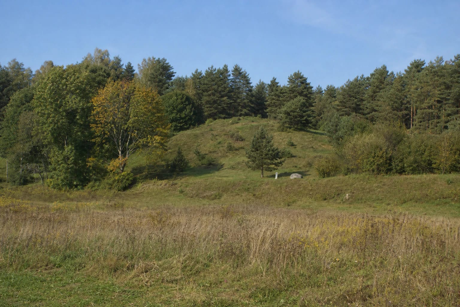
The hillfort occupies a promontory at the edge of the high ground. Its surviving quadrangular summit measures about 6 m by 5 m. At the northern end stands a rampart roughly 16 m long, 10 m wide, and up to 2 m above the summit. Its outer slope rises only about 1 m, so it is not a high defensive wall that dominates the landscape from afar.
Beyond the rampart, a depression up to 0.5 m deep marks the former ditch. A road in the valley bounds the promontory from the south-east, ravines protect the north-east and south-west sides, and the high ground continues northwards. The southern slope towards the Nemunas valley rises up to 15 m, while the other slopes are lower.
The southern part of the summit slipped into the Nemunas valley. Old pit marks remain on the summit, and the rampart has been levelled, ploughed, and disturbed elsewhere. The Saugoma.lt description gives the remnant as only 2 by 2 m, whereas the KVR valuable-features record updated in 2020 uses approximately 6 by 5 m. Both official sources agree on the essential point: most of the southern part has gone, so visitors see a damaged remnant of an earthwork rather than its complete original form.
The first-millennium date remains broad because the cultural layer has not been investigated
The Register of Cultural Properties assigns Naravai Hillfort broadly to the first millennium. The property was registered on 23 December 1996 and is now state-protected and of national significance. Its archaeological character determines its importance, while its landscape value comes from the surviving promontory in the setting of the Nemunas valley.
The registration date is not the date when the rampart was built. It marks the beginning of legal registration. The KVR bibliography lists twentieth-century surveys, earlier inventory records, a publication by Bronius Dakanis, and the Atlas of Lithuanian Hillforts, but the 2020 valuable-features description explicitly records the cultural layer as uninvestigated.
The public sources checked contain no published excavation results, confirmed artefact assemblage, named timber castle, or documented battle. The responsible conclusion is limited to the evidence: this is a hillfort assigned broadly to the first millennium with surviving earthen defences. A narrower century, population group, and exact use have not yet been demonstrated.
The story of bones and coins is not an archaeological finds report
Prienai Regional Museum records a local account that human bones and unidentified old coins were found on the high ground above the Nemunas. It also notes speculation that a small burial place may have existed there and that residents digging sand reportedly found coins. The museum text itself says that neither the number of objects nor their later fate is known, so this is not a verified catalogue of archaeological finds.
A separate state-protected Naravai burial ground, KVR 3774, lies about 200 m to the north-east. It is not a component of hillfort 13019 or a settlement attached to it. Proximity alone does not allow the museum's recorded story to be assigned automatically either to the hillfort summit or to the registered burial ground.
The old depressions visible on the summit and rampart are not proven graves either. They must not be enlarged, dug, or tested by visitors. Protection extends beyond the visible relief to archaeological evidence that may survive underground, so leave any possible find in place and notify the Department of Cultural Heritage.
This left-bank site belongs to Suvalkija, although Dzūkija begins just across the Nemunas
Prienai District Municipality describes the Nemunas at Prienai as a boundary between ethnographic regions: residents on the left bank are Suvalkijans, while those on the right are Dzūkians. Naravai Hillfort is on the left bank and is therefore classified as Suvalkija in this catalogue. It is a border landscape, so broader accounts of the Nemunas Loops may also associate the surrounding area with Dzūkija.
KVR identifies the setting within the Naravai Village Landscape Reserve in Nemunas Loops Regional Park as a valuable landscape feature. The promontory is not an isolated artificial mound: its defensive form depends on the edge of the high ground, the two side ravines, and the southern slope falling towards the Nemunas valley.
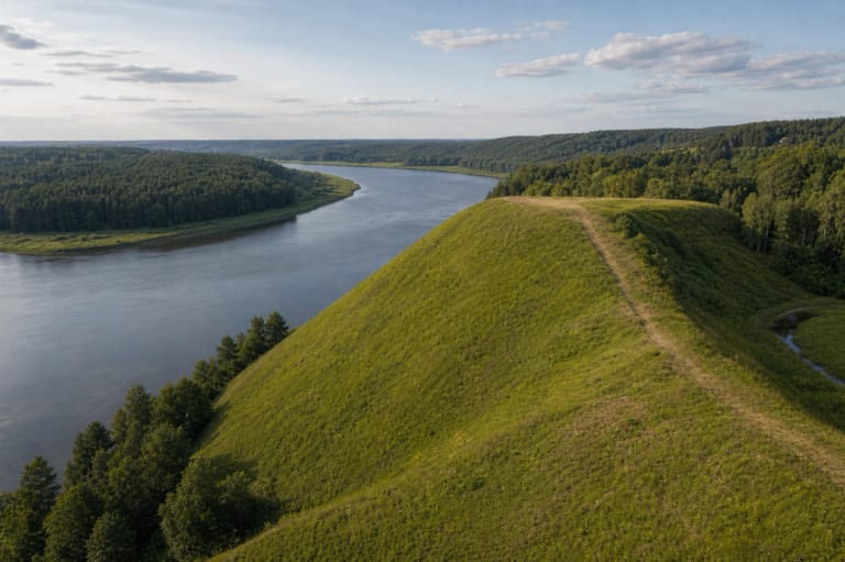
Official photographs taken between 2004 and 2020 show a low grass-covered ridge, scattered pines, patches of scrub, mixed woodland behind it, and open meadow at the foot. There are no reconstructed walls, tower, or monumental staircase. The place rewards close attention to the subtle rampart and ditch and to their relationship with the river valley.
You can drive close, but viewing from a car does not mean the summit path is accessible
Prienai District Municipality directs visitors along the Prienai-Naravai road. Continue roughly 300 m beyond the forest until the road begins to descend towards the Nemunas valley; the hillfort is on the right, to the north. The exact Google pin marks the property itself. No separately marked official car park was found in the authoritative sources checked, so stop only where legal and do not obstruct the road.
The Dzūkija-Suvalkija Protected Areas Directorate says Naravai Hillfort can be viewed after driving right up to it and without leaving the car. That helps a visitor with limited mobility see the mound from the approach, but the directorate does not certify a universal route to the 6 by 5 m summit. Steep slopes, grass, and uneven earth may make an independent wheelchair ascent unsuitable.
Official sources publish no separate admission ticket, staffed gate, or controlled opening schedule. Google displayed 24-hour access on 15 July 2026, but that is not an official operator timetable. The hillfort is unlit and unstaffed, so visit in daylight and dry weather and check current park notices before travelling. Avoid climbing directly up an eroding slope, damaging the rampart, or leaving litter.