- Place
- Bačkininkėliai, Pakuonis Eldership, Prienai District Municipality
- Region
- Suvalkija
- Type
- a first-millennium hillfort with a foot settlement, an almost fully excavated summit, and a much earlier archaeological horizon
- Address
- Bačkininkėliai village, Pakuonis Eldership, Prienai District Municipality
- Coordinates
- 54.74303, 24.10786
- Visit duration
- 45-75 minutes for the hillfort form, summit, and foot-settlement setting; allow longer to take in the wider Kauno Marios landscape
- Best time
- a dry day from spring to autumn; the truncated-cone profile is clearest without leaves, while wet grass and soil make the slopes slippery
Bačkininkėliai Hillfort and Settlement, Bačkininkėlių piliakalnis, Bačkininkėlių piliakalnis su gyvenviete
A separate mound stands at the edge of the Nemunas valley beside present-day Kauno Marios
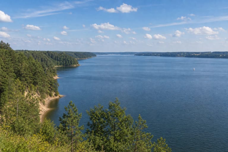
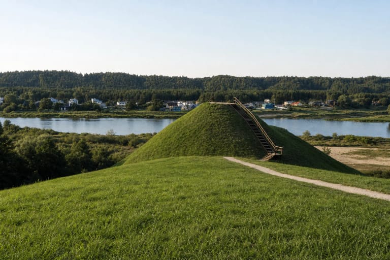
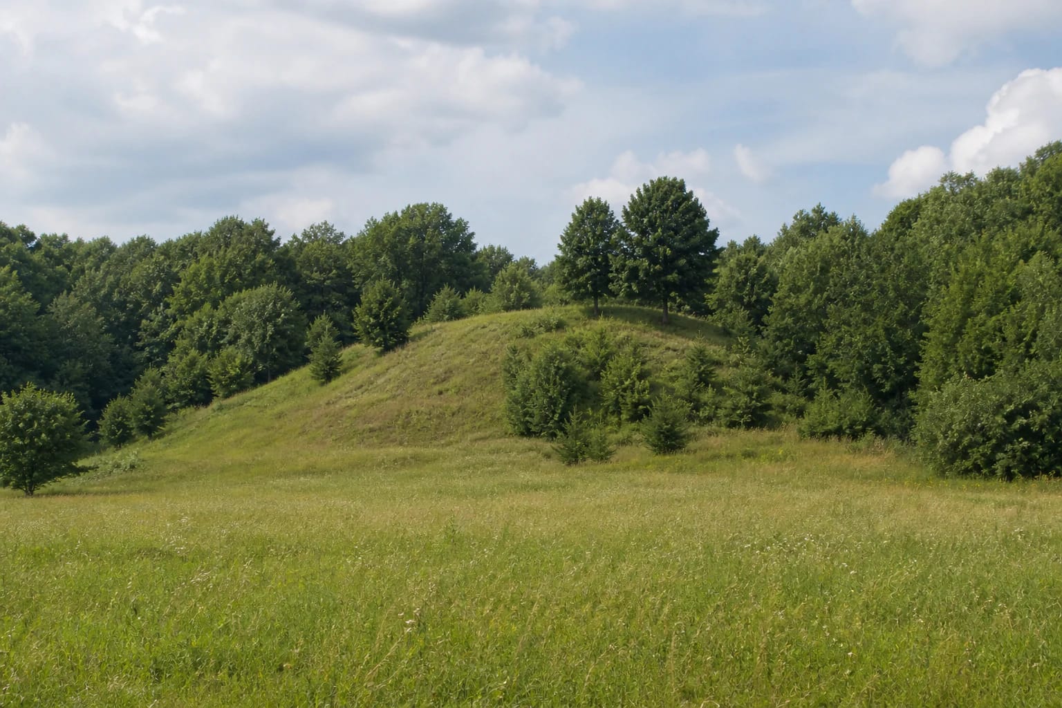
Bačkininkėliai Hillfort was established on a detached hill at the edge of the Nemunas left-bank valley. The place now lies on the western shore of Kauno Marios, so it operates at two scales. At close range, the archaeological mound resembles a truncated cone; from farther away, it belongs to a landscape of water and valley slopes transformed when the Nemunas was dammed. The official map of Pakuonis Eldership places it at the reservoir-facing edge of Bačkininkėliai village.
The exact Google Maps listing, place ID ChIJaZ2lkws550YREwP-XPdEd2E, marks 54.7430304, 24.1078564. Coordinates published by Prienai Regional Museum differ by only about one or two metres, independently confirming that the pin identifies the hillfort itself. It does not identify a verified car park, gate, or best vehicle entrance.
On 15 July 2026, the exact listing averaged 4.9 out of 5 from 27 reviews. That exceeded the 4.5 selection threshold, but both the average and review count are changeable map data. They offer no guarantee about the condition of the field road, grass, or slope on the day of a visit.
Official sources describe the summit both as a 17 m circle and as a 20 by 15 m oval
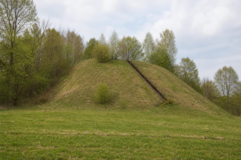
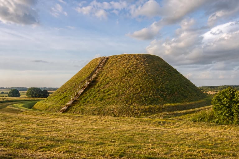
The mound has the profile of a truncated cone. VLE gives steep slopes rising 15-20 m and an oval summit measuring 20 by 15 m. Prienai Regional Museum describes the same summit as circular and 17 m in diameter. Both are official accounts, yet neither explains whether the difference reflects measurement boundaries, interpretation of the landform, or editorial simplification. Combining the two into one supposedly definitive measurement would conceal the disagreement.
In real photographs the mound looks low and broad from the field, but its steepness becomes apparent on approach. Sparse deciduous trees cover the crown and parts of the slopes, while the open ground is grassed. Seen from the southeast across the reservoir, the very same mound appears only as a small interruption in a long wooded shore. A distant water view therefore understates the scale of the landform.
The museum says that almost the entire summit, an area of 209 square metres, was excavated. VLE summarises the work as excavation of the whole summit. This breadth makes Bačkininkėliai more than a scenic viewpoint: archaeologists were able to compare much of the summit rather than infer its sequence from a handful of test trenches.
The 1956-1957 excavation separated two horizons in a deposit up to 1.25 m thick
The Institute of History excavated the hillfort in 1956-1957 under archaeologist Ona Kuncienė. The summit deposit was approximately 1.2-1.25 m thick and contained two horizons. Their separation records activity at different times on the same hill rather than one short, undifferentiated episode.
Stone hearths occurred in the upper horizon. Another official summary also lists stone paving, roughened pottery, a fragment of an iron awl, a small furnace used in metalworking, and two pits of uncertain purpose. These are material features and finds. By themselves they cannot identify the community by name or reconstruct a particular political history for the hillfort.
A broad excavation does not mean that open trenches form part of today's visit. The investigated areas were backfilled, leaving a green archaeological landform. Visitors encounter its stratigraphy through the research record, not through reconstructed walls, buildings, or marked findspots.
Posts, a compacted floor, and an open hearth are evidence; a cult building is an interpretation
In the lower summit horizon, archaeologists recorded the outline of a post-built structure approximately 6 by 4 m, a compacted clay floor, an open hearth, and remnants of paving. VLE and the official Pakuonis Eldership brochure associate this group with the Late Neolithic and describe it as a cult building. If the dating is correct, this activity predates the broadly first-millennium hillfort by a very long interval.
Function, however, is not an object that can be excavated directly. The post pattern, floor, hearth, and their stratigraphic position are documented evidence; a religious purpose is an interpretation of that evidence. It is therefore more accurate to say that some scholars have interpreted the structure as a possible cult building or pagan temple than to claim that a temple was conclusively found.
That caution does not make the discovery unimportant. The compact hill preserves an early structure, later hearths, and material from the first-millennium hillfort and its settlement. Its significance lies precisely in this multi-period and partly contested archaeological sequence beneath an outwardly simple grassed mound.
A 650-square-metre excavation at the foot revealed domestic life and craftwork
The ancient settlement extended across the eastern and southeastern foot. VLE reports that 650 square metres were excavated and that its cultural deposit reached 1.2 m in places. A layer dated to the first millennium BC contained stone paving, storage or refuse pits, handmade pottery with roughened and black surfaces, clay spindle whorls, an iron awl, and a chisel.
The museum's account also records a crucible fragment, animal bones, striated, smooth, and burnished pottery, and early wheel-thrown sherds with wavy decoration. Together these finds point to domestic work, spinning, metalworking, and changing ceramic traditions. A long list of objects does not, however, prove continuous occupation throughout every period represented at the site.
VLE states that the finds are held by the National Museum of Lithuania. There is no display case on the mound, so do not collect objects from the surface, dig, or use a metal detector. The foot field belongs to the protected archaeological setting and should not be assumed to be a public walking trail.
Plan for daylight and dry ground, treating the map's 24-hour label only as changeable guidance
The official eldership map marks the hillfort on the Bačkininkėliai side, but the checked official sources publish no verified car park, toilet, lighting, or visitor centre. The final approach can depend on the condition of local and field roads. Leave a vehicle only where it is legal and safe, do not obstruct a track or homestead entrance, and expect to walk the last section.
Slopes rise 15-20 m and are steep in places. Wet grass, leaves, and bare soil can be slippery, while no reliably step-free route is confirmed by the official sources checked. The site should therefore not be presented as universally wheelchair-accessible. Keep children close at the top and avoid cutting new paths across an eroding slope.
On 6 July 2026, the municipality organised a procession from the Bačkininkėliai waterfront to the hillfort and a singing of the national anthem on its summit. That event demonstrates a living community connection, not a permanent event or access schedule. Google displayed 24-hour access on 15 July 2026, while official sources published neither an admission fee nor gated opening hours. The site is unlit and unstaffed, so visit in daylight and check current information before setting out.