- Place
- boundary of Pagaršvys and Pošventis villages, Prienai District Municipality
- Region
- Suvalkija
- Type
- a nationally significant hillfort with a ring rampart, foot settlement, and steps on its steep slope
- Address
- boundary of Pagaršvys and Pošventis villages, Pakuonis Eldership, Prienai District Municipality
- Coordinates
- 54.66568, 24.03001
- Visit duration
- 30-60 minutes for the hillfort relief, summit, and foot landscape; allow more time only for a lawful walk on public roads
- Best time
- a dry day in spring or autumn, when sparse foliage reveals the cone and rampart; after rain and in winter the timber steps can be slippery
Pošventis Hillfort, Pagaršvys Hillfort and Settlement, Pagaršvys (Pošventis)
The names Pagaršvys and Pošventis identify the same field-side hillfort
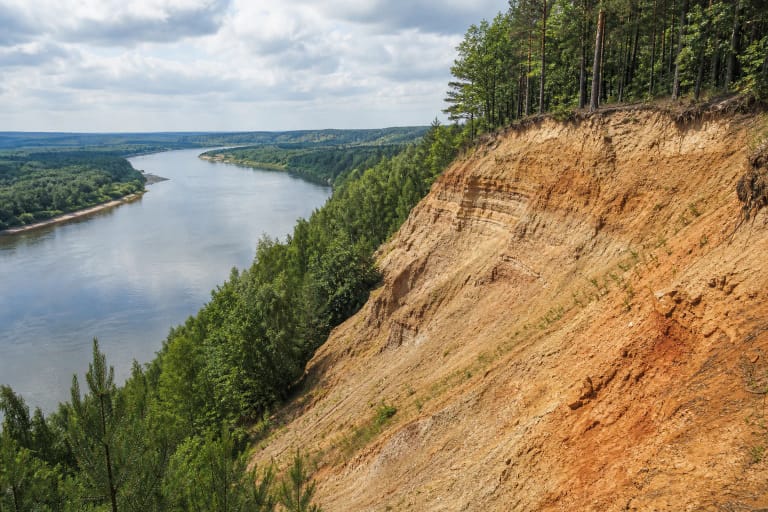
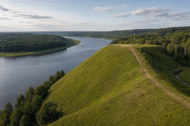
The hillfort stands at the edge of the Nemunas left-bank valley, on the boundary between Pagaršvys and Pošventis villages. KVR addresses the complex as a whole to Pošventis, but its separate hillfort and settlement components to Pagaršvys. VLE likewise gives both Pagaršvys Hillfort and Pošventis Hillfort. The two names are therefore meaningful variants, and different address lines on maps do not indicate two separate sites.
The exact Google Maps listing, place ID ChIJ78xetsY350YR1UwzZDN2U28, marks 54.6656757, 24.0300137. This is a point on the archaeological mound, not a confirmed car park or vehicle entrance. On 15 July 2026, the card displayed the address Ašmintos, 59326 Prienai District Municipality, so coordinates and the place name are more useful for arrival than the automated locality label alone.
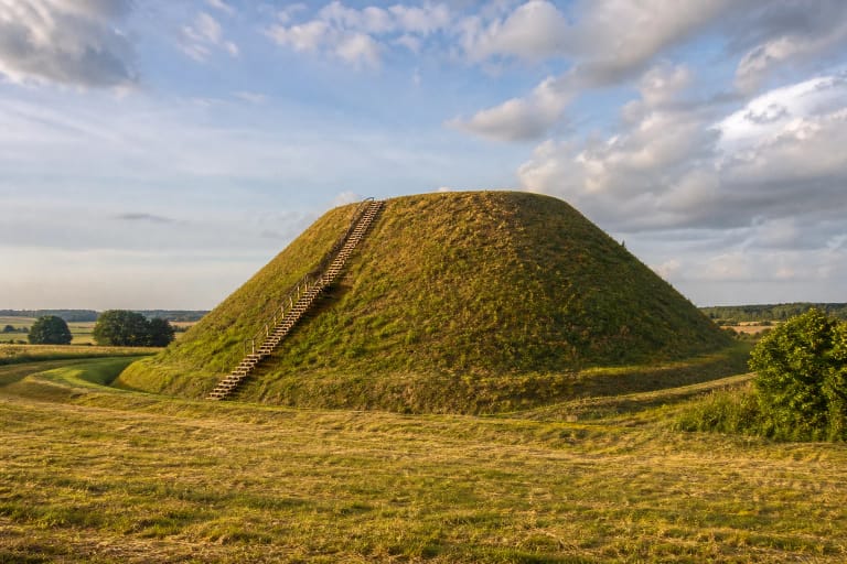
On the same date, the exact card averaged 4.9 out of 5 from 11 reviews. That exceeds the 4.5 selection threshold, although eleven ratings are too few for a stable long-term average. The attraction is neither a building nor an exhibition: it is the unusually regular, cone-shaped mound that separates cleanly from the surrounding field.
The updated KVR record identifies a 25 by 20 m summit and a rampart up to 3.8 m high
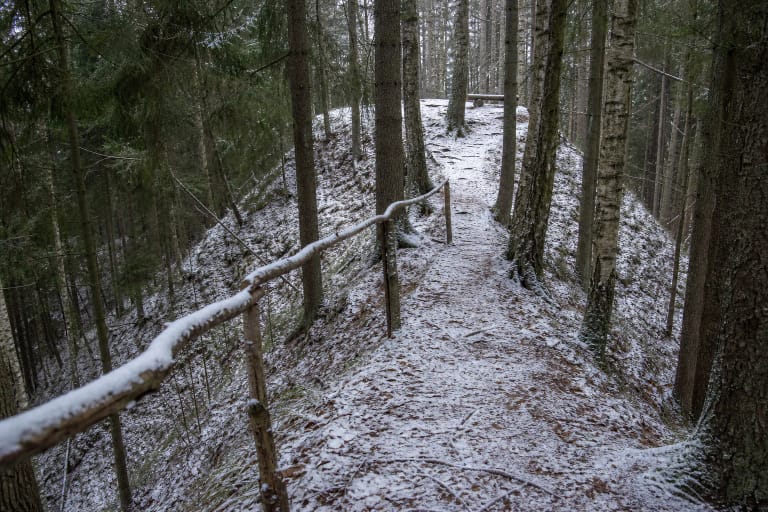
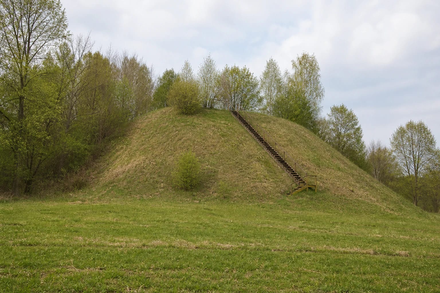
The valuable properties updated in KVR in 2021 describe the hillfort as a spur on the slope of an upper Nemunas terrace. Its oval summit measures 25 m by 20 m and runs southwest to northeast. A ring rampart surrounds it. The earthwork is highest on the western and northern side, where it reaches up to 3.8 m in height and 14-15 m across at the base.
The highest eastern and southeastern slopes stand 13-14 m high. KVR records damage from ploughing, erosion, and pits; trees cover parts of the slopes, while steps climb the southeastern side. Official photographs from 2021 show a grass-covered mound clearly visible from the field, a belt of trees behind it, and a timber stairway ascending the steep face.
Older descriptions do not agree on every number. The atlas-based account from Prienai Regional Museum gives a 25 by 18 m, basin-shaped summit up to 1.5 m deep and a 5 m rampart, while VLE gives a summit of only 6 by 4 m. The sources do not explain whether different parts of the relief were measured. This guide therefore uses the latest 2021 KVR dimensions for the present form and treats the older figures as part of the site's research history.
The foot settlement matters as much as the conspicuous mound
KVR registers Pagaršvys as complex 22571. It contains the hillfort itself, code 5505, and a separately protected ancient settlement, code 22572. The settlement occupies a level field in the Nemunas valley at the eastern and southeastern foot. The current complex description gives an area of about 2 ha, while the 1953 surface survey observed signs of a cultural layer across a larger field of roughly 3-4 ha.
Striated, smooth, roughened, and wheel-thrown pottery has been found at the foot. The older survey description singles out a handmade sherd with fingernail impressions and a wheel-thrown fragment decorated with a wavy incised line. VLE states that the finds are held by the National Museum of Lithuania. The current KVR record also notes animal bones and traces of iron objects from the hillfort and settlement.
KVR explicitly describes the cultural layers of both components as unexcavated. Surface pottery confirms habitation, but it cannot substitute for a stratigraphic excavation. Do not collect sherds, use a metal detector, or dig at the foot. The cultivated field is not automatically a public path either, so respect its boundary and the landholder's rights even when the mound appears close.
Surveyed in 1953, the site has a chronology still being refined
Archaeologists from the Institute of History surveyed the hillfort in June 1953, measured its relief, and recorded surface finds. The KVR bibliography also lists Algimantas Merkevičius's report from a 1988 field-survey expedition. The public register record contains no excavated buildings, rampart sections, or closed find assemblages, however, so reconnaissance must not be mistaken for a large-scale archaeological excavation.
The current KVR record dates the complex to the late 1st millennium BC and the 1st millennium AD. VLE publishes a range extending from the 1st millennium AD into the beginning of the 2nd millennium AD, while the museum page repeats the older 3rd-12th-century date. The disagreement shows that the chronology has been revised through pottery, landform type, and newer heritage documentation. The responsible approach is to disclose that difference rather than select the most convenient precise date for a castle.
The complex has monument status and a national level of significance. The Lithuanian Government declared it a cultural monument on 19 May 1998, and a culture minister's order recognised it as state-protected cultural heritage on 29 April 2005. Protection covers not just the visible mound but also the foot settlement, landform, and archaeological information surviving below ground.
The sunken castle is legend; visibility towards other hillforts remains a research hypothesis
Prienai Regional Museum records a story in which the mound resembles a pyramid because a castle sank inside it. Treasure hunters supposedly caused the bewitched castle to sink still deeper whenever they dug, enlarging the hollow on the summit. The story belongs with phrases such as it is said or according to legend. It is valuable local folklore, not an archaeological explanation for the basin-shaped summit.
A theoretical LiDAR study published by archaeologist Laurynas Kurila in 2018 identified terrain-based lines of sight from Pagaršvys towards Pelekonys II and Pelekonys IV Hillforts. This helps explain why the open space of the Nemunas loops could have supported observation. The study models possibilities, however; it does not prove that a signal fire burned at Pagaršvys or that a permanent beacon network operated here.
Modern foliage and scrub alter the view from the summit, so a visitor may not see every point marked in a terrain model. The complex itself deserves equal attention: the ring rampart, basin-shaped summit, and meeting of field with upper terrace. Its shape and surface finds are documented; the enchanted castle and signalling role should remain, respectively, folklore and a cautious hypothesis.
Timber steps assist the climb, but there is no confirmed car park or gate
Local tracks approach the hillfort through the Pagaršvys and Pošventis area, but no marked car park, toilet, or visitor centre was found in the official sources checked. The Google pin sits on the mound. Leave a vehicle only in a legal safe place, do not block a field road or homestead entrance, and never drive across crops. Plan to walk the final section.
Timber steps climb the steep southeastern slope. They were reconstructed in 2015 and KVR still recorded them in 2021, but rain, frost, and many seasons can leave wood slippery or damaged. Assess their present condition before climbing, do not treat the handrail as certified fall protection, and choose another day after heavy rain. The steps and steep slopes provide no reliable step-free wheelchair route.
Official sources publish neither an admission fee nor gated opening hours. Google displayed 24-hour access on 15 July 2026, but this is an unlit and unstaffed archaeological site. Visit in daylight, check present access and weather conditions before travelling, and keep children close on the basin-shaped summit and beside the steep slopes.