- Place
- Vilnius City Municipality
- Region
- Vilnius
- Type
- historic water-source site and contemporary 1.5 ha city square
- Address
- Vingrių g. 9D, between Mindaugo and Pylimo streets, Vilnius
- Coordinates
- 54.67868, 25.27611
- Visit duration
- 20-45 minutes; about 1.5 hours with the MO Museum surroundings and the nearest part of the Old Town
- Best time
- daylight from spring to autumn, when the flowing water, planting, sculptures, and Old Town view are easiest to appreciate
Vingrių šaltinių skveras, Vingrių skveras, Square of Vingriai Springs
The exact Vingriai Springs site and its names
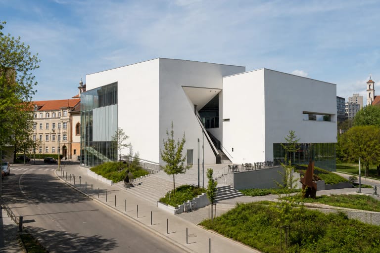
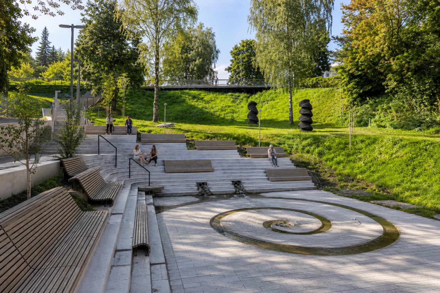
Vingriai Springs Square runs along the western edge of Vilnius Old Town between Mindaugo and Pylimo streets, beside MO Museum. It combines a pedestrian link, a green slope, and the historic water-source site. At the lower level, water follows a narrow open channel into a spiral basin, while terraced steps, wooden benches, and a higher viewing area let visitors read the square at several levels.
Vilnius City uses the full Lithuanian name Vingrių šaltinių skveras, while the project manager shortens the same 1.5 ha space to Vingrių skveras. These are two names for one place, not two separate squares. The exact Google Maps card, place ID ChIJl4_I-wOV3UYRj-fC5TolnsY, is titled Vingrių šaltinių skveras and carried a rating of 4.8/5 on 2026-07-15.
From the gravity-fed system of 1501 to a buried stream
VLE dates the beginning of the Vilnius water supply to 1501. The Vingriai springs belonged to the Dominicans, local people called their water St John's water, and wooden pipes initially carried it to two monasteries and several private houses. Gravity did the work because the springs stood above their users. By the late sixteenth century, Vilnius had three systems drawing on Vingriai, Žiuproniai, and the Gate of Dawn springs.
Vilnius City states that the Vingriai water source served the city until 1914. A stream once left this slope, crossed the Old Town, and joined the Vilnia near the Lower Castle, but it became badly polluted in the early nineteenth century and was enclosed during work on Pylimo Street. Reservoirs were renewed and cast-iron pipes replaced timber ones in the mid-nineteenth century. After the Second World War, a collecting reservoir occupied this site and the spring water was diverted into the sewer network.
Archaeology confirms that this is more than an urban anecdote. Work around the springs in 2006 found fragments of wooden water pipes and masonry structures associated with the source. Archaeological investigation and monitoring in 2021 recorded seventeenth- to nineteenth-century masonry and timber water-pipe and reservoir remains, together with seventeenth- to twentieth-century cultural layers. The Vingriai Springs water-source site is listed in the Register of Cultural Property under code 30598.
Water returned to view in an award-winning public space
The renewed square opened in October 2022. Project architects Lolita Vileikienė and Paulius Jonys made the historic water flow the organising line of the landscape: the channelled spring is brought to the surface, carried through small cascades, and completed by the distinctive spiral. Pavements, terraced steps, viewing paths, planting, lighting, and resting places were renewed around it.
The project does not pretend to reconstruct the early wooden pipe system. It is a contemporary landscape interpretation on the authentic water-source site, designed to make a buried layer of the city's hydrology visible. In 2023, Lithuania's National Architecture Awards named Vingriai Springs Square the country's best public space.
A water-themed sculpture route
MO Museum contributed an outdoor display by seven Lithuanian artists, connected by the theme of water. The route includes Tulip by Petras Mazūras, Submerged by Nerijus Erminas, Observer by Jonas Aničas, Island by Tauras Kensminas, Asukas by Beatričė Mockevičiūtė, Eels by Mykolas Sauka, and Black Rubber by Vytautas Viržbickas, who created the work under the name Geraširdis Linkėtojas.
Another work tied directly to the memory of the water source stands on the slope: Water Lilies by Severija Inčirauskaitė-Kriaunevičienė. It turns an industrial water tank into a support for a cross-stitched freshwater-plant motif. The sculptures unfold most clearly while walking uphill from Pylimo Street towards Mindaugo Street and looking back across the terraces and Old Town.
Access, practical limits, and why not to drink the water
Allow 20-45 minutes for the square. You can begin beside MO Museum on Pylimo Street or approach from Mindaugo Street, but the pronounced level change brings both stairs and gradients. A 2024 landscape-architecture review found that universal-design principles had only been met in part: some areas remain difficult for people with impaired mobility, and provision for visitors with visual impairments is limited. Choose the approach that suits your needs and take care on wet, snowy, or icy steps.
This is an open public space, and Vilnius City does not publish a separate visitor ticket or tourist schedule. Water flow may nevertheless be paused in winter or for maintenance, and events or temporary works can alter a route, so check the official page and on-site signs before making a special journey.
The historical fact that Vingriai water was once drunk is not a present-day safety guarantee. Vilnius' 2025 environmental monitoring report included the Vingriai spring among monitored sources and assessed only the northern Antakalnis spring as uncontaminated; water from the other tested springs did not meet drinking-water requirements. The channel is not an official drinking fountain, so do not taste the water or let children play in the channel and spiral basin.