Marcinkonys eldership, Varėna District Municipality
Dzūkija National Park
spring-fed left tributary of the Merkys in Dzūkija National Park
54.00100, 24.29900
30 minutes to 4 hours depending on the chosen section; the full loop trail takes a day
spring to autumn, when water, bank vegetation, and trails are easiest to observe
Skroblus, Skroblaus upelis
Skroblus, or Skroblaus upelis: key facts
Authoritative sources usually give the hydronym as Skroblus, but travellers often search for Skroblaus upelis, Skroblus Stream. This page uses both forms so it is clear they refer to the same stream in Dzūkija National Park. VLE describes it as a left tributary of the Merkys in Varėna District Municipality.
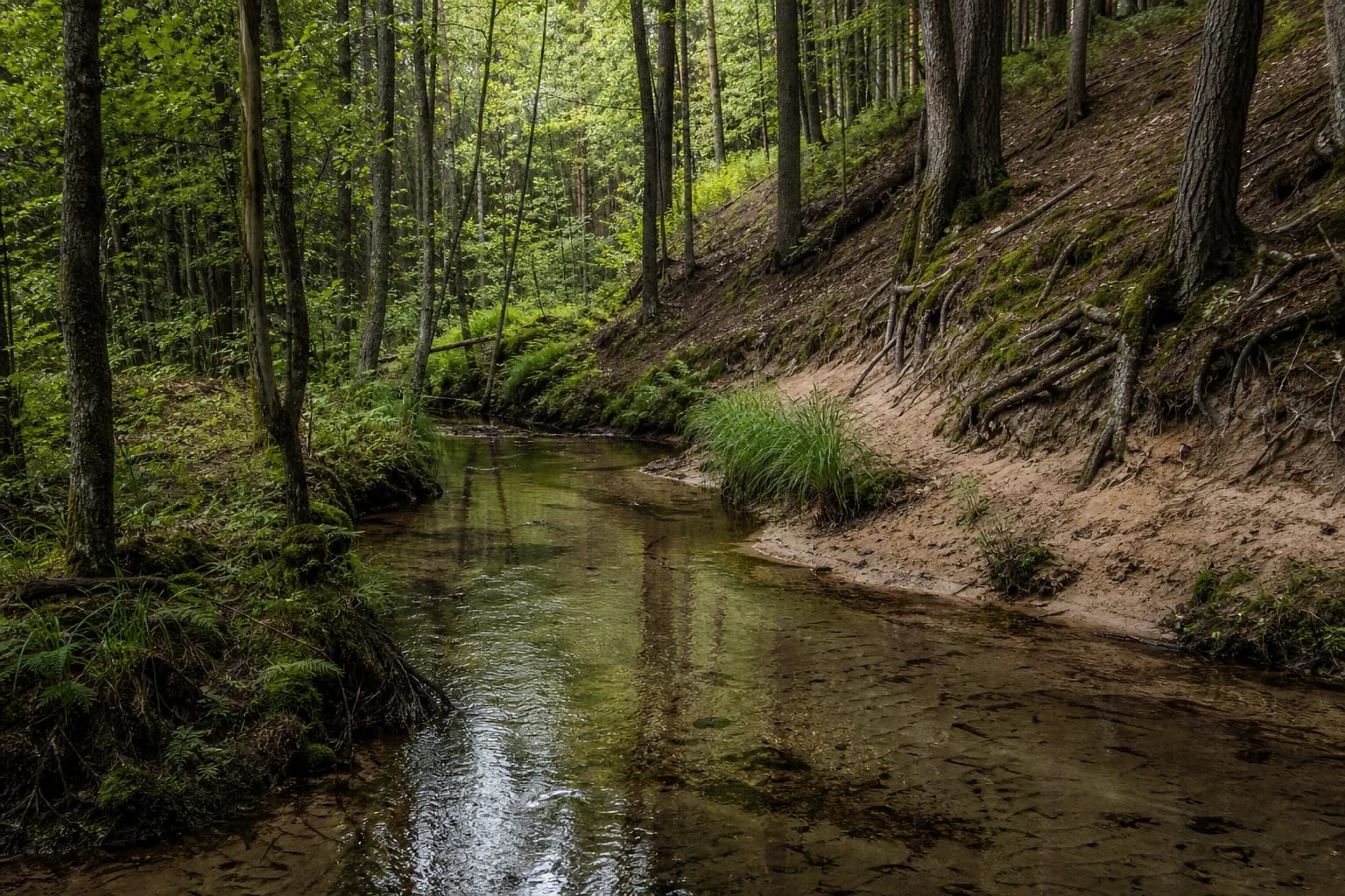
VLE gives the length of Skroblus as 20.31 km, with other data giving 17 km, and the basin area as 76 km2. The natural channel is 3-4 m wide, winding, with an average gradient of 1.77 m/km. It is short but very important for the landscape because it flows through protected territory for its entire length.
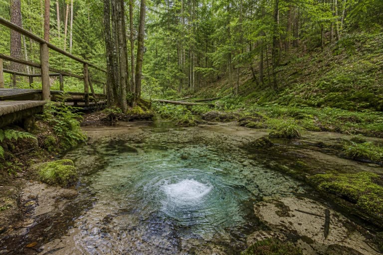
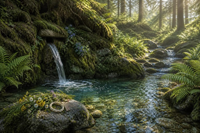
Thermokarst sources near Margionys
VLE states that Skroblus begins in a marshy thermokarst hollow near Margionys, 9 km southwest of Marcinkonys, and flows north through the Dainava Plain, then northwest in its lower course. Saugoma.lt presents the Bobos Daržas spring as the source of the most beautiful Dzūkija stream, where underground waters rise from deep intermorainic layers and gather in small hollows locally called burbaklės.
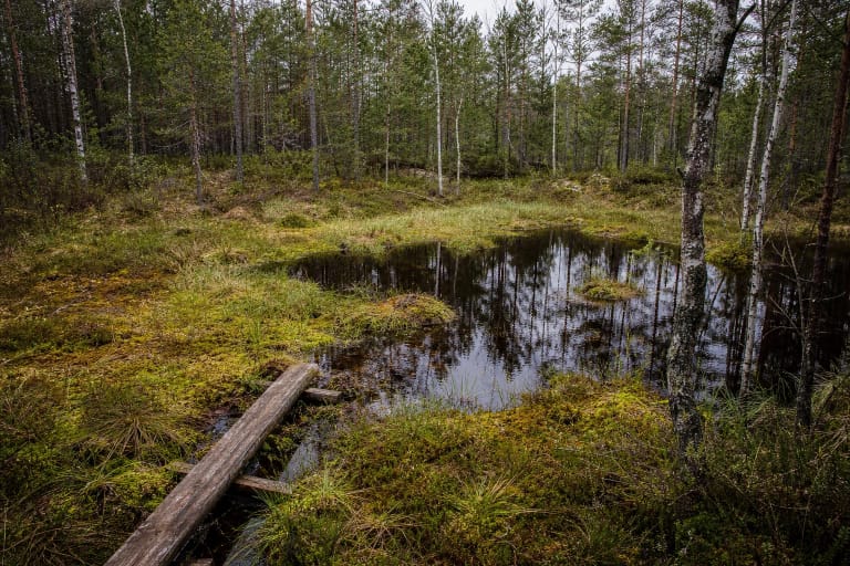
According to Saugoma.lt, a boardwalk over the boggy hollow lets visitors reach the spring itself, where water flows from a cavity disappearing into the depths of the earth. Because of abundant spring feeding, the stream water is often clear and cool, and the valley shows a mix of wet meadows, marshy hollows, and sandy banks.
One of Lithuania's cleanest rivers
VLE calls Skroblus one of Lithuania's cleanest rivers. Its banks are spring-rich and forested, and the valley is distinct, in places wide, 600-700 m, and marshy. The average discharge at the mouth is 0.73 m3/s; at Dubininkas in the lower course the average is 0.64 and the maximum 1.73 m3/s. The annual water-level fluctuation is small, about 0.3 m on average.
This steady spring-supported regime explains why Skroblus looks different from a ditch fed mainly by rain or snowmelt. VLE notes that A. Barisas and Algimantas Tiknius carried out hydrometric studies of Skroblus in 1969, so the stream's cleanliness and water richness are measured facts, not only impressions.
Protected areas: reserve and landscape reserve
VLE states that the whole Skroblus flows through Dzūkija National Park: its upper course through Kapiniškiai Landscape Reserve, and its middle course and part of the lower course through Skroblus Nature Reserve. This means that in many parts of the stream, visiting is governed by stricter rules, not by free walking along the bank.
According to VLE, the Skroblus springs themselves have been a hydrogeological natural heritage object and natural monument since 2000. Nearby in Margionys grows Lietuvis Lime, and in the middle-course valley lie Rudnia Cirque and Rudnia horn-shaped landforms, also protected natural heritage objects. The Skroblus valley thus gathers several monument-level points in one stretch.
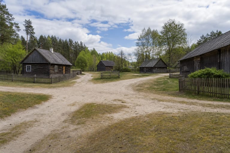
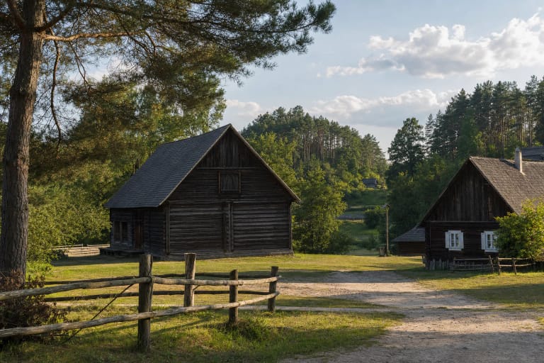
Villages by the Skroblus and the loop trail
Skroblus Stream is important not only for nature. Margionys and Dubininkas stand by or near it, where water, village plan, and forest life join into one cultural landscape. VLE states that Skroblus flows into the Merkys 11 km from the Merkys mouth, at Trasninkas, so the lower course connects Dzūkija villages with the region's main river.
VLE notes that a 13 km loop Skroblus Nature Trail is arranged here. For a short stop, the Bobos Daržas springs or one stream section is enough; the whole loop is a longer hike. Along it you can see springs, forest roads, wetlands, Bakanauskų pelkutė, and a changing stream valley, so Skroblus is best visited not as one point but as a route.
How to protect the stream and plan a visit
Skroblus is valuable for its clear water, springs, wetlands, and sensitive banks, and much of it belongs to a nature reserve. Do not wade into springs, shortcut through wet places, wash items in the stream, or leave litter. After rain, trails may be wet, so footwear should suit both sand and damp ground.
No separate opening hours or ticket apply to the stream itself, but it is a protected-area object. Check Dzūkija National Park sources for current trail condition, permitted sections, visitor ticket, or park-support information, especially if you plan the full 13 km loop.