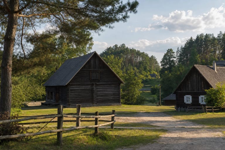
Margionys and Kapiniškiai area, Varėna District Municipality
Dzūkija National Park
small mire stop on the Skroblus trail in Dzūkija National Park
30-60 minutes as a Skroblus trail stop; the full loop trail takes a day
spring to autumn, when the trail is safer and mire vegetation and water are visible
Bakanauskų pelkutė, Bakanauskai small mire
Why both bog and small mire are used
The user-facing list names this place Bakanauskų pelkė, while Dzūkija National Park route descriptions more often use the diminutive Bakanauskų pelkutė. This page uses both ideas so it is clear that the subject is the same small wetland point on the Skroblus trail.
During research, no reliable separate object record with coordinates was found, so this page deliberately avoids assigning a precise standalone point. On the ground, follow official Skroblus Nature Trail or park route markings.
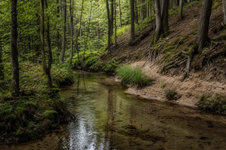
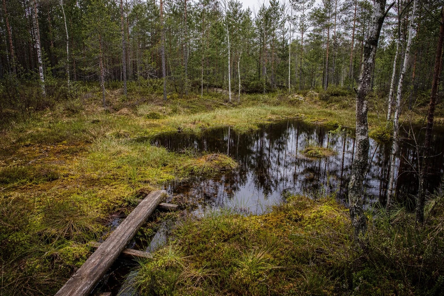
A small wetland on the Skroblus trail
Bakanauskai Bog is part of the Skroblus Nature Trail between the Margionys and Kapiniškiai areas. It is not a broad raised bog or a large viewpoint. Its value is an intimate forest wetland scene: water, mosses, sedges, birches, pinewood edge, and a damp hollow.
This kind of object helps explain Dzūkija more accurately than a single pretty river view. In a sandy pinewood region, small wet hollows are important habitats and water-storage places, so this small mire is not an accidental puddle but part of the forest water system.
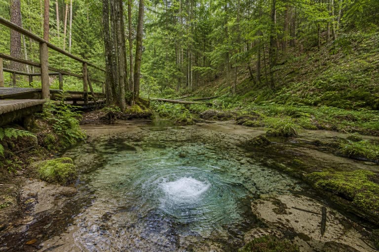
Thermokarst landscape and the link with Skroblus
Skroblus is a short but water-rich left tributary of the Merkys. VLE gives its length as 20.31 km and its basin as 76 km2, and most importantly notes that Skroblus begins in a marshy thermokarst hollow near Margionys. That description also explains Bakanauskai Bog: in the sandy Dainava Plain, depressions left by melting blocks of ancient ice became wet hollows.
VLE notes that the Skroblus valley is in places wide, 600-700 m, and marshy, with spring-rich banks. In this context, Bakanauskai Bog is part of the wet Skroblus landscape. It is worth visiting together with the springs, stream, and villages, because then the connection between water, relief, and homesteads becomes visible.
A stop on the Skroblus loop
VLE notes that a 13 km loop Skroblus Nature Trail is arranged in Dzūkija National Park. Bakanauskų pelkutė is one of its smaller stops, so it should not be searched for as a separate object with its own car park; it is reached by walking the trail.
Other protected points cluster around it as well: VLE notes that the Skroblus springs have been a natural heritage object since 2000, and the upper course belongs to Kapiniškiai Landscape Reserve. The small mire is therefore best understood not alone, but as one detail of the Skroblus valley between springs, reserve, and villages.
What to expect and how to behave
This is not a site where you should expect a large information board or a long exhibition. The best visit is a short pause to look at the vegetation and water edge, then continue the route. The meaning of a small mire opens through quiet observation, not through loud photography.
After rain, paths may be slippery, and wet places are sensitive to trampling. If you see a boardwalk or clear path, stay on it: do not wade, do not try to shorten the route across moss, and do not pick plants. Wetlands recover slowly, so one careless step can do lasting damage.
Tickets and visit planning
No separate Bakanauskai Bog ticket or opening hours were listed during research. It is visited as part of a Dzūkija National Park route, so the most relevant information is the park trail condition, seasonal circumstances, and any visitor ticket or support arrangements.
If you walk the full 13 km Skroblus loop, plan several hours, water, and suitable footwear. A short pause by the small mire needs less time, but the logistics depend on where you start and finish the route.