- Place
- Molėtai District Municipality
- Region
- Molėtai District
- Type
- a long walking and cycling route through Labanoras Forest on a narrow peninsula between Lakes Baltieji Lakajai and Juodieji Lakajai
- Address
- Ščiūrys peninsula, Inturkė eldership, Molėtai District
- Coordinates
- 55.20960, 25.60579
- Visit duration
- about 3-4 hours for the complete route; allow longer for extended lakeshore and interpretation-panel stops
- Best time
- May-October in dry weather; the route can be visited in other seasons, but wet, snowy, or icy natural ground may be slippery
Ščiūrio Rago Nature Trail, Ščiūrys Cape Trail, Ščiūrio Ragas Trail
The official route is 8 km, but a tracker may show closer to 10 km
The State Service for Protected Areas describes an 8 km walking and cycling route on Ščiūrys Cape. Its layout is not one simple circle: one part forms a loop, while the spurs to the end of the main peninsula and to Cibaragis have to be walked out and back. At the start, first read which line the current diagram marks as the main route and where it diverts around private property.
Visitor-recorded distances are not identical. Some GPS tracks give about 8.5 km and others roughly 9-9.6 km because walkers choose different shore sections, include both spurs, start at slightly different points, and encounter normal satellite drift beneath trees. This does not invalidate the official 8 km design, but preparing for an 8-10 km walk is more useful than expecting the counter to stop at exactly eight.
Allow about 3-4 hours for the complete version. A brisk walker may return sooner, but interpretation panels, lake views, and time at Cibaragis easily extend the outing. If you want a shorter version, decide only after reading the current diagram on site, since an old GPS trace may not reflect today's markers or a temporarily impassable section.
An almost 3 km peninsula separates the two Lakajai lakes
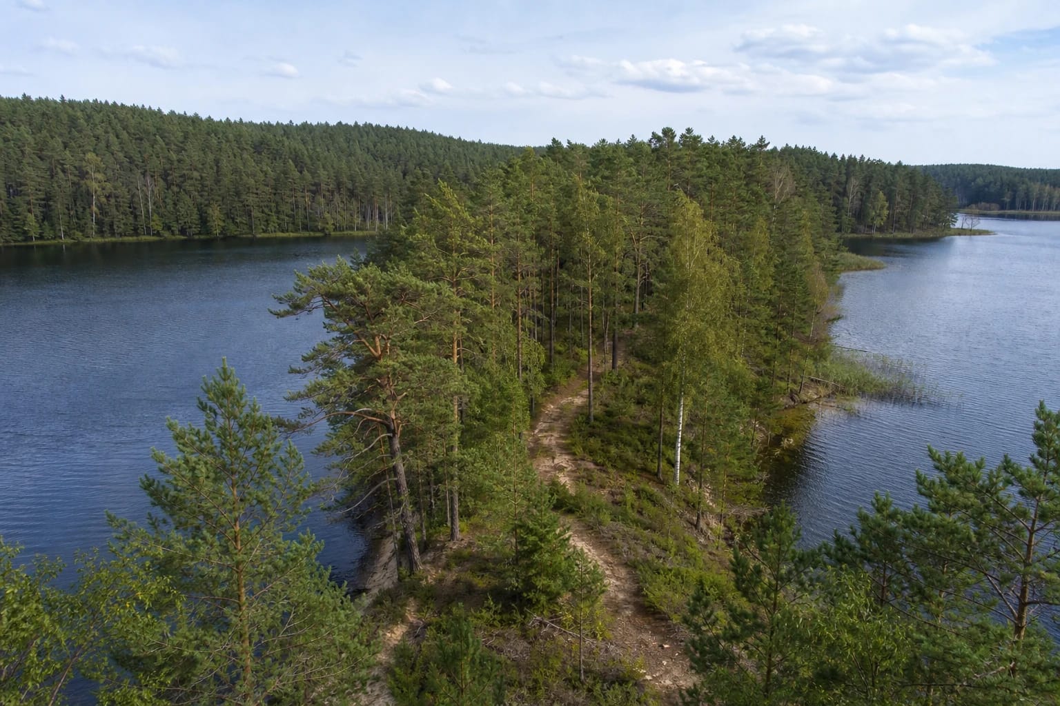
Ščiūrys Cape is a long and, in places, very narrow peninsula. Lake Baltieji Lakajai lies along its northern shore and Lake Juodieji Lakajai along its southern one. The official object description gives a length of about 3 km. At narrower points, water can be seen through the pines on both sides, so the defining experience is not merely a forest walk but the clear sense of standing on a thin strip of land between two lakes.
Cibaragis is a smaller side peninsula, effectively a peninsula within the peninsula. Its spur is not automatically the shortest route to the main cape's end, so find the Cibaragis direction separately on the diagram. At the far end, the two Lakajai water bodies appear to meet visually around the tapering point of land.
The official Saugoma.lt object coordinate, 55.2021, 25.6424, lies deep inside the peninsula and represents the natural feature well, but it is not a car park. The map on this page instead marks the small car-park and trailhead area in the western part of the cape, checked against Geoportal.lt orthophotography.
Expect forest road and shore paths, not an 8 km boardwalk
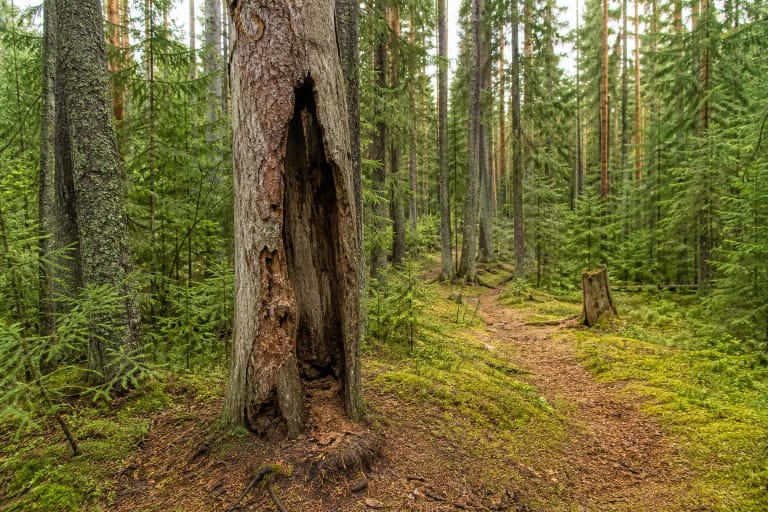
Most of the route follows a natural forest road or a narrower earth path. Official and visitor photographs show sand, pine needles, roots, occasional grass, small rises, and lakeshore slopes. There is no continuous timber walkway, observation tower, or paved promenade. Lower ground can soften after rain, and fallen leaves may hide roots in autumn.
The route is officially intended for cyclists too, but that does not make every narrow shore bend equally comfortable on a city bicycle. The broader forest road is easier, while roots, loose sand, and narrow sloping sections may require dismounting. Walkers and riders share the route, so reduce speed at bends and near interpretation stops.
The natural surface, distance, and uneven shore sections make the full route unsuitable for an ordinary wheelchair or city pushchair. Even if part of the central forest road is manageable, that does not mean the complete 8 km circuit and both spurs are accessible.
The double-trunk pine and Lakaja panels tell two different kinds of story
A state-protected double-trunk pine grows near the start of the peninsula. Its official entry gives a height of about 30 m and diameter of 0.6 m: the two trunks merge roughly 3 m above the ground, then divide again into two crowns higher up. It is a specific natural heritage object and should not be confused with any forked pine seen along the route.
Interpretive panels, direction markers, and playful tasks stand along the trail. They are narrated by Lakaja, presented as a spirit of Labanoras Forest. Lakaja is a contemporary interpretive character created to communicate the site's nature; reliable sources do not present the figure as a Lithuanian deity established by old written records or documented folklore.
Green trail bands on trees and individual panels help with navigation, but forest markers can be damaged or renewed. Photograph the route diagram at the start, carry a charged phone, and do not attempt to shorten the walk through the marked private property.
Two lakes support valuable plant habitat and water birds
Saugoma.lt highlights the distinctive microclimate of a peninsula enclosed by two lakes and habitats for rare plants of Labanoras Forest. Official descriptions mention great crested grebes, common mergansers, great cormorants, grey herons, several duck species, and the osprey, a symbol of the forest. These are species that may be observed, not a promise that every visitor will see all of them.
Watch wildlife quietly from the route and shore without pushing into dense vegetation or reed beds. Proximity to water does not make every access point an official beach: banks may be muddy, steep, or overgrown, and the trail description promises neither lifeguards nor a marked bathing area.
Pitching tents and lighting fires are prohibited on the peninsula. The restriction has applied since Labanoras Regional Park was established and was explicitly retained when Ščiūrys was adapted for visitors. Use only designated park sites for overnight stays or fires and carry all rubbish out.
Getting there, the small car park, toilets, and the visitor ticket
Motor access into the peninsula is restricted. Cars should be left in the small area at the trailhead, with the route continued on foot or by bicycle. This page's point, 55.209595, 25.605792, marks the small approach and start clearing visible on Geoportal.lt orthophotography, but it does not guarantee a free space or a particular parking bay. Do not obstruct the forest road and obey local signs.
In the directorate's 2024 survey, the 8 per cent of respondents dissatisfied with public visitor infrastructure across Labanoras Regional Park cited a shortage of rubbish bins and toilets and the small car park at Ščiūrys Cape Trail. The 2025 report recorded 13,736 passages on the trail counter but did not provide a new site-specific inspection of this car park, toilet provision, or bins. Use a toilet before arrival, bring a bag for your rubbish, and do not plan around facilities that the current official record does not guarantee.
This is an outdoor route, and the official trail pages publish neither daily opening hours nor a compulsory admission charge for individual walkers. In 2026 the State Service for Protected Areas lists a voluntary visitor ticket at €1 for one day or €5 for 30 days in one park; separate mandatory rules apply to commercial-event participants. Always check current prices, purchase methods, post-storm conditions, and any seasonal restrictions on the official sites before travelling.